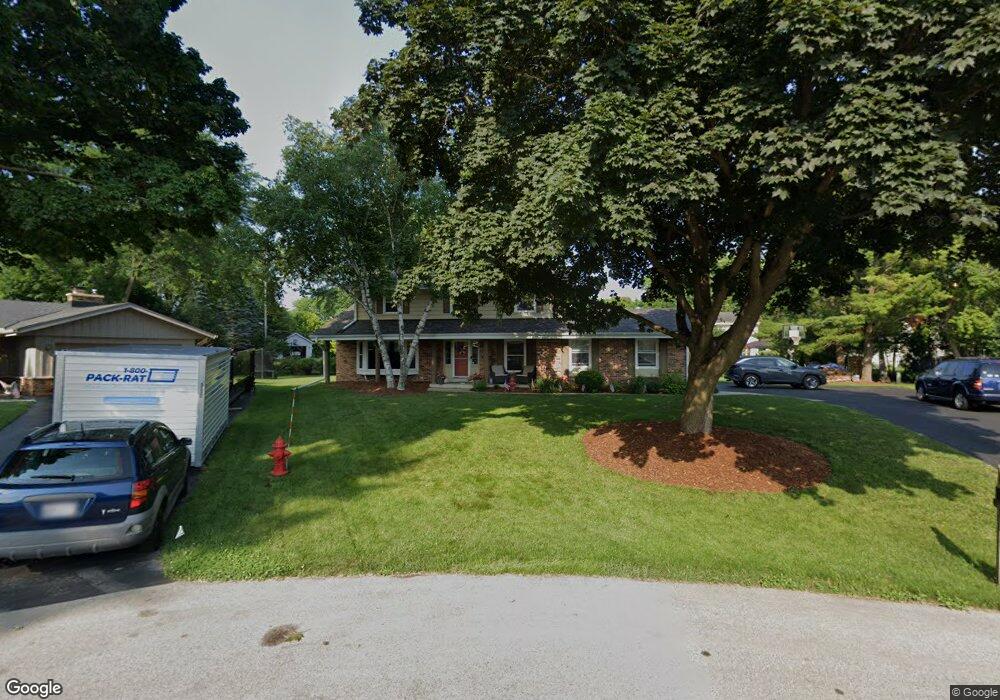
2480 Le Fey Ct Brookfield, WI 53045
Estimated Value: $509,000 - $542,000
4
Beds
3
Baths
2,159
Sq Ft
$244/Sq Ft
Est. Value
About This Home
This home is located at 2480 Le Fey Ct, Brookfield, WI 53045 and is currently estimated at $525,795, approximately $243 per square foot. 2480 Le Fey Ct is a home located in Waukesha County with nearby schools including Brookfield Elementary School, Wisconsin Hills Middle School, and Brookfield Central High School.
Ownership History
Date
Name
Owned For
Owner Type
Purchase Details
Closed on
Jan 22, 2003
Sold by
Estate Of Robert T Simon
Bought by
Ledvorowski Daniel S and Ledvorowski Leslie M
Current Estimated Value
Home Financials for this Owner
Home Financials are based on the most recent Mortgage that was taken out on this home.
Original Mortgage
$188,000
Outstanding Balance
$80,144
Interest Rate
6.01%
Mortgage Type
Purchase Money Mortgage
Estimated Equity
$445,651
Create a Home Valuation Report for This Property
The Home Valuation Report is an in-depth analysis detailing your home's value as well as a comparison with similar homes in the area
Home Values in the Area
Average Home Value in this Area
Purchase History
| Date | Buyer | Sale Price | Title Company |
|---|---|---|---|
| Ledvorowski Daniel S | $235,000 | -- |
Source: Public Records
Mortgage History
| Date | Status | Borrower | Loan Amount |
|---|---|---|---|
| Open | Ledvorowski Daniel S | $188,000 |
Source: Public Records
Tax History Compared to Growth
Tax History
| Year | Tax Paid | Tax Assessment Tax Assessment Total Assessment is a certain percentage of the fair market value that is determined by local assessors to be the total taxable value of land and additions on the property. | Land | Improvement |
|---|---|---|---|---|
| 2024 | $4,215 | $382,500 | $125,000 | $257,500 |
| 2023 | $4,211 | $382,500 | $125,000 | $257,500 |
| 2022 | $5,309 | $318,800 | $117,700 | $201,100 |
| 2021 | $5,619 | $318,800 | $117,700 | $201,100 |
| 2020 | $4,985 | $318,800 | $117,700 | $201,100 |
| 2019 | $4,784 | $318,800 | $117,700 | $201,100 |
| 2018 | $4,182 | $272,300 | $110,000 | $162,300 |
| 2017 | $4,195 | $272,300 | $110,000 | $162,300 |
| 2016 | $4,255 | $272,300 | $110,000 | $162,300 |
| 2015 | $4,236 | $272,300 | $110,000 | $162,300 |
| 2014 | $4,393 | $272,300 | $110,000 | $162,300 |
| 2013 | $4,393 | $272,300 | $110,000 | $162,300 |
Source: Public Records
Map
Nearby Homes
- 21300 Astolat Dr
- 2410 Talbots Ln
- 21380 Woodchuck Ln
- 21965 Valiant Dr
- 20780 Tennyson Dr
- 21330 Hollycrest Ct
- 21905 W North Ave
- N19W22081 Foxview Ct Unit 2B
- W223N2314 Meadowood Ln
- W222N2872 Timberwood Ct
- 7034 Stonewood Ln
- 7038 Stonewood Ln
- 7018 Stonewood Ln
- 7022 Stonewood Ln
- W225N2549 Alderwood Ln
- W225N2516 Alderwood Ln
- N31W22134 Green Rd
- Lt119 Berwick Ct
- Lt117 Berwick Ct
- Lt115 Berwick Ct
- 2475 Almesbury Ave
- 2470 Le Fey Ct
- 2485 Almesbury Ave
- 2465 Almesbury Ave
- 2485 Le Fey Ct
- 21520 Ann Rita Dr
- 2505 Almesbury Ave
- 2475 Le Fey Ct
- 2465 Le Fey Ct
- 21480 Ann Rita Dr
- 21580 Ann Rita Dr
- 2480 Almesbury Ave
- 2490 Almesbury Ave
- 2480 Lionel Ct
- 2470 Almesbury Ave
- 2525 Almesbury Ave
- 2470 Lionel Ct
- 21415 Almesbury Ct
- 21420 Ann Rita Dr
- 2490 Lionel Ct