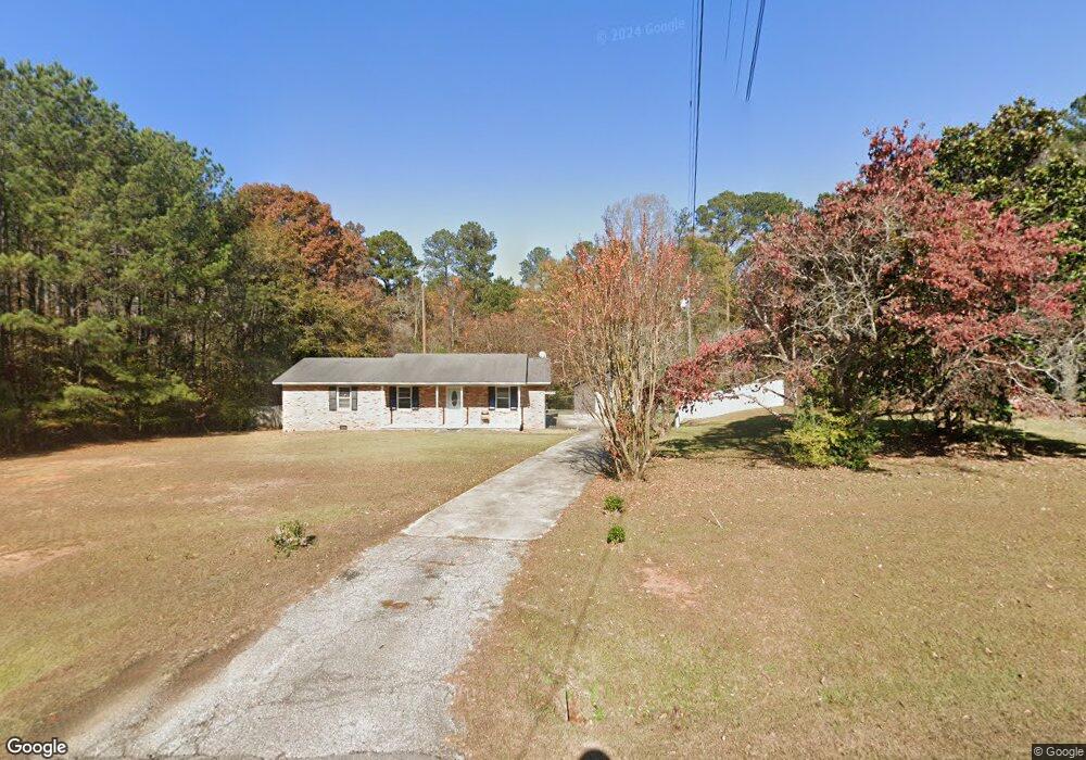
2481 Ga Highway 18 West Point, GA 31833
Estimated Value: $124,000 - $225,000
3
Beds
1
Bath
1,326
Sq Ft
$126/Sq Ft
Est. Value
About This Home
This home is located at 2481 Ga Highway 18, West Point, GA 31833 and is currently estimated at $166,657, approximately $125 per square foot. 2481 Ga Highway 18 is a home located in Troup County with nearby schools including West Point Elementary School, Long Cane Elementary School, and Whitesville Road Elementary School.
Ownership History
Date
Name
Owned For
Owner Type
Purchase Details
Closed on
Jul 12, 2006
Sold by
Adams Jeffry Ray
Bought by
Brown Tony L
Current Estimated Value
Purchase Details
Closed on
Nov 20, 1998
Sold by
Gilmore Herren J and Gilmore Ruby T
Bought by
Christy Jeffry and Christy Adams
Purchase Details
Closed on
Aug 22, 1980
Sold by
Guantt Mary
Bought by
Gilmore Herren J and Gilmore Ruby T
Purchase Details
Closed on
Jan 1, 1973
Sold by
Lee Ernest and Brenda Faye
Bought by
Guantt Mary
Purchase Details
Closed on
Aug 2, 1968
Sold by
Smith Alton M
Bought by
Lee Ernest and Brenda Faye
Create a Home Valuation Report for This Property
The Home Valuation Report is an in-depth analysis detailing your home's value as well as a comparison with similar homes in the area
Home Values in the Area
Average Home Value in this Area
Purchase History
| Date | Buyer | Sale Price | Title Company |
|---|---|---|---|
| Brown Tony L | $95,000 | -- | |
| Christy Jeffry | $62,500 | -- | |
| Gilmore Herren J | $27,000 | -- | |
| Guantt Mary | $18,000 | -- | |
| Lee Ernest | -- | -- |
Source: Public Records
Tax History Compared to Growth
Tax History
| Year | Tax Paid | Tax Assessment Tax Assessment Total Assessment is a certain percentage of the fair market value that is determined by local assessors to be the total taxable value of land and additions on the property. | Land | Improvement |
|---|---|---|---|---|
| 2024 | $1,219 | $44,684 | $3,640 | $41,044 |
| 2023 | $1,078 | $39,524 | $3,640 | $35,884 |
| 2022 | $1,046 | $37,484 | $3,640 | $33,844 |
| 2021 | $927 | $30,740 | $2,800 | $27,940 |
| 2020 | $800 | $26,520 | $3,700 | $22,820 |
| 2019 | $797 | $26,440 | $3,700 | $22,740 |
| 2018 | $734 | $24,344 | $3,700 | $20,644 |
| 2017 | $734 | $24,344 | $3,700 | $20,644 |
| 2016 | $720 | $23,867 | $3,700 | $20,167 |
| 2015 | $691 | $22,863 | $3,700 | $19,163 |
| 2014 | $662 | $21,863 | $3,700 | $18,163 |
| 2013 | -- | $23,331 | $3,700 | $19,631 |
Source: Public Records
Map
Nearby Homes
- 134 Garden Walk
- 111 Tudor Way
- Winfield Plan at The Villages at Harris Creek
- Cecil Plan at The Villages at Harris Creek
- Poplar Plan at The Villages at Harris Creek
- Russell Plan at The Villages at Harris Creek
- Jodeco Plan at The Villages at Harris Creek
- Nelson Plan at The Villages at Harris Creek
- Sierra Plan at The Villages at Harris Creek
- 103 Garden Walk
- 4517 Georgia 18
- 4509 Georgia 18
- 4523 Georgia 18
- 4527 Georgia 18
- 107 Garden Walk
- 115 Garden Walk
- 201 Harris Walk
- 201 Harris Walk Unit 20
- 204 Harris Walk
- 206 Harris Walk Unit 81
- 2491 Ga Highway 18
- 2459 Ga Highway 18
- 2403 Ga Highway 18
- 2474 Ga Highway 18
- 146 Horseshoe Bend Rd
- 200 Horseshoe Bend Rd
- 2336 Ga Highway 18
- 44 Horseshoe Bend Rd
- A B C D Horseshoe Bend Creek
- 0 Horseshoe Bend Creek
- B Horseshoe Bend Creek
- A Horseshoe Bend Creek
- A B Horseshoe Bend Creek
- 4 LOTS Horseshoe Bend Creek
- 79 Horseshoe Bend Rd
- C D Horsehoe Bend Cir
- 4 LOTS Horseshoe Bend Cir Cir
- 2334 Ga Highway 18
- 0 Sandtown Unit 25484273
- 0 Sandtown