Estimated Value: $198,000 - $254,000
4
Beds
2
Baths
1,998
Sq Ft
$112/Sq Ft
Est. Value
About This Home
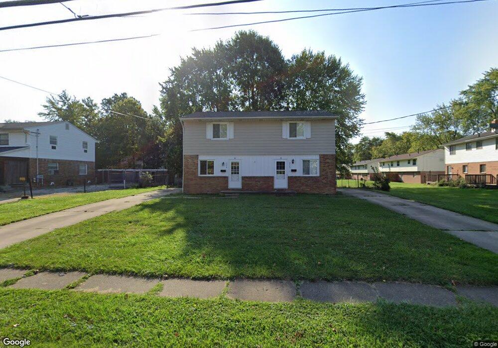
This home is located at 2482 Maplehurst Dr Unit 2486, Stow, OH 44224 and is currently estimated at $224,373, approximately $112 per square foot. 2482 Maplehurst Dr Unit 2486 is a home located in Summit County with nearby schools including Stow-Munroe Falls High School, Holy Family Elementary School, and Walsh Jesuit High School.
Ownership History
Date
Name
Owned For
Owner Type
Purchase Details
Closed on
Mar 18, 2015
Sold by
Stavarz David J
Bought by
Stow Property Llc
Current Estimated Value
Purchase Details
Closed on
Oct 14, 2014
Sold by
Stavarz David J
Bought by
Stavarz David J
Purchase Details
Closed on
Oct 4, 2002
Sold by
Krisher Kimberly S and Montoney Kimberly S
Bought by
Stavarz David J and Stavarz Family Revocable Living Trust
Create a Home Valuation Report for This Property
The Home Valuation Report is an in-depth analysis detailing your home's value as well as a comparison with similar homes in the area
Home Values in the Area
Average Home Value in this Area
Purchase History
| Date | Buyer | Sale Price | Title Company |
|---|---|---|---|
| Stow Property Llc | -- | None Available | |
| Stavarz David J | -- | None Available | |
| Stavarz David J | $129,000 | Resource Title Agency Inc |
Source: Public Records
Tax History Compared to Growth
Tax History
| Year | Tax Paid | Tax Assessment Tax Assessment Total Assessment is a certain percentage of the fair market value that is determined by local assessors to be the total taxable value of land and additions on the property. | Land | Improvement |
|---|---|---|---|---|
| 2025 | $3,256 | $55,521 | $13,213 | $42,308 |
| 2024 | $3,256 | $55,521 | $13,213 | $42,308 |
| 2023 | $3,256 | $55,521 | $13,213 | $42,308 |
| 2022 | $2,782 | $41,745 | $9,933 | $31,812 |
| 2021 | $2,503 | $41,745 | $9,933 | $31,812 |
| 2020 | $2,462 | $41,740 | $9,930 | $31,810 |
| 2019 | $2,643 | $42,020 | $9,930 | $32,090 |
| 2018 | $2,602 | $42,020 | $9,930 | $32,090 |
| 2017 | $2,494 | $42,020 | $9,930 | $32,090 |
| 2016 | $2,535 | $39,040 | $9,930 | $29,110 |
| 2015 | $2,494 | $39,040 | $9,930 | $29,110 |
| 2014 | $2,496 | $39,040 | $9,930 | $29,110 |
| 2013 | $2,849 | $45,070 | $9,930 | $35,140 |
Source: Public Records
Map
Nearby Homes
- 4131 Burton Dr
- 2418 Wrens Dr S Unit G
- 4227 Baird Rd
- 4903 Fishcreek Rd Unit 11B
- 4621 Graford Ln
- 4901 Independence Cir Unit B
- 4120 Klein Ave
- 2140 Woodlawn Cir Unit 2144
- 0 Stow Rd Unit 5102979
- 2410 Liberty Rd
- 2380 Port Williams Dr Unit 2380
- 4917 Independence Cir Unit B
- 3961 Klein Ave
- 4731 Haughton Ct
- 2755 Laurel Woods Blvd
- 0 Vira Rd
- 2140 Uniondale Dr
- 2327 Crockett Cir
- 2043 Conwill Rd
- 2028 Willowdale Dr
- 2490 Maplehurst Dr Unit 2494
- 4419 N Norman Dr Unit 4423
- 4388 Elmhurst Dr Unit 4392
- 4405 N Norman Dr Unit 4409
- 4409 N Norman Dr
- 4405 4409 N Norman Dr
- 2473 Maplehurst Dr Unit 2477
- 2483 Maplehurst Dr Unit 2487
- 2495 Maplehurst Dr
- 4397 N Norman Dr Unit 4401
- 4380 Elmhurst Dr Unit 4384
- 2491 Maplehurst Dr
- 2491 Maplehurst Dr Unit 2495
- 2506 Maplehurst Dr Unit 2510
- 4429 N Norman Dr Unit 4433
- 4433 N Norman Dr
- 4391 Elmhurst Dr
- 2503 Maplehurst Dr Unit 2507
- 4426 N Norman Dr Unit 4430
- 4426 4430 N Norman Dr