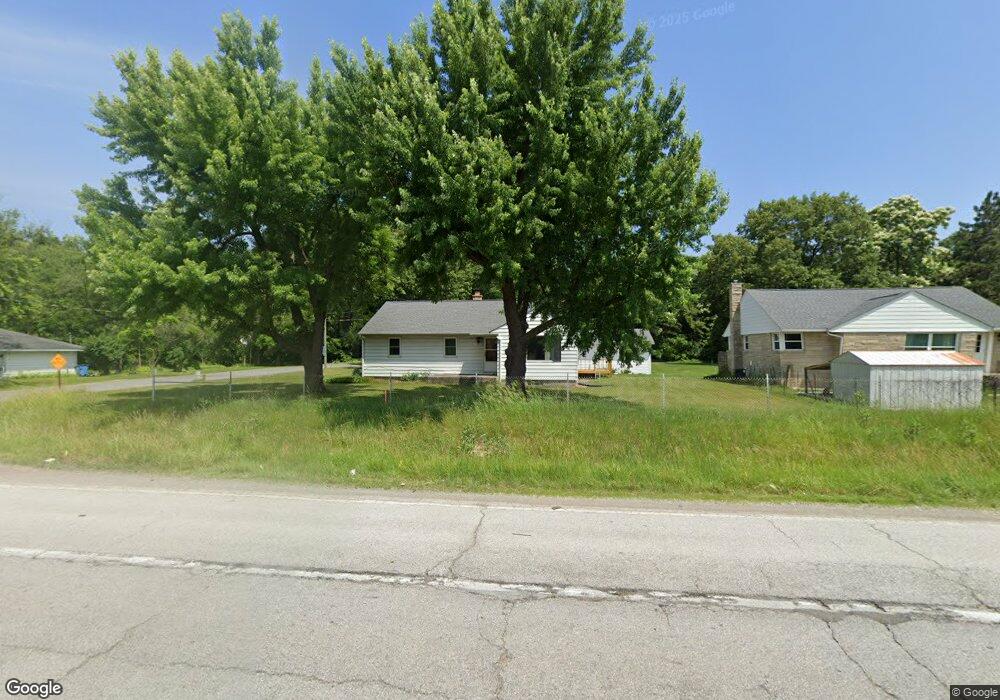
24835 State Road 2 South Bend, IN 46619
Estimated Value: $170,000 - $243,000
3
Beds
1
Bath
1,246
Sq Ft
$159/Sq Ft
Est. Value
About This Home
This home is located at 24835 State Road 2, South Bend, IN 46619 and is currently estimated at $197,754, approximately $158 per square foot. 24835 State Road 2 is a home located in St. Joseph County with nearby schools including Warren Elementary School, Clay Intermediate Center, and Dickinson Fine Arts Academy.
Ownership History
Date
Name
Owned For
Owner Type
Purchase Details
Closed on
Jan 2, 2020
Sold by
Bella Pamela and Wolf Patricia
Bought by
Leszcz Trust
Current Estimated Value
Purchase Details
Closed on
Apr 19, 2013
Sold by
Bilinski Carol A
Bought by
Bella Pamela
Purchase Details
Closed on
Oct 9, 2012
Sold by
Bilionski Robert J
Bought by
Bilinski Carol A
Home Financials for this Owner
Home Financials are based on the most recent Mortgage that was taken out on this home.
Original Mortgage
$41,000
Interest Rate
3.57%
Mortgage Type
New Conventional
Create a Home Valuation Report for This Property
The Home Valuation Report is an in-depth analysis detailing your home's value as well as a comparison with similar homes in the area
Home Values in the Area
Average Home Value in this Area
Purchase History
| Date | Buyer | Sale Price | Title Company |
|---|---|---|---|
| Leszcz Trust | -- | None Available | |
| Bella Pamela | -- | -- | |
| Bilinski Carol A | -- | None Available |
Source: Public Records
Mortgage History
| Date | Status | Borrower | Loan Amount |
|---|---|---|---|
| Previous Owner | Bilinski Carol A | $41,000 |
Source: Public Records
Tax History Compared to Growth
Tax History
| Year | Tax Paid | Tax Assessment Tax Assessment Total Assessment is a certain percentage of the fair market value that is determined by local assessors to be the total taxable value of land and additions on the property. | Land | Improvement |
|---|---|---|---|---|
| 2024 | $455 | $148,800 | $3,600 | $145,200 |
| 2023 | $1,035 | $83,400 | $3,600 | $79,800 |
| 2022 | $1,035 | $115,900 | $6,300 | $109,600 |
| 2021 | $1,571 | $80,800 | $3,600 | $77,200 |
| 2020 | $495 | $75,900 | $3,400 | $72,500 |
| 2019 | $394 | $73,600 | $3,300 | $70,300 |
| 2018 | $497 | $98,500 | $3,700 | $94,800 |
| 2017 | $420 | $74,300 | $2,800 | $71,500 |
| 2016 | $428 | $74,400 | $2,800 | $71,600 |
| 2014 | $353 | $64,400 | $2,500 | $61,900 |
Source: Public Records
Map
Nearby Homes
- 56435 Eastlea Dr
- 55915 Dorn St
- 57195 Pinewood Dr
- 56266 Butternut Rd
- 56131 Butternut Rd
- 56872 Butternut Rd
- 23735 State Road 2
- 57248 Mcquade St
- 57383 Mcquade St
- 23560 Fillmore Rd
- 55275 Orchid Rd
- 55075 Sundown Rd
- 57845 Crumstown Hwy
- 1109 Sylvan Ln
- 4988 Scenic Dr
- 57860 Crumstown Hwy
- 5033 W Sample St
- 5113 Packard Ave
- 23826 Edison Rd
- 57115 White Pine Trail
- 24825 State Road 2
- 24865 State Road 2
- 24805 State Road 2
- 24780 Lancer Dr
- 56455 Westlea Dr
- 24770 Lancer Dr
- 56445 Westlea Dr
- 56435 Westlea Dr
- 24750 Lancer Dr
- 24805 Lancer Dr
- 24760 Lancer Dr
- 56440 Westlea Dr
- 56425 Westlea Dr
- 24740 Lancer Dr
- 56430 Westlea Dr
- 24733 Lancer Dr
- 56420 Westlea Dr
- 24700 Lancer Dr
- 56410 Westlea Dr
- 56445 Eastlea Dr