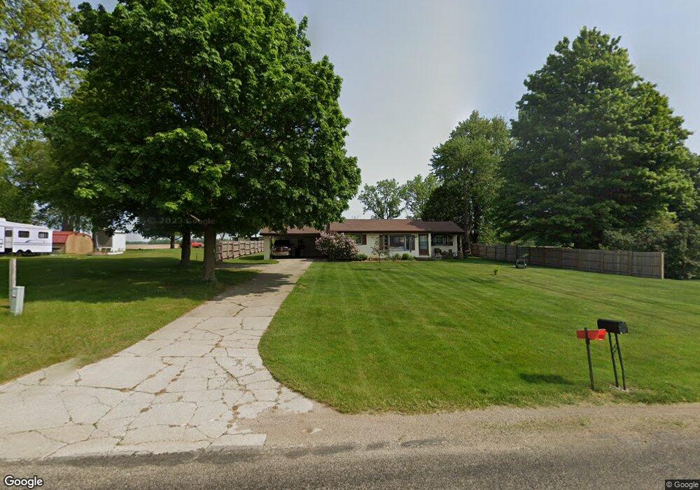
24846 Airline Rd Sturgis, MI 49091
Estimated Value: $33,000 - $169,000
--
Bed
--
Bath
--
Sq Ft
0.59
Acres
About This Home
This home is located at 24846 Airline Rd, Sturgis, MI 49091 and is currently estimated at $92,667. 24846 Airline Rd is a home located in St. Joseph County with nearby schools including Sturgis High School, New Dawn School, and Trinity Lutheran School.
Ownership History
Date
Name
Owned For
Owner Type
Purchase Details
Closed on
Mar 7, 2011
Sold by
Mingus Scott M and Mingus Angela R
Bought by
Kimes Michael N and Kimes Shena B
Current Estimated Value
Purchase Details
Closed on
Oct 4, 2002
Sold by
Mingus Cynthia K
Bought by
Mingus Scott M and Mingus Angela R
Purchase Details
Closed on
Oct 1, 1995
Sold by
Bidwell Cynthia K
Purchase Details
Closed on
Jan 1, 1901
Create a Home Valuation Report for This Property
The Home Valuation Report is an in-depth analysis detailing your home's value as well as a comparison with similar homes in the area
Home Values in the Area
Average Home Value in this Area
Purchase History
| Date | Buyer | Sale Price | Title Company |
|---|---|---|---|
| Kimes Michael N | $15,000 | Multiple | |
| Mingus Scott M | -- | -- | |
| -- | -- | -- | |
| -- | -- | -- |
Source: Public Records
Tax History Compared to Growth
Tax History
| Year | Tax Paid | Tax Assessment Tax Assessment Total Assessment is a certain percentage of the fair market value that is determined by local assessors to be the total taxable value of land and additions on the property. | Land | Improvement |
|---|---|---|---|---|
| 2025 | $74 | $5,600 | $5,600 | $0 |
| 2024 | $25 | $4,800 | $4,800 | $0 |
| 2023 | $24 | $2,900 | $2,900 | $0 |
| 2022 | $23 | $2,700 | $2,700 | $0 |
| 2021 | $43 | $2,500 | $2,500 | $0 |
| 2020 | $65 | $2,100 | $2,100 | $0 |
| 2019 | $22 | $2,100 | $2,100 | $0 |
| 2018 | $59 | $2,100 | $2,100 | $0 |
| 2017 | $60 | $2,100 | $2,100 | $0 |
| 2016 | -- | $2,100 | $2,100 | $0 |
| 2015 | -- | $2,600 | $2,600 | $0 |
| 2014 | -- | $3,600 | $3,600 | $0 |
| 2012 | -- | $3,300 | $3,300 | $0 |
Source: Public Records
Map
Nearby Homes
- 0 Vl Seneca Ct
- VL1 Ottokee Dr
- VL2 Ottokee Dr
- 67696 Thunderbird Dr
- 23772 Wilson Rd
- 69375 Vicky Dr
- 26137 Diana Dr
- 200 Broadus St
- 0 Deer Rd
- 26865 Us Highway 12
- 69760 White School Rd
- 206 1st St
- 501 W Ohio Ct
- 202 N Centerville Rd
- 600 Saint Joseph St
- 708 N Centerville Rd
- 0 N Centerville Rd
- 203 Grove St
- 210 Grove St
- 501 Norwood St
- 24846 Airline Rd
- 24890 Airline Rd
- 24920 Airline Rd
- 25108 Airline Rd
- 24696 Airline Rd
- 24724 Airline Rd
- 24802 Airline Rd
- 24650 Airline Rd
- 24766 Airline Rd
- 67974 Balk Rd
- 67974 Balk Rd
- 67969 Balk Rd
- 67940 Balk Rd
- 68610 Balk Rd
- 68640 Balk Rd
- 67862 Balk Rd
- 24583 Airline Rd
- 25219 Airline Rd
- 67869 Balk Rd
- 67890 Balk Rd