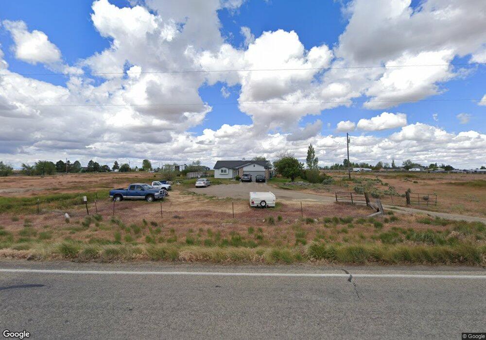
2485 Highway 51 Mountain Home, ID 83647
Estimated Value: $397,000 - $474,000
3
Beds
2
Baths
1,560
Sq Ft
$280/Sq Ft
Est. Value
About This Home
This home is located at 2485 Highway 51, Mountain Home, ID 83647 and is currently estimated at $436,319, approximately $279 per square foot. 2485 Highway 51 is a home located in Elmore County with nearby schools including West Elementary School, Hacker Middle School, and Mountain Home Junior High School.
Ownership History
Date
Name
Owned For
Owner Type
Purchase Details
Closed on
May 11, 2009
Sold by
Dyssegard Paul E and Dyssegard Patridia L
Bought by
Cochran Ricky P
Current Estimated Value
Home Financials for this Owner
Home Financials are based on the most recent Mortgage that was taken out on this home.
Original Mortgage
$188,775
Outstanding Balance
$119,080
Interest Rate
4.82%
Mortgage Type
FHA
Estimated Equity
$317,239
Create a Home Valuation Report for This Property
The Home Valuation Report is an in-depth analysis detailing your home's value as well as a comparison with similar homes in the area
Home Values in the Area
Average Home Value in this Area
Purchase History
| Date | Buyer | Sale Price | Title Company |
|---|---|---|---|
| Cochran Ricky P | -- | -- |
Source: Public Records
Mortgage History
| Date | Status | Borrower | Loan Amount |
|---|---|---|---|
| Open | Cochran Ricky P | $188,775 |
Source: Public Records
Tax History Compared to Growth
Tax History
| Year | Tax Paid | Tax Assessment Tax Assessment Total Assessment is a certain percentage of the fair market value that is determined by local assessors to be the total taxable value of land and additions on the property. | Land | Improvement |
|---|---|---|---|---|
| 2024 | $1,152 | $411,359 | $76,316 | $335,043 |
| 2023 | $1,152 | $404,500 | $61,840 | $342,660 |
| 2022 | $1,755 | $442,906 | $58,440 | $384,466 |
| 2021 | $1,306 | $306,230 | $40,501 | $265,729 |
| 2020 | $1,031 | $222,909 | $33,877 | $189,032 |
| 2019 | $1,067 | $190,125 | $33,877 | $156,248 |
| 2018 | $928 | $145,949 | $30,817 | $115,132 |
| 2017 | $903 | $133,309 | $30,817 | $102,492 |
| 2016 | $909 | $132,712 | $30,220 | $102,492 |
| 2015 | $919 | $0 | $0 | $0 |
| 2012 | -- | $105,724 | $43,827 | $61,897 |
Source: Public Records
Map
Nearby Homes
- TBD SW Buckeye
- TBA Tba
- TBD SW Hwy 51 Smith Rd
- 1740 SW Besra Dr
- 1726 SW Besra Dr
- 1698 SW Besra Dr
- 1670 SW Besra Dr
- 1656 SW Besra Dr
- 1642 SW Besra Dr
- 1025 SW Sparrow Place
- 1820 SW Sparrow Place
- Langton 1502 Plan at Morning View
- 1711 SW Pegasus Peak Ave
- Columbia 2530 Plan at Blue Yonder
- Sundance 2710 Plan at Blue Yonder
- Lennox 2332 Plan at Blue Yonder
- 1697 SW Pegasus Peak Ave
- 910 SW Lago St
- 1920 SW Challis Dr
- 1775 Wasatch Dr
- 2540 SW Churella Dr
- 2420 SW Buckey Dr
- 2533 SW Churella Dr
- 2358 SW Buckey Dr
- tbd SE Buckey Dr
- 2475 SW Buckey Dr
- 2645 SW Buckey Dr
- 2689 SW Buckey Dr
- Lot 6 Blk3 SW Buckey Dr
- 2363 SW Buckey Dr
- Lot 6 Block 3 SW Buckey Dr
- 2165 Highway 51
- 2165 Highway 51
- 2245 SW Buckey Dr
- 2090 SW Buckey Dr
- 2081 SW Buckey Dr
- 2171 SW Buckey Dr
- 745 SW Raelynn St
- 760 SW Raelynn St
- 710 SW Raelynn St