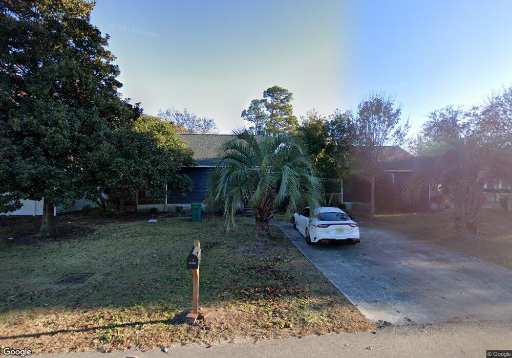
249 Lander Dr Conway, SC 29526
Estimated Value: $334,000 - $477,000
3
Beds
2
Baths
2,540
Sq Ft
$161/Sq Ft
Est. Value
About This Home
This home is located at 249 Lander Dr, Conway, SC 29526 and is currently estimated at $408,467, approximately $160 per square foot. 249 Lander Dr is a home located in Horry County with nearby schools including Palmetto Bays Elementary School, Black Water Middle School, and Carolina Forest High School.
Ownership History
Date
Name
Owned For
Owner Type
Purchase Details
Closed on
Oct 4, 2005
Sold by
Melvin Jeanne E
Bought by
Murray James F and Murray Michael S
Current Estimated Value
Home Financials for this Owner
Home Financials are based on the most recent Mortgage that was taken out on this home.
Original Mortgage
$179,000
Outstanding Balance
$92,250
Interest Rate
5.66%
Mortgage Type
Fannie Mae Freddie Mac
Estimated Equity
$316,217
Purchase Details
Closed on
Jun 18, 1998
Sold by
Melvin Jeanne E
Bought by
Burnett J Owens Construction Company Inc
Create a Home Valuation Report for This Property
The Home Valuation Report is an in-depth analysis detailing your home's value as well as a comparison with similar homes in the area
Home Values in the Area
Average Home Value in this Area
Purchase History
| Date | Buyer | Sale Price | Title Company |
|---|---|---|---|
| Murray James F | $223,900 | -- | |
| Burnett J Owens Construction Company Inc | $27,500 | -- |
Source: Public Records
Mortgage History
| Date | Status | Borrower | Loan Amount |
|---|---|---|---|
| Open | Murray James F | $179,000 |
Source: Public Records
Tax History
| Year | Tax Paid | Tax Assessment Tax Assessment Total Assessment is a certain percentage of the fair market value that is determined by local assessors to be the total taxable value of land and additions on the property. | Land | Improvement |
|---|---|---|---|---|
| 2025 | $2,634 | $0 | $0 | $0 |
| 2024 | $2,634 | $21,966 | $5,400 | $16,566 |
| 2023 | $2,634 | $11,005 | $2,713 | $8,292 |
| 2021 | $2,431 | $11,005 | $2,713 | $8,292 |
| 2020 | $2,303 | $11,005 | $2,713 | $8,292 |
| 2019 | $2,303 | $11,005 | $2,713 | $8,292 |
| 2018 | $2,442 | $11,272 | $2,386 | $8,886 |
| 2017 | $702 | $11,272 | $2,386 | $8,886 |
| 2016 | -- | $11,272 | $2,386 | $8,886 |
| 2015 | $702 | $11,272 | $2,386 | $8,886 |
| 2014 | $649 | $11,272 | $2,386 | $8,886 |
Source: Public Records
Map
Nearby Homes
- 221 Lander Dr
- 281 Ridge Point Dr
- Lot 11 Professional Park Dr
- 208 Lander Dr
- 891 Helms Way
- 800 Wilcot Branch Ct
- 109 Wofford Rd
- 208 Myrtle Grande Dr
- 1705 Brookshade Ct
- 1432 Highway 544 Unit B7
- 1432 Highway 544 Unit B-2
- 153 Myrtle Grande Dr
- 145 Ridge Point Dr
- 827 Helms Way
- 425 Myrtle Greens Dr Unit C
- 708 Walking Fern Ct
- 220 Myrtle Greens Dr Unit I
- 110 Cart Crossing Dr Unit 102
- 1004 Woodall Ct
- 150 Cart Crossing Dr Unit 103
- 247 Lander Dr
- 236 Lander Dr
- 138 Erskine Dr
- 234 Lander Dr
- 235 Lander Dr
- 238 Lander Dr
- 136 Erskine Dr
- 232 Lander Dr
- 233 Lander Dr
- 690 Singleton Ridge Rd
- 134 Erskine Dr
- 230 Lander Dr
- 231 Lander Dr
- 100 Sharon Ct
- 132 Erskine Dr
- 102 Sharon Ct
- 130 Erskine Dr
- 229 Lander Dr
- 104 Sharon Ct Unit Partridge Glen
- 1213 Silverstone Ct Unit Magnolia B 46
Your Personal Tour Guide
Ask me questions while you tour the home.