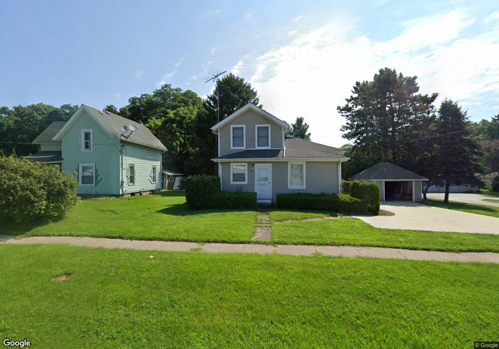
249 Maple St Springport, MI 49284
Estimated Value: $127,000 - $211,000
3
Beds
1
Bath
1,393
Sq Ft
$112/Sq Ft
Est. Value
About This Home
This home is located at 249 Maple St, Springport, MI 49284 and is currently estimated at $155,765, approximately $111 per square foot. 249 Maple St is a home located in Jackson County with nearby schools including Springport Elementary School, Springport Middle School, and Springport High School.
Create a Home Valuation Report for This Property
The Home Valuation Report is an in-depth analysis detailing your home's value as well as a comparison with similar homes in the area
Tax History
| Year | Tax Paid | Tax Assessment Tax Assessment Total Assessment is a certain percentage of the fair market value that is determined by local assessors to be the total taxable value of land and additions on the property. | Land | Improvement |
|---|---|---|---|---|
| 2025 | $1,102 | $52,500 | $0 | $0 |
| 2024 | $7 | $56,800 | $0 | $0 |
| 2023 | $658 | $47,800 | $0 | $0 |
| 2022 | $1,309 | $40,300 | $0 | $0 |
| 2021 | $991 | $36,700 | $0 | $0 |
| 2020 | $297 | $36,500 | $0 | $0 |
| 2019 | $1,381 | $31,900 | $0 | $0 |
| 2018 | $932 | $30,000 | $0 | $0 |
| 2017 | $881 | $29,700 | $0 | $0 |
| 2016 | $277 | $29,400 | $29,400 | $0 |
| 2015 | -- | $32,900 | $32,900 | $0 |
| 2014 | -- | $40,200 | $0 | $0 |
| 2013 | -- | $40,200 | $40,200 | $0 |
Source: Public Records
Map
Nearby Homes
- 216 Bayport Cir Unit 10
- 252 Bay Port Cir Unit 19
- 598 E Main St
- 16711 Stark Rd
- 29510 S Dr N
- 10870 Eaton Rapids Rd
- 13025 Pope Church Rd
- 19822 27 1 2 Mile Rd
- 6600 Calhoun Rd
- 12261 Pope Church Rd
- 9761 Brown Rd
- 12441 Town Rd
- 9733 Blue Heron
- 26854 Q-Drive N
- 4371 Anderson Dr
- 6950 Brown Rd
- 5901 Monroe Rd
- 6947 Brown Rd
- 21133 26 Mile Rd
- V/L 26 1 2 Mile Rd
Your Personal Tour Guide
Ask me questions while you tour the home.