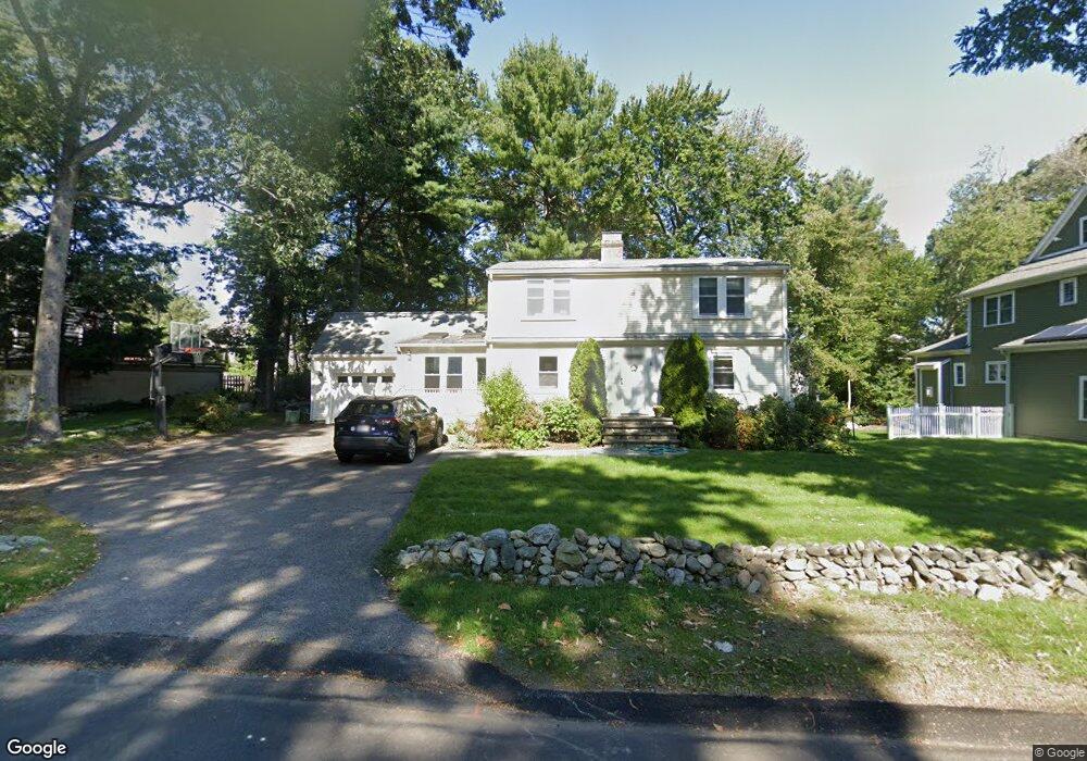
249 Marked Tree Rd Needham, MA 02492
Estimated Value: $1,305,000 - $1,484,915
4
Beds
2
Baths
1,600
Sq Ft
$868/Sq Ft
Est. Value
About This Home
This home is located at 249 Marked Tree Rd, Needham, MA 02492 and is currently estimated at $1,388,729, approximately $867 per square foot. 249 Marked Tree Rd is a home located in Norfolk County with nearby schools including Newman Elementary School, High Rock Middle School, and Pollard Middle School.
Ownership History
Date
Name
Owned For
Owner Type
Purchase Details
Closed on
Jul 19, 2002
Sold by
Remington Donald R and Remington Barbara J
Bought by
Weyman-Barnett K
Current Estimated Value
Home Financials for this Owner
Home Financials are based on the most recent Mortgage that was taken out on this home.
Original Mortgage
$300,700
Interest Rate
6.73%
Mortgage Type
Purchase Money Mortgage
Create a Home Valuation Report for This Property
The Home Valuation Report is an in-depth analysis detailing your home's value as well as a comparison with similar homes in the area
Home Values in the Area
Average Home Value in this Area
Purchase History
| Date | Buyer | Sale Price | Title Company |
|---|---|---|---|
| Weyman-Barnett K | $410,000 | -- | |
| Weyman-Barnett K | $410,000 | -- |
Source: Public Records
Mortgage History
| Date | Status | Borrower | Loan Amount |
|---|---|---|---|
| Open | Weyman-Barnett K | $417,000 | |
| Closed | Weyman-Barnett K | $87,000 | |
| Closed | Weyman-Barnett K | $300,700 |
Source: Public Records
Tax History
| Year | Tax Paid | Tax Assessment Tax Assessment Total Assessment is a certain percentage of the fair market value that is determined by local assessors to be the total taxable value of land and additions on the property. | Land | Improvement |
|---|---|---|---|---|
| 2025 | $13,056 | $1,231,700 | $797,600 | $434,100 |
| 2024 | $10,592 | $846,000 | $429,200 | $416,800 |
| 2023 | $10,648 | $816,600 | $429,200 | $387,400 |
| 2022 | $10,263 | $767,600 | $393,800 | $373,800 |
| 2021 | $10,002 | $767,600 | $393,800 | $373,800 |
| 2020 | $9,703 | $776,900 | $393,800 | $383,100 |
| 2019 | $9,136 | $737,400 | $358,000 | $379,400 |
| 2018 | $8,760 | $737,400 | $358,000 | $379,400 |
| 2017 | $8,220 | $691,300 | $358,000 | $333,300 |
| 2016 | $8,020 | $695,000 | $358,000 | $337,000 |
| 2015 | $7,847 | $695,000 | $358,000 | $337,000 |
| 2014 | $7,480 | $642,600 | $311,300 | $331,300 |
Source: Public Records
Map
Nearby Homes
- 620 High Rock St
- 95 Deerfield Rd
- 189 Bridle Trail Rd
- 15 Jenna Cir
- 287 High Rock St
- 73 Maple St Unit 1
- 52 Hancock Rd
- 3 Hancock Rd
- 47 Emerson Rd
- 193 Garden St
- 37 Carleton Dr
- 19 Mason Rd
- 569 Chestnut St
- 37 Standish Rd
- 362 Country Way
- 233 Warren St
- 34 Stratford Rd
- 90 Norfolk St
- 102 Jarvis Cir Unit 102
- 15 Mackintosh Ave
- 243 Marked Tree Rd
- 257 Marked Tree Rd
- 22 Bonwood Rd
- 16 Bonwood Rd
- 237 Marked Tree Rd
- 248 Marked Tree Rd
- 30 Bonwood Rd
- 8 Bonwood Rd
- 242 Marked Tree Rd
- 254 Marked Tree Rd
- 267 Marked Tree Rd
- 65 Avalon Rd
- 34 Bonwood Rd
- 53 Avalon Rd
- 277 Marked Tree Rd
- 234 Marked Tree Rd
- 268 Marked Tree Rd
- 15 Gilbert Rd
- 15 Bonwood Rd
- 23 Bonwood Rd
Your Personal Tour Guide
Ask me questions while you tour the home.