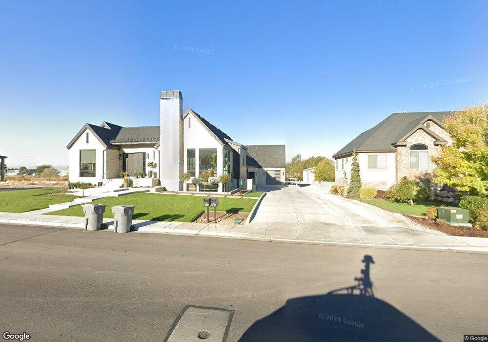
249 N 800 W Unit A Lindon, UT 84042
Estimated Value: $817,000 - $1,246,000
3
Beds
4
Baths
3,978
Sq Ft
$271/Sq Ft
Est. Value
About This Home
This home is located at 249 N 800 W Unit A, Lindon, UT 84042 and is currently estimated at $1,076,935, approximately $270 per square foot. 249 N 800 W Unit A is a home located in Utah County with nearby schools including Aspen Elementary School, Oak Canyon Junior High School, and Pleasant Grove High School.
Ownership History
Date
Name
Owned For
Owner Type
Purchase Details
Closed on
Jun 24, 2021
Sold by
Bunker Ryan L
Bought by
Bunker Ryan
Current Estimated Value
Home Financials for this Owner
Home Financials are based on the most recent Mortgage that was taken out on this home.
Original Mortgage
$360,000
Outstanding Balance
$325,935
Interest Rate
2.9%
Mortgage Type
New Conventional
Estimated Equity
$751,000
Purchase Details
Closed on
Aug 13, 2018
Sold by
Clegg Phil L and Clegg Jennifer S
Bought by
Bunker Ryan L
Purchase Details
Closed on
Jun 25, 2009
Sold by
Maxfield Thomas H and Maxfield Patti B
Bought by
Clegg Phil L and Clegg Jennifer S
Home Financials for this Owner
Home Financials are based on the most recent Mortgage that was taken out on this home.
Original Mortgage
$180,000
Interest Rate
4.83%
Mortgage Type
Seller Take Back
Create a Home Valuation Report for This Property
The Home Valuation Report is an in-depth analysis detailing your home's value as well as a comparison with similar homes in the area
Home Values in the Area
Average Home Value in this Area
Purchase History
| Date | Buyer | Sale Price | Title Company |
|---|---|---|---|
| Bunker Ryan | -- | First American American Fork | |
| Bunker Ryan L | -- | Gt Title Services | |
| Clegg Phil L | -- | None Available |
Source: Public Records
Mortgage History
| Date | Status | Borrower | Loan Amount |
|---|---|---|---|
| Open | Bunker Ryan | $360,000 | |
| Previous Owner | Clegg Phil L | $180,000 |
Source: Public Records
Tax History Compared to Growth
Tax History
| Year | Tax Paid | Tax Assessment Tax Assessment Total Assessment is a certain percentage of the fair market value that is determined by local assessors to be the total taxable value of land and additions on the property. | Land | Improvement |
|---|---|---|---|---|
| 2025 | $3,475 | $479,820 | $471,100 | $401,300 |
| 2024 | $3,475 | $428,340 | $0 | $0 |
| 2023 | $3,160 | $418,495 | $0 | $0 |
| 2022 | $3,222 | $412,115 | $0 | $0 |
| 2021 | $2,653 | $281,400 | $281,400 | $0 |
| 2020 | $2,246 | $234,500 | $234,500 | $0 |
| 2019 | $2,152 | $234,500 | $234,500 | $0 |
| 2018 | $1,964 | $201,700 | $201,700 | $0 |
| 2017 | $415 | $197,000 | $0 | $0 |
| 2016 | $1,940 | $179,700 | $0 | $0 |
| 2015 | $1,790 | $156,700 | $0 | $0 |
| 2014 | $1,460 | $126,600 | $0 | $0 |
Source: Public Records
Map
Nearby Homes
- 605 W 100 S
- 578 W 150 S
- 472 W 520 N
- 523 W 100 S
- 464 W 520 N
- 1277 W Sweet Corn Ln
- 557 N Buffalo Grass Ln
- 556 N Cornstalk Ln
- 264 N Old Farm Ln
- 1424 Gala Ln
- 364 W 600 N
- 1437 W Stable St
- 425 N Locust Ave
- Kirkwood Farmhouse Plan at Anderson Farms
- Clairemont Traditional Plan at Anderson Farms
- Montclair Traditional Plan at Anderson Farms
- Aspen Plan at Anderson Farms - Towns
- Sundance Ballpark Plan at Anderson Farms
- Keystone Ballpark Plan at Anderson Farms
- Washington Farmhouse Plan at Anderson Farms