Estimated Value: $853,000 - $1,013,782
4
Beds
4
Baths
4,195
Sq Ft
$221/Sq Ft
Est. Value
About This Home
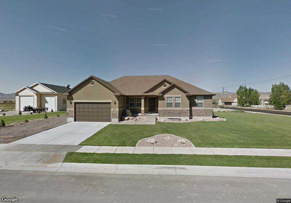
This home is located at 249 N Constitution Dr, Lehi, UT 84043 and is currently estimated at $926,261, approximately $220 per square foot. 249 N Constitution Dr is a home located in Utah County with nearby schools including River Rock Elementary, Willowcreek Middle School, and Lehi High School.
Ownership History
Date
Name
Owned For
Owner Type
Purchase Details
Closed on
Sep 18, 2013
Sold by
Walker Jeremy H and Walker Kimbelry
Bought by
Inokuchi Jim T and Inokuchi Jolene N
Current Estimated Value
Home Financials for this Owner
Home Financials are based on the most recent Mortgage that was taken out on this home.
Original Mortgage
$288,000
Outstanding Balance
$214,574
Interest Rate
4.36%
Mortgage Type
New Conventional
Estimated Equity
$711,687
Purchase Details
Closed on
Dec 19, 2011
Sold by
Bd Homes Lehi Llc
Bought by
Walker Jeremy H and Walker Kimberly
Home Financials for this Owner
Home Financials are based on the most recent Mortgage that was taken out on this home.
Original Mortgage
$289,100
Interest Rate
3.94%
Mortgage Type
New Conventional
Purchase Details
Closed on
May 31, 2011
Sold by
Larson Farm Lc
Bought by
Bd Homes Lehi Llc
Create a Home Valuation Report for This Property
The Home Valuation Report is an in-depth analysis detailing your home's value as well as a comparison with similar homes in the area
Home Values in the Area
Average Home Value in this Area
Purchase History
| Date | Buyer | Sale Price | Title Company |
|---|---|---|---|
| Inokuchi Jim T | -- | Provo Land Title Co | |
| Walker Jeremy H | -- | Affiliated First Title Compa | |
| Bd Homes Lehi Llc | -- | Integrated Title Insurance S |
Source: Public Records
Mortgage History
| Date | Status | Borrower | Loan Amount |
|---|---|---|---|
| Open | Inokuchi Jim T | $288,000 | |
| Previous Owner | Walker Jeremy H | $289,100 |
Source: Public Records
Tax History
| Year | Tax Paid | Tax Assessment Tax Assessment Total Assessment is a certain percentage of the fair market value that is determined by local assessors to be the total taxable value of land and additions on the property. | Land | Improvement |
|---|---|---|---|---|
| 2025 | $3,712 | $497,475 | -- | -- |
| 2024 | $3,712 | $434,445 | $0 | $0 |
| 2023 | $3,340 | $424,435 | $0 | $0 |
| 2022 | $3,723 | $458,590 | $0 | $0 |
| 2021 | $3,331 | $620,300 | $194,800 | $425,500 |
| 2020 | $3,140 | $578,100 | $180,400 | $397,700 |
| 2019 | $2,835 | $542,600 | $180,400 | $362,200 |
| 2018 | $2,652 | $479,800 | $154,700 | $325,100 |
| 2017 | $2,680 | $257,730 | $0 | $0 |
| 2016 | $2,478 | $221,155 | $0 | $0 |
| 2015 | $2,501 | $211,860 | $0 | $0 |
| 2014 | $1,538 | $176,825 | $0 | $0 |
Source: Public Records
Map
Nearby Homes
- 2162 W Main St Unit E303
- 2178 W Main St Unit D101
- 1741 W 150 S
- 1784 W Grays Place
- 616 N 1375 W
- 180 S Tamarak Cir
- 105 N 2430 W
- 210 S Tamarak Cir
- 441 S 1915 W
- 265 S 1300 W
- 1215 W 125 S
- 2512 W 610 N Unit 99
- 581 S 1500 W
- 592 S 2150 W
- 1035 W Main St
- 1635 W 700 S
- 1012 W 425 S Unit 5
- 1012 W 425 S
- 1132 Titan Dr
- 1423 W 1220 North St Unit 214
- 249 N Constitution Dr Unit 101
- 223 N Constitution Dr Unit 102
- 223 N Constitution Dr
- 278 N Constitution Dr Unit 127
- 254 N Constitution Dr Unit 126
- 321 N 1750 W
- 212 N Constitution Dr
- 197 N Constitution Dr
- 333 N 1750 W
- 1776 W 300 N
- 194 N Constitution Dr
- 322 N 1750 W
- 347 N 1750 W
- 1912 W 300 N
- 283 N 1700 W Unit 128
- 251 N 1700 W Unit 129
- 175 N Constitution Dr Unit 104
- 217 N 1700 W
- 1751 W Dawn St Unit 123
- 172 N Constitution Dr
Your Personal Tour Guide
Ask me questions while you tour the home.