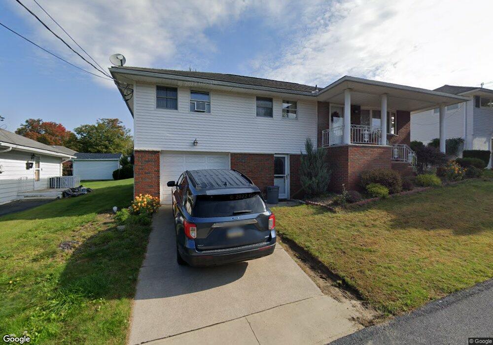
249 Nancy Dr Scranton, PA 18505
Minooka NeighborhoodEstimated Value: $194,000 - $253,000
Studio
--
Bath
--
Sq Ft
5,576
Sq Ft Lot
About This Home
This home is located at 249 Nancy Dr, Scranton, PA 18505 and is currently estimated at $217,672. 249 Nancy Dr is a home located in Lackawanna County with nearby schools including John F. Kennedy Elementary School, South Scranton Intermediate, and West Scranton High School.
Ownership History
Date
Name
Owned For
Owner Type
Purchase Details
Closed on
Jan 21, 2021
Sold by
Kearney David and Kearney Richard
Bought by
Subba Garja M and Tanang Nirmala M
Current Estimated Value
Home Financials for this Owner
Home Financials are based on the most recent Mortgage that was taken out on this home.
Original Mortgage
$128,000
Outstanding Balance
$114,018
Interest Rate
2.6%
Mortgage Type
New Conventional
Estimated Equity
$103,654
Create a Home Valuation Report for This Property
The Home Valuation Report is an in-depth analysis detailing your home's value as well as a comparison with similar homes in the area
Home Values in the Area
Average Home Value in this Area
Purchase History
| Date | Buyer | Sale Price | Title Company |
|---|---|---|---|
| Subba Garja M | $160,000 | United One Resources |
Source: Public Records
Mortgage History
| Date | Status | Borrower | Loan Amount |
|---|---|---|---|
| Open | Subba Garja M | $128,000 |
Source: Public Records
Tax History
| Year | Tax Paid | Tax Assessment Tax Assessment Total Assessment is a certain percentage of the fair market value that is determined by local assessors to be the total taxable value of land and additions on the property. | Land | Improvement |
|---|---|---|---|---|
| 2025 | $4,603 | $15,000 | $1,253 | $13,747 |
| 2024 | $4,192 | $15,000 | $1,253 | $13,747 |
| 2023 | $4,192 | $15,000 | $1,253 | $13,747 |
| 2022 | $4,099 | $15,000 | $1,253 | $13,747 |
| 2021 | $4,099 | $15,000 | $1,253 | $13,747 |
| 2020 | $4,018 | $15,000 | $1,253 | $13,747 |
| 2019 | $3,775 | $15,000 | $1,253 | $13,747 |
| 2018 | $3,775 | $15,000 | $1,253 | $13,747 |
| 2017 | $3,704 | $15,000 | $1,253 | $13,747 |
| 2016 | $986 | $15,000 | $1,253 | $13,747 |
| 2015 | $2,411 | $15,000 | $1,253 | $13,747 |
| 2014 | -- | $15,000 | $1,253 | $13,747 |
Source: Public Records
Map
Nearby Homes
- 3222 Doud Ave
- 3102 Grimes Ave
- 2932 Penman St
- Parcel B Railroad St
- LOT # 6 Railroad St
- 3709 Winfield Ave
- 3709 Laurel Ave Unit REAR
- 0 Cooper St Unit GSBSC255606
- Lot 1 Railroad St
- 112 E Taylor St
- Lot 9 Railroad St
- Lot 10 Railroad St
- 115 W High St
- Lot 2 Railroad St
- 804 School St
- 108 W Taylor St
- Parcel B Davis Ct
- 208 W Taylor St
- 124 Bengar Dr
- 807 Marion Ln
Your Personal Tour Guide
Ask me questions while you tour the home.