Estimated Value: $1,066,000 - $2,359,000
2
Beds
3
Baths
2,099
Sq Ft
$786/Sq Ft
Est. Value
About This Home
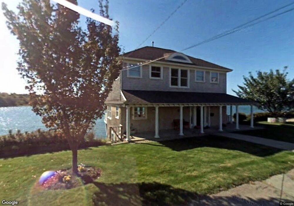
This home is located at 249 Nantasket Rd, Hull, MA 02045 and is currently estimated at $1,648,994, approximately $785 per square foot. 249 Nantasket Rd is a home located in Plymouth County with nearby schools including Lillian M. Jacobs Elementary School, Memorial Middle School, and Hull High School.
Ownership History
Date
Name
Owned For
Owner Type
Purchase Details
Closed on
Nov 5, 2008
Sold by
Moehlenkamp Kevin W
Bought by
Blacker Allan Scott
Current Estimated Value
Home Financials for this Owner
Home Financials are based on the most recent Mortgage that was taken out on this home.
Original Mortgage
$417,000
Outstanding Balance
$273,729
Interest Rate
6.08%
Mortgage Type
Purchase Money Mortgage
Estimated Equity
$1,375,265
Purchase Details
Closed on
Jun 18, 2007
Sold by
Nazar Robert C
Bought by
Moehlenkamp Kevin W
Create a Home Valuation Report for This Property
The Home Valuation Report is an in-depth analysis detailing your home's value as well as a comparison with similar homes in the area
Home Values in the Area
Average Home Value in this Area
Purchase History
| Date | Buyer | Sale Price | Title Company |
|---|---|---|---|
| Blacker Allan Scott | $875,000 | -- | |
| Moehlenkamp Kevin W | $978,000 | -- |
Source: Public Records
Mortgage History
| Date | Status | Borrower | Loan Amount |
|---|---|---|---|
| Open | Moehlenkamp Kevin W | $417,000 | |
| Closed | Moehlenkamp Kevin W | $283,000 |
Source: Public Records
Tax History Compared to Growth
Tax History
| Year | Tax Paid | Tax Assessment Tax Assessment Total Assessment is a certain percentage of the fair market value that is determined by local assessors to be the total taxable value of land and additions on the property. | Land | Improvement |
|---|---|---|---|---|
| 2025 | $15,438 | $1,378,400 | $677,200 | $701,200 |
| 2024 | $15,093 | $1,295,500 | $638,300 | $657,200 |
| 2023 | $14,550 | $1,195,600 | $583,800 | $611,800 |
| 2022 | $14,008 | $1,117,100 | $544,900 | $572,200 |
| 2021 | $13,598 | $1,072,400 | $505,900 | $566,500 |
| 2020 | $12,579 | $981,200 | $409,500 | $571,700 |
| 2019 | $12,600 | $965,500 | $409,500 | $556,000 |
| 2018 | $8,101 | $902,400 | $409,500 | $492,900 |
| 2017 | $11,949 | $870,900 | $409,500 | $461,400 |
| 2016 | $11,740 | $870,900 | $409,500 | $461,400 |
| 2015 | $11,659 | $836,400 | $382,200 | $454,200 |
| 2014 | $11,601 | $836,400 | $382,200 | $454,200 |
Source: Public Records
Map
Nearby Homes
- 246 Nantasket Rd
- 248 Nantasket Rd
- 243 Nantasket Rd
- 250 Nantasket Rd
- 252 Nantasket Rd
- 238 Nantasket Rd
- 45 Clifton Ave
- 254 Nantasket Rd
- 239 Nantasket Rd
- 0 Clifton Ave
- 236 Nantasket Rd
- 258 Nantasket Rd
- 48 Clifton Ave
- 52 Clifton Ave
- 46 Clifton Ave
- 46 Clifton Ave Unit 1
- 59 Clifton Ave
- 54 Clifton Ave
- 44 Clifton Ave
- 44 Clifton Ave Unit Waterfront