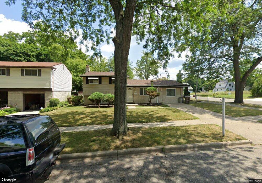
249 Oriley Ct Pontiac, MI 48342
Estimated Value: $139,743 - $235,000
3
Beds
2
Baths
1,615
Sq Ft
$119/Sq Ft
Est. Value
About This Home
This home is located at 249 Oriley Ct, Pontiac, MI 48342 and is currently estimated at $191,436, approximately $118 per square foot. 249 Oriley Ct is a home located in Oakland County with nearby schools including Walt Whitman Elementary School, Pontiac Middle School, and Pontiac High School.
Ownership History
Date
Name
Owned For
Owner Type
Purchase Details
Closed on
Sep 5, 2001
Sold by
Sunanon Cecil B
Bought by
Rodgers Martha
Current Estimated Value
Home Financials for this Owner
Home Financials are based on the most recent Mortgage that was taken out on this home.
Original Mortgage
$25,520
Outstanding Balance
$9,937
Interest Rate
6.97%
Estimated Equity
$181,499
Purchase Details
Closed on
May 26, 1998
Sold by
United Companies Lending
Bought by
R E Investments Inc
Purchase Details
Closed on
Oct 28, 1997
Sold by
Simon Eddie Jr
Bought by
United Companies Lending Corp
Create a Home Valuation Report for This Property
The Home Valuation Report is an in-depth analysis detailing your home's value as well as a comparison with similar homes in the area
Home Values in the Area
Average Home Value in this Area
Purchase History
| Date | Buyer | Sale Price | Title Company |
|---|---|---|---|
| Rodgers Martha | $127,600 | -- | |
| R E Investments Inc | $55,000 | -- | |
| United Companies Lending Corp | $78,504 | -- |
Source: Public Records
Mortgage History
| Date | Status | Borrower | Loan Amount |
|---|---|---|---|
| Open | Rodgers Martha | $25,520 |
Source: Public Records
Tax History Compared to Growth
Tax History
| Year | Tax Paid | Tax Assessment Tax Assessment Total Assessment is a certain percentage of the fair market value that is determined by local assessors to be the total taxable value of land and additions on the property. | Land | Improvement |
|---|---|---|---|---|
| 2024 | $846 | $41,430 | $0 | $0 |
| 2023 | $736 | $31,430 | $0 | $0 |
| 2022 | $777 | $27,950 | $0 | $0 |
| 2021 | $756 | $25,300 | $0 | $0 |
| 2020 | $669 | $22,720 | $0 | $0 |
| 2019 | $730 | $19,600 | $0 | $0 |
| 2018 | $698 | $18,990 | $0 | $0 |
| 2017 | $664 | $18,390 | $0 | $0 |
| 2016 | $691 | $18,100 | $0 | $0 |
| 2015 | -- | $17,130 | $0 | $0 |
| 2014 | -- | $16,660 | $0 | $0 |
| 2011 | -- | $24,530 | $0 | $0 |
Source: Public Records
Map
Nearby Homes
- 000 Wall St
- 0 Woodward Ave
- 397 S Jessie St
- 328 Whittemore St
- 187 Wall St
- 472 S Jessie St
- 000 Rapid St
- 18 S Shirley St
- 389 Osmun St
- 209 Ferry Ave
- 176 S Francis Ave
- 33 S Tasmania St
- 59 Bellevue St
- 54 Bellevue St
- 53 N Roselawn St
- 55 N Roselawn St
- 505 Auburn Ave
- 57 N Roselawn St
- 70 N Roselawn St
- 323 Ferry Ave