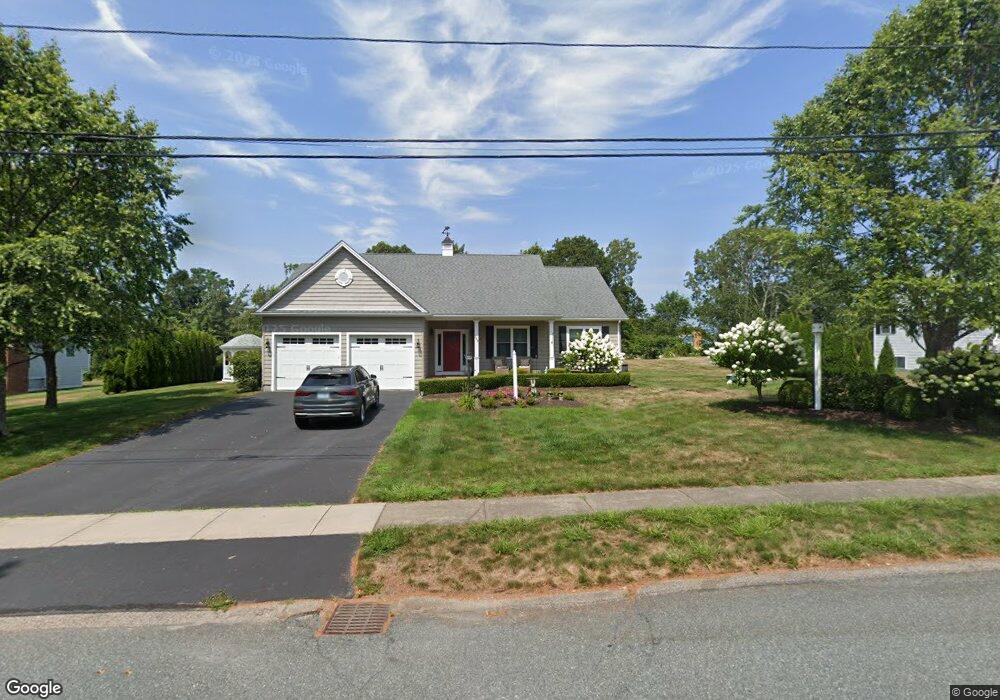
249 Osprey Rd Wakefield, RI 02879
Estimated Value: $1,009,000 - $1,270,000
3
Beds
2
Baths
1,772
Sq Ft
$622/Sq Ft
Est. Value
About This Home
This home is located at 249 Osprey Rd, Wakefield, RI 02879 and is currently estimated at $1,102,009, approximately $621 per square foot. 249 Osprey Rd is a home with nearby schools including South Kingstown High School.
Ownership History
Date
Name
Owned For
Owner Type
Purchase Details
Closed on
Sep 29, 2015
Sold by
Tallman William M and Tallman Joan F
Bought by
Tallman William M and Tallman Joan F
Current Estimated Value
Purchase Details
Closed on
Dec 26, 2012
Sold by
Mcvey Robert C and Mcvey Claudia
Bought by
Tallman William M and Tallman Joan F
Create a Home Valuation Report for This Property
The Home Valuation Report is an in-depth analysis detailing your home's value as well as a comparison with similar homes in the area
Home Values in the Area
Average Home Value in this Area
Purchase History
| Date | Buyer | Sale Price | Title Company |
|---|---|---|---|
| Tallman William M | -- | -- | |
| Tallman William M | $155,000 | -- |
Source: Public Records
Mortgage History
| Date | Status | Borrower | Loan Amount |
|---|---|---|---|
| Previous Owner | Tallman William M | $277,500 | |
| Previous Owner | Tallman William M | $230,000 | |
| Previous Owner | Tallman William M | $210,818 |
Source: Public Records
Tax History Compared to Growth
Tax History
| Year | Tax Paid | Tax Assessment Tax Assessment Total Assessment is a certain percentage of the fair market value that is determined by local assessors to be the total taxable value of land and additions on the property. | Land | Improvement |
|---|---|---|---|---|
| 2025 | $8,048 | $900,200 | $394,200 | $506,000 |
| 2024 | $8,100 | $733,000 | $330,700 | $402,300 |
| 2023 | $8,100 | $733,000 | $330,700 | $402,300 |
| 2022 | $8,026 | $733,000 | $330,700 | $402,300 |
| 2021 | $8,065 | $558,100 | $269,300 | $288,800 |
| 2020 | $8,065 | $558,100 | $269,300 | $288,800 |
| 2019 | $8,065 | $558,100 | $269,300 | $288,800 |
| 2018 | $7,216 | $460,200 | $215,500 | $244,700 |
| 2017 | $7,046 | $460,200 | $215,500 | $244,700 |
| 2016 | $6,944 | $460,200 | $215,500 | $244,700 |
| 2015 | $6,899 | $444,500 | $207,000 | $237,500 |
| 2014 | $6,872 | $443,900 | $207,000 | $236,900 |
Source: Public Records
Map
Nearby Homes
- 27 Holden Rd
- 240 Cards Pond Rd
- 854 Matunuck Beach #215 Rd
- 854 Matunuck Beach Rd
- 24 Peninsula Rd
- 975 Matunuck Beach Rd
- 550 Cards Pond Rd
- 2321 Post Rd
- 2139 Commodore Oliver Hazard Perry Hwy
- 14 E Pointe Ct Unit 14
- 689 Succotash Rd
- 691 Succotash Rd
- 23 E Matunuck Farm Dr
- 76 Hartford Ave
- 16 High Tides Ln
- 40 Wild Rose Ct
- 6 MacAlder St
- 183 Gravelly Hill Rd
- 1185 Succotash Rd
- 201 Gravelly Hill Rd
- 235 Osprey Rd
- 263 Osprey Rd
- 264 Osprey Rd
- 111 Matunuck School House Rd
- 238 Osprey Rd
- 230 Osprey Rd
- 221 Osprey Rd
- 89 Matunuck School House Rd
- 281 Osprey Rd
- 331 Blackberry Hill Dr
- 216 Osprey Rd
- 286 Osprey Rd
- 321 Blackberry Hill Dr
- 205 Osprey Rd
- 61 Matunuck School House Rd
- 133 Matunuck School House Rd
- 176 N Weeden Rd
- 307 Blackberry Hill Dr
- 298 Blackberry Hill Dr
- 295 Osprey Rd