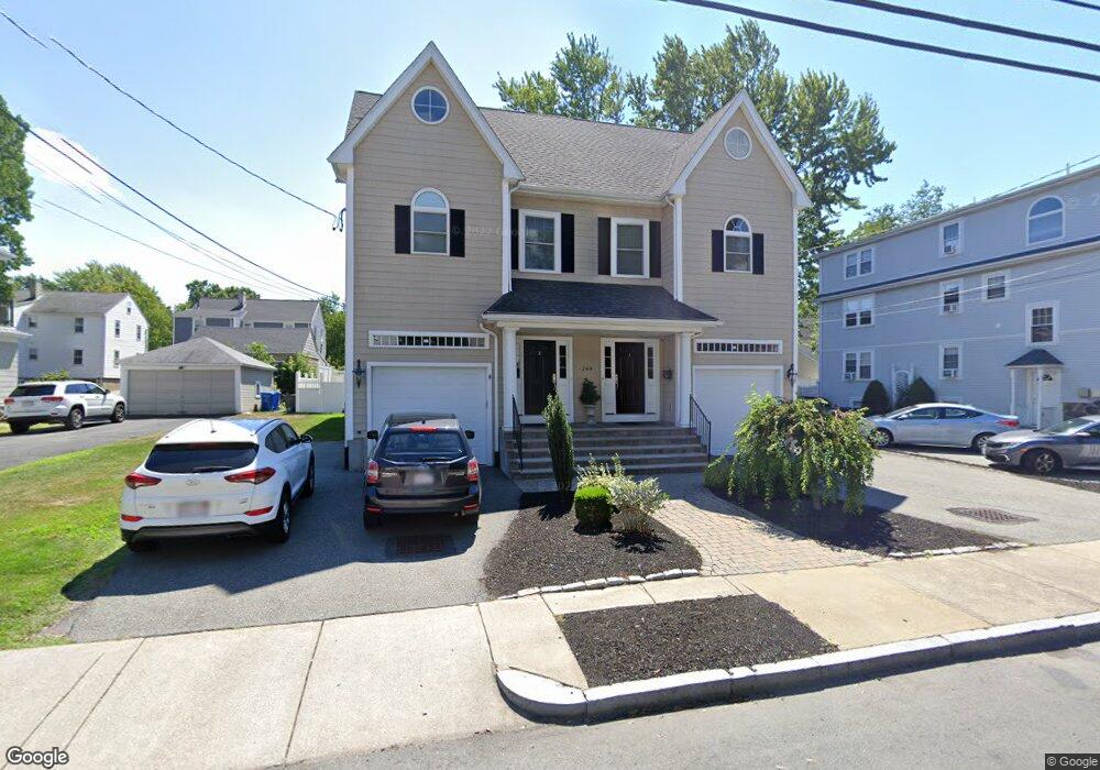
249 Robbins St Waltham, MA 02453
South Side NeighborhoodEstimated Value: $1,102,000 - $1,331,000
5
Beds
5
Baths
3,350
Sq Ft
$357/Sq Ft
Est. Value
About This Home
This home is located at 249 Robbins St, Waltham, MA 02453 and is currently estimated at $1,196,622, approximately $357 per square foot. 249 Robbins St is a home located in Middlesex County with nearby schools including Henry Whittemore Elementary School, John W. Mcdevitt Middle School, and Waltham Sr High School.
Ownership History
Date
Name
Owned For
Owner Type
Purchase Details
Closed on
Nov 2, 2023
Sold by
Loesel Deborah
Bought by
Deborah L Loesel Lt and Loesel
Current Estimated Value
Purchase Details
Closed on
Nov 2, 2020
Sold by
Ferrera Frank K and Ferrera Elizabeth C
Bought by
Loesel Deborah
Purchase Details
Closed on
Feb 24, 2004
Sold by
Rousseau Thomas J
Bought by
Ferrera Elizabeth C and Ferrera Frank K
Home Financials for this Owner
Home Financials are based on the most recent Mortgage that was taken out on this home.
Original Mortgage
$300,000
Interest Rate
5.83%
Mortgage Type
Purchase Money Mortgage
Create a Home Valuation Report for This Property
The Home Valuation Report is an in-depth analysis detailing your home's value as well as a comparison with similar homes in the area
Home Values in the Area
Average Home Value in this Area
Purchase History
| Date | Buyer | Sale Price | Title Company |
|---|---|---|---|
| Deborah L Loesel Lt | -- | None Available | |
| Loesel Deborah | $915,000 | None Available | |
| Ferrera Elizabeth C | $381,000 | -- |
Source: Public Records
Mortgage History
| Date | Status | Borrower | Loan Amount |
|---|---|---|---|
| Previous Owner | Ferrera Elizabeth C | $300,000 |
Source: Public Records
Tax History
| Year | Tax Paid | Tax Assessment Tax Assessment Total Assessment is a certain percentage of the fair market value that is determined by local assessors to be the total taxable value of land and additions on the property. | Land | Improvement |
|---|---|---|---|---|
| 2025 | $9,942 | $1,012,400 | $0 | $1,012,400 |
| 2024 | $9,556 | $991,300 | $0 | $991,300 |
| 2023 | $9,662 | $936,200 | $0 | $936,200 |
| 2022 | $10,134 | $909,700 | $0 | $909,700 |
| 2021 | $9,127 | $806,300 | $0 | $806,300 |
| 2020 | $6,308 | $527,900 | $0 | $527,900 |
| 2019 | $5,674 | $448,200 | $0 | $448,200 |
| 2018 | $5,652 | $448,200 | $0 | $448,200 |
| 2017 | $5,629 | $448,200 | $0 | $448,200 |
| 2016 | $5,486 | $448,200 | $0 | $448,200 |
| 2015 | $8,440 | $642,800 | $197,900 | $444,900 |
Source: Public Records
Map
Nearby Homes
- 24 Tolman St Unit 1
- 24 Tolman St Unit 2
- 215 Ash St Unit 3
- 25 Tolman St Unit 2
- 138 Myrtle St Unit 2
- 231 Lowell St Unit 2
- 54-56 Noble St
- 308 Newton St Unit 1
- 31-37 Washington Ave
- 38 Barbara Rd
- 17 Wadsworth Ave Unit 2
- 17 Washington Ave Unit 3
- 10 Washington Ave Unit 3
- 10 Washington Ave Unit 2
- 11 Derby St
- 105 Adams Ave
- 15 Underwood Park Unit 2
- 76 Taft Ave
- 76 Taft Ave Unit 2
- 76 Taft Ave Unit 1
- 249 Robbins St
- 249 Robbins St Unit 1
- 249 Robbins St Unit B
- 249 Robbins St Unit 2
- 251 Robbins St Unit 253
- 239 Robbins St
- 239 Robbins St Unit 2
- 239 Robbins St Unit 1
- 239 Robbins St Unit 3
- 78 Fuller St Unit 80
- 80 Fuller St
- 72 Fuller St Unit 74
- 74 Fuller St Unit 2
- 74 Fuller St
- 235-237 Robbins St
- 235 Robbins St Unit 237
- 237 Robbins St Unit 2
- 244 Robbins St Unit B
- 252 Robbins St Unit A
- 252 Robbins St
Your Personal Tour Guide
Ask me questions while you tour the home.