Estimated Value: $290,000 - $313,176
3
Beds
2
Baths
1,822
Sq Ft
$166/Sq Ft
Est. Value
About This Home
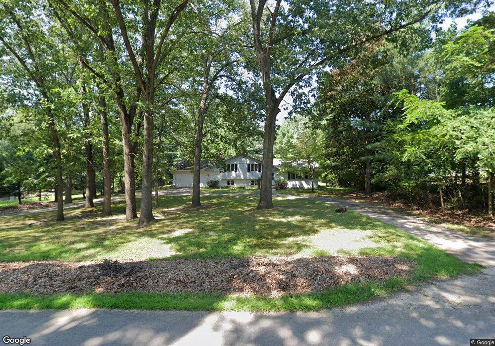
This home is located at 2490 Weaver Rd, Niles, MI 49120 and is currently estimated at $303,044, approximately $166 per square foot. 2490 Weaver Rd is a home located in Berrien County with nearby schools including Merritt Elementary School, Brandywine Elementary School, and Brandywine Middle School.
Ownership History
Date
Name
Owned For
Owner Type
Purchase Details
Closed on
Sep 6, 2018
Sold by
Ault-Williams Family Trust
Bought by
Molenda Cory Ryan
Current Estimated Value
Purchase Details
Closed on
Sep 4, 2018
Sold by
Aull Michael D and The Ault Williams Family Trust
Bought by
Molenda Cory Ryan
Purchase Details
Closed on
Jan 14, 2015
Sold by
Ault Michael David and Williams Karen Ann
Bought by
Ault Michael D and Williams Karen A
Purchase Details
Closed on
Aug 7, 2014
Sold by
Williams Karen Ann and Molenda Karen Ann
Bought by
Ault Michael David and Williams Karen Ann
Purchase Details
Closed on
Sep 23, 1985
Create a Home Valuation Report for This Property
The Home Valuation Report is an in-depth analysis detailing your home's value as well as a comparison with similar homes in the area
Home Values in the Area
Average Home Value in this Area
Purchase History
| Date | Buyer | Sale Price | Title Company |
|---|---|---|---|
| Molenda Cory Ryan | -- | None Listed On Document | |
| Molenda Cory Ryan | -- | None Available | |
| Ault Michael D | -- | Attorney | |
| Ault Michael David | -- | None Available | |
| -- | $59,300 | -- |
Source: Public Records
Tax History Compared to Growth
Tax History
| Year | Tax Paid | Tax Assessment Tax Assessment Total Assessment is a certain percentage of the fair market value that is determined by local assessors to be the total taxable value of land and additions on the property. | Land | Improvement |
|---|---|---|---|---|
| 2025 | $3,180 | $129,800 | $0 | $0 |
| 2024 | $983 | $117,600 | $0 | $0 |
| 2023 | $937 | $102,300 | $0 | $0 |
| 2022 | $892 | $89,000 | $0 | $0 |
| 2021 | $2,810 | $85,500 | $17,600 | $67,900 |
| 2020 | $2,789 | $87,500 | $0 | $0 |
| 2019 | $2,737 | $68,000 | $13,700 | $54,300 |
| 2018 | $2,657 | $68,000 | $0 | $0 |
| 2017 | $2,640 | $69,000 | $0 | $0 |
| 2016 | $2,605 | $73,500 | $0 | $0 |
| 2015 | $2,537 | $71,100 | $0 | $0 |
| 2014 | $643 | $70,600 | $0 | $0 |
Source: Public Records
Map
Nearby Homes
- 1680 River Bend Blvd
- 1670 River Bend Blvd
- 1650 Whitetail Cir
- 1640 Forest St
- 1610 Whitetail Cir
- 1240 Chapelgate Rd
- 1245 Woodland Ave
- 62 Madeline
- 1860 High Meadow N
- 112 Bertram Rd
- 112 E Bertrand Rd
- 2975 Portage Rd
- 2160 Portage Rd
- 2819 Adams Rd
- 249 Higgins St
- 1834 Bond St
- 2559 S 3rd St
- 2639 S 3rd St
- 2834 Mason St
- 2120 S 3rd St
- 2510 Weaver Rd
- 2460 Weaver Rd
- 2495 Weaver Rd
- 2530 Weaver Rd
- 2475 Weaver Rd
- 2450 Weaver Rd
- 1800 Briar Rd
- 1800 Briar Rd
- 2600 Weaver Rd
- 2600 Weaver Rd
- 2600 Weaver Rd
- 2535 Weaver Rd
- 2430 Weaver Rd
- 2410 Weaver Rd
- V/L Weaver Rd
- 2445 Weaver Rd
- 1820 Briar Rd
- 2610 Weaver Rd
- 1420 Whitetail Cir
- 1420 Whitetail Cir Unit 15