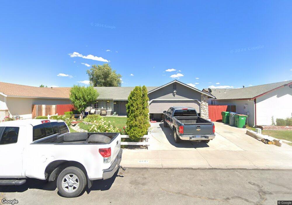
2491 Canter Way Carson City, NV 89706
Northridge NeighborhoodEstimated Value: $456,787 - $484,000
3
Beds
2
Baths
1,440
Sq Ft
$325/Sq Ft
Est. Value
About This Home
This home is located at 2491 Canter Way, Carson City, NV 89706 and is currently estimated at $468,447, approximately $325 per square foot. 2491 Canter Way is a home located in Carson City with nearby schools including Mark Twain Elementary School, Carson Middle School, and Carson High School.
Ownership History
Date
Name
Owned For
Owner Type
Purchase Details
Closed on
Mar 31, 2005
Sold by
Rodriguez Manuel C and Rodriguez Palmira
Bought by
Rodriguez Manuel C and Rodriguez Palmira
Current Estimated Value
Home Financials for this Owner
Home Financials are based on the most recent Mortgage that was taken out on this home.
Original Mortgage
$208,000
Interest Rate
1%
Mortgage Type
New Conventional
Create a Home Valuation Report for This Property
The Home Valuation Report is an in-depth analysis detailing your home's value as well as a comparison with similar homes in the area
Home Values in the Area
Average Home Value in this Area
Purchase History
| Date | Buyer | Sale Price | Title Company |
|---|---|---|---|
| Rodriguez Manuel C | -- | First American Title Co Nv |
Source: Public Records
Mortgage History
| Date | Status | Borrower | Loan Amount |
|---|---|---|---|
| Closed | Rodriguez Manuel C | $208,000 |
Source: Public Records
Tax History Compared to Growth
Tax History
| Year | Tax Paid | Tax Assessment Tax Assessment Total Assessment is a certain percentage of the fair market value that is determined by local assessors to be the total taxable value of land and additions on the property. | Land | Improvement |
|---|---|---|---|---|
| 2025 | $2,047 | $87,511 | $33,250 | $54,261 |
| 2024 | $1,879 | $85,148 | $31,500 | $53,648 |
| 2023 | $1,741 | $79,154 | $28,700 | $50,454 |
| 2022 | $1,612 | $69,496 | $23,975 | $45,521 |
| 2021 | $1,621 | $64,706 | $19,950 | $44,756 |
| 2020 | $1,621 | $60,551 | $16,450 | $44,101 |
| 2019 | $1,474 | $60,201 | $16,450 | $43,751 |
| 2018 | $1,431 | $57,977 | $15,750 | $42,227 |
| 2017 | $1,389 | $55,509 | $13,475 | $42,034 |
| 2016 | $1,355 | $55,220 | $12,250 | $42,970 |
| 2015 | $1,352 | $49,109 | $10,500 | $38,609 |
| 2014 | $1,312 | $37,047 | $8,750 | $28,297 |
Source: Public Records
Map
Nearby Homes
- 1331 Rolling Hills Dr
- 1381 Spooner Dr
- 2616 Carriage Crest Dr
- 1359 Windridge Dr
- 2554 Pinion Pine Dr
- 2750 Carriage Crest Dr
- 2743 Longridge Dr
- 2051 Southridge Ct
- 1968 Marian Ave
- 0 Research Way
- 493 Hot Springs Rd Unit 24
- 1529 E Long St
- 1366 Campagni Ln
- 1955 F St
- 2048 Poole Way
- 40 Bryan Cir
- 1393 Handelin Rd
- 1902 N Peter's St
- 20 Royal Dr
- 1610 N Stewart St
- 2509 Canter Way
- 2479 Canter Way
- 2486 Rockbridge Dr
- 2474 Rockbridge Dr
- 2502 Rockbridge Dr
- 2521 Canter Way
- 1518 Rolling Hills Dr
- 2488 Canter Way
- 2504 Canter Way
- 2476 Canter Way
- 2514 Rockbridge Dr
- 1530 Rolling Hills Dr
- 2516 Canter Way
- 2533 Canter Way
- 2464 Canter Way
- 2526 Rockbridge Dr
- 2487 Ravenshorn Dr
- 2528 Canter Way
- 2475 Ravenshorn Dr
- 2503 Ravenshorn Dr