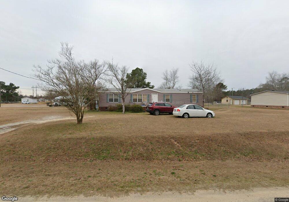
2491 Lindfield Cir Effingham, SC 29541
Estimated Value: $53,000 - $124,000
--
Bed
--
Bath
--
Sq Ft
0.53
Acres
About This Home
This home is located at 2491 Lindfield Cir, Effingham, SC 29541 and is currently estimated at $80,667. 2491 Lindfield Cir is a home located in Florence County with nearby schools including Savannah Grove Elementary School, Southside Middle School, and South Florence High School.
Ownership History
Date
Name
Owned For
Owner Type
Purchase Details
Closed on
Aug 24, 2015
Sold by
Chico Jessica Lynn
Bought by
Chico Ruben A
Current Estimated Value
Purchase Details
Closed on
May 15, 2015
Sold by
Chico Ruben A
Bought by
Chico Jessica Lynn
Purchase Details
Closed on
Aug 30, 2007
Sold by
Goines Dwayne Allen
Bought by
Chico Ruben A
Home Financials for this Owner
Home Financials are based on the most recent Mortgage that was taken out on this home.
Original Mortgage
$56,700
Outstanding Balance
$9,621
Interest Rate
6.7%
Mortgage Type
Purchase Money Mortgage
Estimated Equity
$71,046
Purchase Details
Closed on
Sep 2, 2003
Sold by
Bouras Gregory and Bouras Vicki L
Bought by
Goines Dwayne Allen
Create a Home Valuation Report for This Property
The Home Valuation Report is an in-depth analysis detailing your home's value as well as a comparison with similar homes in the area
Home Values in the Area
Average Home Value in this Area
Purchase History
| Date | Buyer | Sale Price | Title Company |
|---|---|---|---|
| Chico Ruben A | -- | -- | |
| Chico Jessica Lynn | -- | -- | |
| Chico Ruben A | $63,000 | Attorney | |
| Goines Dwayne Allen | $12,500 | -- |
Source: Public Records
Mortgage History
| Date | Status | Borrower | Loan Amount |
|---|---|---|---|
| Open | Chico Ruben A | $56,700 |
Source: Public Records
Tax History Compared to Growth
Tax History
| Year | Tax Paid | Tax Assessment Tax Assessment Total Assessment is a certain percentage of the fair market value that is determined by local assessors to be the total taxable value of land and additions on the property. | Land | Improvement |
|---|---|---|---|---|
| 2024 | $636 | $1,267 | $556 | $711 |
| 2023 | $646 | $556 | $556 | $0 |
| 2022 | $779 | $556 | $556 | $0 |
| 2021 | $672 | $1,900 | $0 | $0 |
| 2020 | $740 | $1,900 | $0 | $0 |
| 2019 | $741 | $1,900 | $0 | $0 |
| 2018 | $697 | $1,900 | $0 | $0 |
| 2017 | $703 | $1,900 | $0 | $0 |
| 2016 | $605 | $1,900 | $0 | $0 |
| 2015 | $600 | $1,900 | $0 | $0 |
| 2014 | $581 | $0 | $0 | $0 |
Source: Public Records
Map
Nearby Homes
- 2222 Ashford Dr
- 2230 Ashford Dr
- 1809 Taylor Ct
- 2304 S Point Rd
- 2206 Wellesly Ct
- 1831 Wax Myrtle Dr
- 1717 Full Moon Rd
- 0 State Road S-21-869
- 1311 Queens Ferry Rd
- 2303 W McCown Dr
- 1719 Furman Dr
- 1658 Jefferson Dr
- 2125 Sanderling Dr
- 1801 Woods Dr
- 1779 S Saint Anthony Ave
- 2113 Sanderling Dr
- 2338 W McCown Dr
- 1770 Woods Dr
- 1682 Jefferson Dr
- 2348 Chadwick Dr
- 2499 Lindfield Cir
- 2475 Lindfield Cir
- 2484 Lindfield Cir
- 2490 Lindfield Cir
- 2492 Lindfield Cir
- 2494 Lindfield Cir
- 2478 Lindfield Cir
- 2496 Lindfield Cir
- 2498 Lindfield Cir Unit 82
- 2447 Lindfield Cir
- 2472 Lindfield Cir
- 2400 Lindfield Cir
- 2445 Lindfield Cir
- 0 Ashford Dr Unit 1225749
- 2408 Lindfield Cir
- 2466 Lindfield Cir
- 2439 Lindfield Cir
- 2116 Ashford Dr
- 2119 Ashford Dr
- 2412 Lindfield Cir