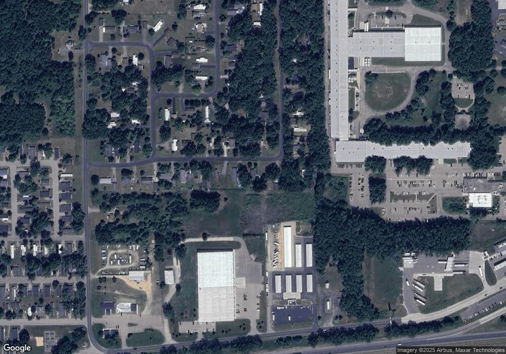
24913 E Point Dr Mattawan, MI 49071
Estimated Value: $177,000 - $211,478
3
Beds
2
Baths
1,120
Sq Ft
$175/Sq Ft
Est. Value
About This Home
This home is located at 24913 E Point Dr, Mattawan, MI 49071 and is currently estimated at $195,870, approximately $174 per square foot. 24913 E Point Dr is a home located in Van Buren County with nearby schools including Mattawan Early Elementary School, Mattawan Later Elementary School, and Mattawan Early Childhood Education Center.
Ownership History
Date
Name
Owned For
Owner Type
Purchase Details
Closed on
Jul 19, 2007
Sold by
Woodford Karlelton and Woodford Janet
Bought by
The Bank Of New York Trust Co Na and Jpmorgan Chase Bank Na
Current Estimated Value
Purchase Details
Closed on
Jun 19, 1998
Sold by
Hastsings James A and Hastsings Vicci
Bought by
Woodford Karleton and Woodford Janet
Create a Home Valuation Report for This Property
The Home Valuation Report is an in-depth analysis detailing your home's value as well as a comparison with similar homes in the area
Home Values in the Area
Average Home Value in this Area
Purchase History
| Date | Buyer | Sale Price | Title Company |
|---|---|---|---|
| The Bank Of New York Trust Co Na | $18,026 | None Available | |
| Woodford Karleton | $39,000 | -- |
Source: Public Records
Tax History
| Year | Tax Paid | Tax Assessment Tax Assessment Total Assessment is a certain percentage of the fair market value that is determined by local assessors to be the total taxable value of land and additions on the property. | Land | Improvement |
|---|---|---|---|---|
| 2025 | $2,103 | $75,900 | $0 | $0 |
| 2024 | $941 | $73,200 | $0 | $0 |
| 2023 | $896 | $70,200 | $0 | $0 |
| 2022 | $1,831 | $62,100 | $0 | $0 |
| 2021 | $1,762 | $51,500 | $9,000 | $42,500 |
| 2020 | $1,735 | $51,600 | $9,000 | $42,600 |
| 2019 | $1,645 | $48,900 | $48,900 | $0 |
| 2018 | $1,584 | $40,600 | $40,600 | $0 |
| 2017 | $1,543 | $38,800 | $0 | $0 |
| 2016 | $4,743 | $42,900 | $0 | $0 |
| 2015 | $1,122 | $42,900 | $0 | $0 |
| 2014 | $1,169 | $42,600 | $0 | $0 |
| 2013 | -- | $36,800 | $36,800 | $0 |
Source: Public Records
Map
Nearby Homes
- 52484 N Point Dr
- 51650 County Road 652
- 4.5 County Road 652
- 51133 25th St
- 25851 Pleasant Dr
- 24537 Brownstone Blvd
- 24308 Brownstone Blvd
- 56550 Village Center Cir Unit 20
- 23753 Red Arrow Hwy
- 47805 Silver Oaks W
- 23901 Village Center Cir
- 23875 Village Center Cir
- 24195 Third Ave
- 23589 Laurel Glen Ave
- 49076 Silver Oaks W
- 57383 Kingdon Dr
- 48692 Silver Oaks Blvd
- 48605 Silver Oaks Blvd
- 25248 Front St
- 57723 Ryan St
- 24923 E Point Dr
- 24903 E Point Dr
- 24893 E Point Dr
- 24933 E Point Dr
- 24934 E Point Dr
- 24944 E Point Dr
- 24943 E Point Dr
- 24883 E Point Dr
- 52535 N Point Dr
- 24954 E Point Dr
- 52514 N Point Dr
- 52525 N Point Dr
- 24953 E Point Dr
- 52507 S Point Dr
- 24964 E Point Dr
- 52517 S Point Dr
- 52504 N Point Dr
- 24963 E Point Dr
- 52527 S Point Dr
- 24974 E Point Dr
Your Personal Tour Guide
Ask me questions while you tour the home.
