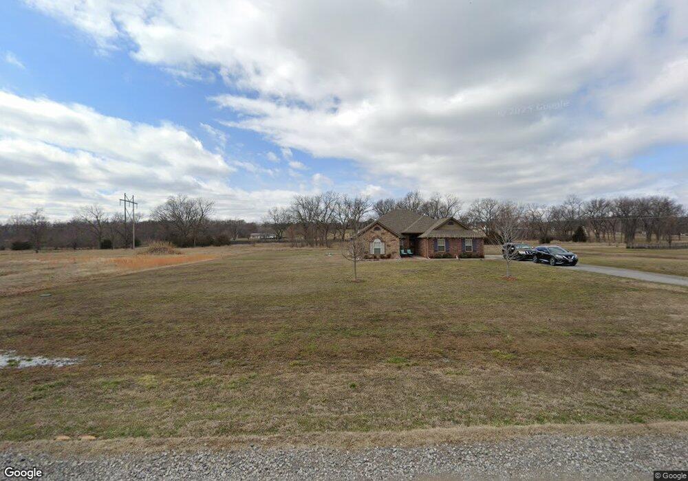
24941 S 382 Rd Fort Gibson, OK 74434
Estimated Value: $296,813 - $328,000
3
Beds
2
Baths
1,773
Sq Ft
$175/Sq Ft
Est. Value
About This Home
This home is located at 24941 S 382 Rd, Fort Gibson, OK 74434 and is currently estimated at $310,703, approximately $175 per square foot. 24941 S 382 Rd is a home with nearby schools including Norwood Public School and Fort Gibson Christian Academy.
Ownership History
Date
Name
Owned For
Owner Type
Purchase Details
Closed on
Aug 20, 2013
Sold by
Arcon Inc
Bought by
Humphrey Monte and Humphrey Carla
Current Estimated Value
Home Financials for this Owner
Home Financials are based on the most recent Mortgage that was taken out on this home.
Original Mortgage
$144,000
Outstanding Balance
$107,358
Interest Rate
4.53%
Mortgage Type
New Conventional
Estimated Equity
$203,345
Create a Home Valuation Report for This Property
The Home Valuation Report is an in-depth analysis detailing your home's value as well as a comparison with similar homes in the area
Home Values in the Area
Average Home Value in this Area
Purchase History
| Date | Buyer | Sale Price | Title Company |
|---|---|---|---|
| Humphrey Monte | $180,000 | Muskogee Title Company |
Source: Public Records
Mortgage History
| Date | Status | Borrower | Loan Amount |
|---|---|---|---|
| Open | Humphrey Monte | $144,000 |
Source: Public Records
Tax History Compared to Growth
Tax History
| Year | Tax Paid | Tax Assessment Tax Assessment Total Assessment is a certain percentage of the fair market value that is determined by local assessors to be the total taxable value of land and additions on the property. | Land | Improvement |
|---|---|---|---|---|
| 2025 | $1,448 | $22,026 | $2,455 | $19,571 |
| 2024 | $1,448 | $21,384 | $2,383 | $19,001 |
| 2023 | $1,448 | $20,761 | $2,200 | $18,561 |
| 2022 | $1,360 | $20,156 | $2,200 | $17,956 |
| 2021 | $1,360 | $20,156 | $2,200 | $17,956 |
| 2020 | $1,360 | $20,156 | $2,200 | $17,956 |
| 2019 | $1,360 | $20,156 | $2,200 | $17,956 |
| 2018 | $1,360 | $20,156 | $2,200 | $17,956 |
| 2017 | $1,377 | $20,394 | $2,185 | $18,209 |
| 2016 | $1,406 | $19,800 | $3,300 | $16,500 |
| 2015 | $1,376 | $19,800 | $3,300 | $16,500 |
| 2014 | $1,376 | $19,800 | $3,300 | $16,500 |
Source: Public Records
Map
Nearby Homes
- 1580 E Dawson Dr
- 1409 Sterling Ct
- 607 Sterling Hill Dr
- 1586 Joelle
- 121 N Meigs St
- 602 Cemetery Rd
- 1003 E Maple St
- 313 S Meigs St
- 1419 Hickory Hills Dr
- 1412 Richmond Dr
- 105 N Firecracker Ln
- 308 N East St
- 1606 Blue Stem Rd
- 608 E Irving
- 604 Irving St
- 24196 N 4 Mile Rd
- 301 E Poplar St
- 0 E Coppinger Ave
- 305 E Hickory Ave
- 125 E Walnut St
- 200 N 2 Mile Rd
- 0 S 382 Rd Unit 2237246
- 0 S 382 Rd Unit 1914091
- 0 S 382 Rd Unit 1914092
- 0 S 382 Rd Unit 1914094
- 0 S 382 Rd Unit 1914095
- 0 S 382 Rd Unit 1914093
- 0 S 382 Rd Unit 1914096
- 0 S 382 Rd Unit 1914097
- 0 S 382 Rd Unit 1914099
- 0 S 382 Rd Unit 1914098
- 0 S 382 Rd Unit 1937397
- 0 S 382 Rd Unit 1937401
- 0 S 382 Rd Unit 1937398
- 0 S 382 Rd Unit 1937400
- 0 S 382 Rd Unit 1937390
- 0 S 382 Rd Unit 1937393
- 0 S 382 Rd Unit 1937396
- 0 S 382 Rd Unit 1937394
- 0 S 382 Rd Unit 1937404