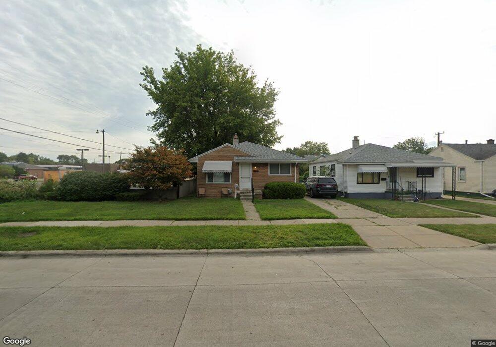
24948 Hayes Ave Eastpointe, MI 48021
Estimated Value: $137,874 - $158,000
--
Bed
1
Bath
935
Sq Ft
$160/Sq Ft
Est. Value
About This Home
This home is located at 24948 Hayes Ave, Eastpointe, MI 48021 and is currently estimated at $149,969, approximately $160 per square foot. 24948 Hayes Ave is a home located in Macomb County with nearby schools including Bellview Elementary School, Eastpointe Middle School, and Eaton Academy.
Ownership History
Date
Name
Owned For
Owner Type
Purchase Details
Closed on
Oct 27, 2015
Sold by
City Of Eastpointe
Bought by
Macomb 30 Llc
Current Estimated Value
Purchase Details
Closed on
Jul 16, 2015
Sold by
Macomb County Treasurer
Bought by
Eastpointe City Of
Purchase Details
Closed on
Nov 7, 1994
Sold by
Robert B Walls
Bought by
Kolakowski Wade S and Kolakowski Theresa M
Home Financials for this Owner
Home Financials are based on the most recent Mortgage that was taken out on this home.
Original Mortgage
$58,998
Interest Rate
9.06%
Mortgage Type
FHA
Create a Home Valuation Report for This Property
The Home Valuation Report is an in-depth analysis detailing your home's value as well as a comparison with similar homes in the area
Home Values in the Area
Average Home Value in this Area
Purchase History
| Date | Buyer | Sale Price | Title Company |
|---|---|---|---|
| Macomb 30 Llc | -- | Chirco Title Agency Inc | |
| Eastpointe City Of | $408,218 | -- | |
| Kolakowski Wade S | $60,000 | -- |
Source: Public Records
Mortgage History
| Date | Status | Borrower | Loan Amount |
|---|---|---|---|
| Previous Owner | Kolakowski Wade S | $58,998 |
Source: Public Records
Tax History Compared to Growth
Tax History
| Year | Tax Paid | Tax Assessment Tax Assessment Total Assessment is a certain percentage of the fair market value that is determined by local assessors to be the total taxable value of land and additions on the property. | Land | Improvement |
|---|---|---|---|---|
| 2025 | $2,031 | $58,400 | $0 | $0 |
| 2024 | $1,927 | $52,600 | $0 | $0 |
| 2023 | $2,541 | $49,500 | $0 | $0 |
| 2022 | $1,914 | $41,500 | $0 | $0 |
| 2021 | $1,883 | $34,500 | $0 | $0 |
| 2020 | $1,816 | $32,900 | $0 | $0 |
| 2019 | $1,806 | $26,800 | $0 | $0 |
| 2018 | $2,275 | $23,940 | $0 | $0 |
| 2017 | $2,238 | $21,500 | $3,220 | $18,280 |
| 2016 | $1,884 | $21,500 | $0 | $0 |
| 2015 | $1,902 | $20,010 | $0 | $0 |
| 2013 | $1,826 | $19,400 | $0 | $0 |
Source: Public Records
Map
Nearby Homes
- 14930 E 10 Mile Rd
- 14948 Chesterfield Ave
- 14879 Shirley Ave
- 25173 Rosenbusch Blvd
- 24805 Dale Ave
- 25207 Fortuna St
- 14945 Alberta Ave
- 25135 Dale St
- 24591 Valley Ave
- 24933 Grove Ave
- 25231 Hayes Blvd
- 24845 Grove Ave
- 25221 Tecla Ave
- 25297 Fortuna St
- 14920 Myola Ave
- 24606 Berry Ave
- 25239 Lehner St
- 25280 Dale St
- 25603 Fortuna St
- 14824 Myola Ave
- 24940 Hayes Ave
- 24934 Hayes Ave
- 24924 Hayes Ave
- 24925 Valley Ave
- 14976 E 10 Mile Rd Unit 14978 E 10 Mile Rd
- 14976 E 10 Mile Rd Unit 14978
- 24916 Hayes Ave
- 14960 E 10 Mile Rd
- 14950 E 10 Mile Rd
- 14940 E 10 Mile Rd Unit 14984
- 14940 E 10 Mile Rd
- 14984 E 10 Mile Rd
- 24909 Valley Ave
- 24910 Hayes Ave
- 24933 Hayes Ave
- 24899 Valley Ave
- 24941 Hayes Ave
- 14924 E 10 Mile Rd Unit ID1032312P
- 14950 E 10 Mile Rd Unit ID1032312P
- 24891 Valley Ave