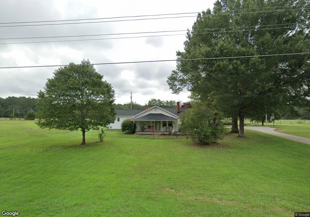
2495 Devine Rd Lincolnton, NC 28092
Estimated Value: $364,000 - $410,000
About This Home
This home is located at 2495 Devine Rd, Lincolnton, NC 28092 and is currently estimated at $380,333, approximately $197 per square foot. 2495 Devine Rd is a home with nearby schools including Iron Station Elementary School, East Lincoln Middle School, and East Lincoln High School.
Ownership History
We collect this data history from publicly available records. To have your information removed, we recommend requesting removal directly through your county’s website.
Purchase Details
Purchase Details
Purchase Details
Purchase Details
Purchase Details
Purchase History
We collect this data history from publicly available records. To have your information removed, we recommend requesting removal directly through your county’s website.
| Date | Buyer | Sale Price | Title Company |
|---|---|---|---|
| $553,000 | None Listed On Document | ||
| $553,000 | None Listed On Document | ||
| -- | None Available | ||
| $75,600 | -- | ||
| $69,800 | -- | ||
| $48,000 | -- |
Tax History
We collect this data history from publicly available records. To have your information removed, we recommend requesting removal directly through your county’s website.
| Year | Tax Paid | Tax Assessment Tax Assessment Total Assessment is a certain percentage of the fair market value that is determined by local assessors to be the total taxable value of land and additions on the property. | Land | Improvement |
|---|---|---|---|---|
| 2025 | $1,790 | $266,588 | $51,004 | $215,584 |
| 2024 | $1,770 | $266,588 | $51,004 | $215,584 |
| 2023 | $1,729 | $266,588 | $51,004 | $215,584 |
| 2022 | $1,247 | $153,882 | $37,545 | $116,337 |
| 2021 | $1,145 | $140,041 | $37,545 | $102,496 |
| 2020 | $1,002 | $140,041 | $37,545 | $102,496 |
| 2019 | $1,002 | $140,041 | $37,545 | $102,496 |
| 2018 | $939 | $115,178 | $35,336 | $79,842 |
| 2017 | $838 | $115,178 | $35,336 | $79,842 |
| 2016 | $838 | $115,178 | $35,336 | $79,842 |
| 2015 | $907 | $115,178 | $35,336 | $79,842 |
| 2014 | $950 | $122,541 | $36,045 | $86,496 |
Map
- 821 Latrobe Dr
- 5329 E Highway 27 Hwy
- 2031 Redskin Trail
- 3136 Philadelphia Church Rd
- 3542 Orchard Rd
- 3132 Fox Den Cir
- 382 Alexis High Shoals Rd
- 3511 Randleman Rd
- 4242 John Ritchie Rd
- 1305 Craig Dr
- 1259 Hardin Rd
- 4432 E Highway 27
- 1249 Hardin Rd
- 853 Spring Lake Dr
- 1222 Hardin Rd
- 1753 Autumn Banks Way Unit 76p
- 1625 Autumn Banks Way Unit 37p
- 1623 Autumn Banks Way Unit 36p
- 1619 Autumn Banks Way Unit 34p
- 1621 Autumn Banks Way Unit 35p
- 2516 Devine Rd
- 2473 Devine Rd
- Lot 5 Bryce Ln
- Lot 3 Bryce Ln
- 2822 Greystone Ln
- Lot #6 Bryce Ln
- Lot 4 Bryce Ln
- 1.91 Acres Devine Rd
- 2453 Devine Rd
- 2549 Colewood Ln
- 2369 Devine Rd
- 2541 Devine Rd
- 2995 Bryce Ln
- 3046 Bryce Ln
- 00 Bryce Ln
- 3009 Bryce Ln
- 2561 Devine Rd
- 2721 Greystone Ln
- 2557 Devine Rd
- 3032 Bryce Ln
Ask me questions while you tour the home.