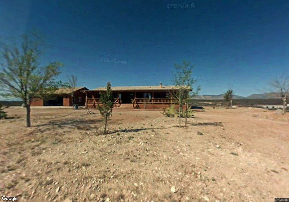
2496 E Colt Rd Tombstone, AZ 85638
Estimated Value: $304,000 - $336,634
Studio
--
Bath
1,697
Sq Ft
$186/Sq Ft
Est. Value
About This Home
This home is located at 2496 E Colt Rd, Tombstone, AZ 85638 and is currently estimated at $314,878, approximately $185 per square foot. 2496 E Colt Rd is a home located in Cochise County with nearby schools including Tombstone High School.
Ownership History
Date
Name
Owned For
Owner Type
Purchase Details
Closed on
Aug 29, 2024
Sold by
Kimberly G Herrig Revocable Trust and Herrig Kimberly G
Bought by
Kimberly G Herrig Revocable Trust and Herrig
Current Estimated Value
Purchase Details
Closed on
Jul 22, 2015
Sold by
Herrig Kimberly G
Bought by
Herrig Kimberly G
Purchase Details
Closed on
Dec 27, 2012
Sold by
Fox Michael J and Herrig Kimberly Gladys
Bought by
Herrig Kimberly G
Home Financials for this Owner
Home Financials are based on the most recent Mortgage that was taken out on this home.
Original Mortgage
$142,000
Interest Rate
3.27%
Mortgage Type
New Conventional
Purchase Details
Closed on
Jan 10, 2007
Sold by
Herrig Kimberly Gladys
Bought by
Fox Michael J and Herrig Kimberly Gladys
Create a Home Valuation Report for This Property
The Home Valuation Report is an in-depth analysis detailing your home's value as well as a comparison with similar homes in the area
Purchase History
| Date | Buyer | Sale Price | Title Company |
|---|---|---|---|
| Kimberly G Herrig Revocable Trust | -- | None Listed On Document | |
| Herrig Kimberly G | -- | None Available | |
| Herrig Kimberly G | -- | Pioneer Title Agency | |
| Fox Michael J | -- | None Available |
Source: Public Records
Mortgage History
| Date | Status | Borrower | Loan Amount |
|---|---|---|---|
| Previous Owner | Herrig Kimberly G | $142,000 |
Source: Public Records
Tax History
| Year | Tax Paid | Tax Assessment Tax Assessment Total Assessment is a certain percentage of the fair market value that is determined by local assessors to be the total taxable value of land and additions on the property. | Land | Improvement |
|---|---|---|---|---|
| 2025 | $2,041 | $29,627 | $4,880 | $24,747 |
| 2024 | $2,041 | $29,303 | $4,880 | $24,423 |
| 2023 | $1,911 | $25,404 | $4,880 | $20,524 |
| 2022 | $1,909 | $24,652 | $4,880 | $19,772 |
| 2021 | $2,085 | $24,457 | $4,880 | $19,577 |
| 2020 | $2,048 | $0 | $0 | $0 |
| 2019 | $1,968 | $0 | $0 | $0 |
| 2018 | $2,116 | $0 | $0 | $0 |
| 2017 | $2,121 | $0 | $0 | $0 |
| 2016 | $1,988 | $0 | $0 | $0 |
| 2015 | -- | $0 | $0 | $0 |
Source: Public Records
Map
Nearby Homes
- 2625 E Deer Run
- 1484 N Cochise Ct
- 1287 N Camino San Rafael
- 1091 N Camino San Rafael
- 1587 E Pony Cir
- 977 N Saddleback Cir
- 1324 N Saddleback Cir
- 1324 N Saddleback Dr
- 2070 E Gleeson Rd
- 1383 N Saddleback Cir
- 2812 E Deer Run
- 0 Lot 112 Kino Place Unit 112
- TBD W Fuller Ranch Rd
- TBD N Via Loma Linda Dr Unit 722,723,724
- 0 N Navajo Place Unit 26 6814733
- 00 N North Dr Unit 27
- 0 N Navaho Place Unit 26 22503323
- 2383 N Middlemarch Rd Unit 1
- Lot 81 Apache Dr
- Lot 81 Apache Dr Unit 81
- 1707 N Curly Bill Dr
- 1688 N Curly Bill Dr
- 1738 N Curly Bill Dr
- TBD N Curly Bill Dr
- 2470 E Colt Rd
- 2530 E Colt Rd
- 1648 N Curly Bill Dr
- 1633 N Curly Bill Dr
- 1745 N Curly Bill Dr
- 2543 E Colt Rd
- 2440 E Colt Rd
- 2553 E Colt Rd
- 1616 N Bent Barrell Trail
- 2546 E Colt Rd
- 1603 N Bent Barrell Trail
- 1641 N Orante Rd
- 1600 N Bent Barrell Trail
- 2421 E Colt Rd
- 1636 N Orante Rd
- 1595 N Bent Barrell Trail
Your Personal Tour Guide
Ask me questions while you tour the home.