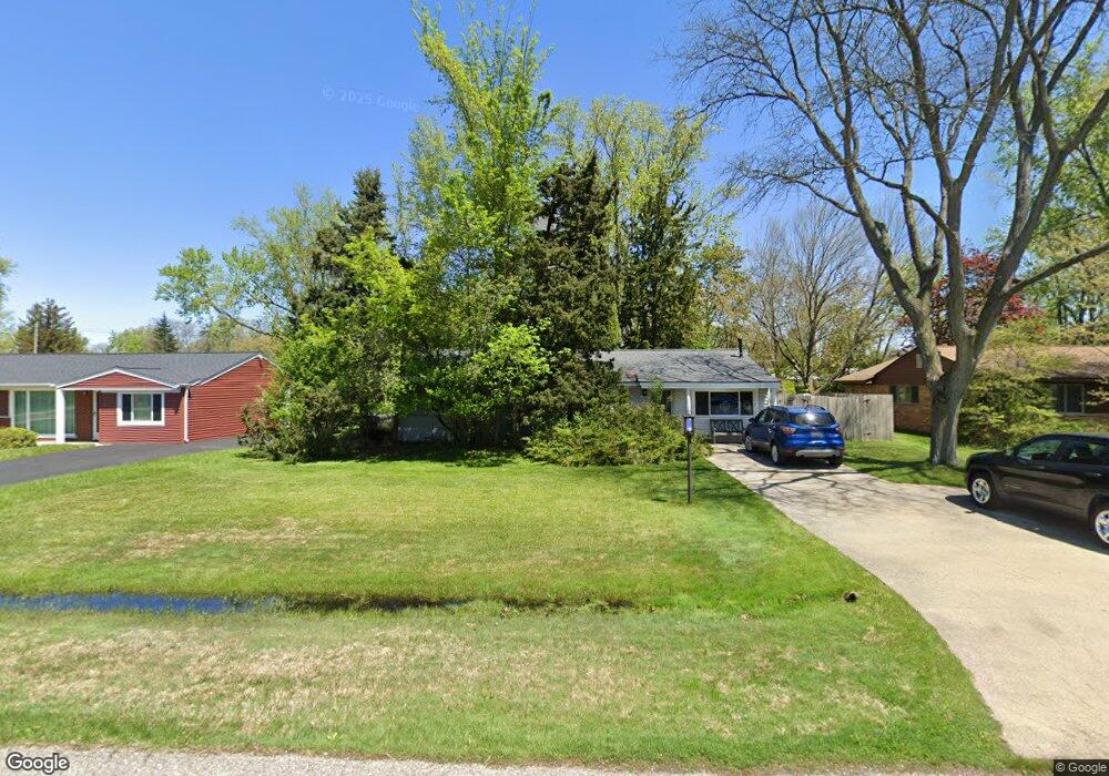
2498 Empire Dr West Bloomfield, MI 48324
Estimated Value: $259,851 - $284,000
3
Beds
2
Baths
1,497
Sq Ft
$179/Sq Ft
Est. Value
About This Home
This home is located at 2498 Empire Dr, West Bloomfield, MI 48324 and is currently estimated at $268,463, approximately $179 per square foot. 2498 Empire Dr is a home located in Oakland County with nearby schools including Walt Whitman Elementary School, Pontiac Middle School, and Pontiac High School.
Ownership History
Date
Name
Owned For
Owner Type
Purchase Details
Closed on
Jul 22, 2022
Sold by
Klinger Robert M
Bought by
Wilson Janice R
Current Estimated Value
Purchase Details
Closed on
Dec 24, 1999
Sold by
Klinger Robert
Bought by
Klinger Robert M
Purchase Details
Closed on
Feb 27, 1998
Sold by
Wilson Janice R
Bought by
Klinger Robert
Home Financials for this Owner
Home Financials are based on the most recent Mortgage that was taken out on this home.
Original Mortgage
$86,600
Interest Rate
7.23%
Create a Home Valuation Report for This Property
The Home Valuation Report is an in-depth analysis detailing your home's value as well as a comparison with similar homes in the area
Home Values in the Area
Average Home Value in this Area
Purchase History
| Date | Buyer | Sale Price | Title Company |
|---|---|---|---|
| Wilson Janice R | -- | Land Title | |
| Klinger Robert M | $13,000 | -- | |
| Klinger Robert | -- | -- |
Source: Public Records
Mortgage History
| Date | Status | Borrower | Loan Amount |
|---|---|---|---|
| Previous Owner | Klinger Robert | $86,600 | |
| Closed | Klinger Robert M | -- |
Source: Public Records
Tax History Compared to Growth
Tax History
| Year | Tax Paid | Tax Assessment Tax Assessment Total Assessment is a certain percentage of the fair market value that is determined by local assessors to be the total taxable value of land and additions on the property. | Land | Improvement |
|---|---|---|---|---|
| 2024 | $913 | $102,410 | $0 | $0 |
| 2022 | $871 | $84,420 | $24,700 | $59,720 |
| 2021 | $1,432 | $75,810 | $0 | $0 |
| 2020 | $802 | $69,520 | $24,700 | $44,820 |
| 2018 | $1,370 | $58,570 | $17,900 | $40,670 |
| 2015 | -- | $47,180 | $0 | $0 |
| 2014 | -- | $43,750 | $0 | $0 |
| 2011 | -- | $50,410 | $0 | $0 |
Source: Public Records
Map
Nearby Homes
- 2468 Walce Dr
- 2630 Depew Dr
- 2230 Middlebelt Rd
- 2216 Middlebelt Rd
- 2084 Woodrow Wilson Blvd Unit A6
- 2622 Pine Ridge Rd
- 2665 Middlebelt Rd
- 2918 Nagle Ct
- 1796 Briarcliff St
- 2952 Prynne St
- 1775 Woodland Ave
- 2411 Pine Lake Ave
- 2825 Wall St
- 2360 Pineview
- 2820 Wall St
- 2329 Fordham St
- 1970 Beechmont St
- 3076 Pridham St
- 2121 Uplong St
- 3087 Brock St
- 2510 Empire Dr
- 2486 Empire Dr
- 2472 Empire Dr
- 2463 Lafay Dr
- 2451 Lafay Dr
- 2475 Lafay Dr
- 2522 Empire Dr
- 2439 Lafay Dr
- 2427 Lafay Dr
- 2499 Empire Dr Unit Bldg-Unit
- 2499 Empire Dr
- 2534 Empire Dr
- 2487 Lafay Dr
- 2458 Empire Dr
- 2487 Empire Dr
- 2511 Empire Dr
- 2473 Empire Dr
- 2415 Lafay Dr
- 2523 Empire Dr
- 2499 Lafay Dr