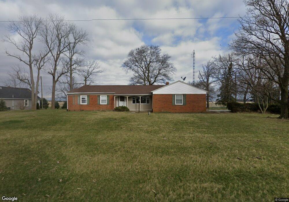
2498 State Route 12 Rawson, OH 45881
Estimated Value: $160,000 - $290,000
3
Beds
2
Baths
1,651
Sq Ft
$148/Sq Ft
Est. Value
About This Home
This home is located at 2498 State Route 12, Rawson, OH 45881 and is currently estimated at $243,829, approximately $147 per square foot. 2498 State Route 12 is a home located in Hancock County with nearby schools including Cory-Rawson Elementary School and Cory-Rawson High School.
Ownership History
Date
Name
Owned For
Owner Type
Purchase Details
Closed on
Apr 24, 2017
Sold by
Gregorowicz Jennifer A
Bought by
Gregorowicz Brian T
Current Estimated Value
Purchase Details
Closed on
Jan 7, 1999
Sold by
Aller Ronnie
Bought by
Gregorowicz Brian and Gregorowicz Devon
Home Financials for this Owner
Home Financials are based on the most recent Mortgage that was taken out on this home.
Original Mortgage
$141,600
Outstanding Balance
$33,041
Interest Rate
6.83%
Mortgage Type
VA
Estimated Equity
$210,788
Purchase Details
Closed on
Aug 27, 1986
Bought by
Aller Ronnie L and Aller Diane M
Purchase Details
Closed on
Aug 9, 1985
Bought by
Krieger Donna M
Create a Home Valuation Report for This Property
The Home Valuation Report is an in-depth analysis detailing your home's value as well as a comparison with similar homes in the area
Purchase History
| Date | Buyer | Sale Price | Title Company |
|---|---|---|---|
| Gregorowicz Brian T | -- | Whitman Title | |
| Gregorowicz Brian | $137,500 | -- | |
| Aller Ronnie L | $78,000 | -- | |
| Krieger Donna M | -- | -- |
Source: Public Records
Mortgage History
| Date | Status | Borrower | Loan Amount |
|---|---|---|---|
| Open | Gregorowicz Brian | $141,600 |
Source: Public Records
Tax History
| Year | Tax Paid | Tax Assessment Tax Assessment Total Assessment is a certain percentage of the fair market value that is determined by local assessors to be the total taxable value of land and additions on the property. | Land | Improvement |
|---|---|---|---|---|
| 2024 | $1,954 | $61,680 | $5,760 | $55,920 |
| 2023 | $1,946 | $61,680 | $5,760 | $55,920 |
| 2022 | $1,956 | $61,680 | $5,760 | $55,920 |
| 2021 | $1,616 | $46,180 | $5,760 | $40,420 |
| 2020 | $1,620 | $46,180 | $5,760 | $40,420 |
| 2019 | $1,584 | $46,180 | $5,760 | $40,420 |
| 2018 | $1,527 | $46,300 | $5,880 | $40,420 |
| 2017 | $760 | $46,300 | $5,880 | $40,420 |
| 2016 | $1,527 | $46,300 | $5,880 | $40,420 |
| 2015 | $1,537 | $49,110 | $5,880 | $43,230 |
| 2014 | $1,551 | $49,110 | $5,880 | $43,230 |
| 2012 | $1,546 | $45,180 | $5,880 | $39,300 |
Source: Public Records
Map
Nearby Homes
- 3016 County Road 37
- 12159 County Road 12
- 163 Bolt St
- 307 Lincoln St
- 11741 Township Road 10
- 110 Magnolia Ln
- 106 Riley St
- 222 N Lawn Ave
- 328 N Main St
- 210 N Jackson St
- 7780 Township Road 89
- 0 Ohio 103
- 199 Hart St
- 101 Maplewood Dr
- 218 S Jackson St
- 160 Chestnut Ln
- 408 Cherry St
- 358 State Route 613
- 1280 Ohio 613
- 217 Grove St
- 2476 State Route 12
- 2558 State Route 12
- 2388 State Route 12
- 2766 State Route 12
- 2229 Ohio 12
- 2603 Township Road 47
- 2467 Township Road 47
- 2229 State Route 12
- 12515 Township Road 53
- 2201 Ohio 12
- 2984 State Route 12
- 2231 County Road 78
- 3080 Township Road 47
- 3080 Trail 47
- 12086 Township Road 53
- 3230 Township Road 47
- 3151 State Route 12
- 12012 Township Road 53
- 1815 State Route 12
- 1815 Ohio 12
Your Personal Tour Guide
Ask me questions while you tour the home.