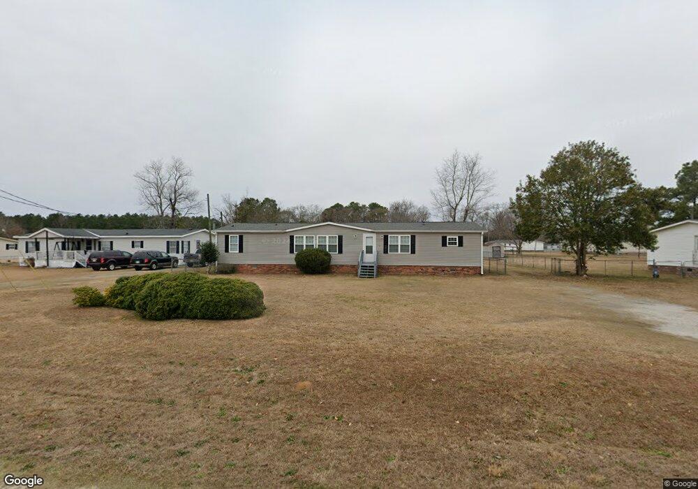
2499 Lindfield Cir Effingham, SC 29541
Estimated Value: $62,531 - $82,000
4
Beds
2
Baths
1,782
Sq Ft
$41/Sq Ft
Est. Value
About This Home
This home is located at 2499 Lindfield Cir, Effingham, SC 29541 and is currently estimated at $72,510, approximately $40 per square foot. 2499 Lindfield Cir is a home located in Florence County with nearby schools including Savannah Grove Elementary School, Southside Middle School, and South Florence High School.
Ownership History
Date
Name
Owned For
Owner Type
Purchase Details
Closed on
Jun 28, 2012
Sold by
Federal Deposit Insurance Corporation
Bought by
First Citizens Bank & Trust Company Inc
Current Estimated Value
Purchase Details
Closed on
Jun 20, 2012
Sold by
First Citizens Bank & Trust Company Inc
Bought by
Benton Real Estate Llc
Purchase Details
Closed on
Jun 4, 2010
Sold by
Tsjm Enterprises Llc
Bought by
Williamsburg First National Bank
Purchase Details
Closed on
Aug 28, 2007
Sold by
Federal National Mortgage Association
Bought by
Tsjm Enterprises Llc
Home Financials for this Owner
Home Financials are based on the most recent Mortgage that was taken out on this home.
Original Mortgage
$14,323
Interest Rate
6.7%
Mortgage Type
Purchase Money Mortgage
Purchase Details
Closed on
May 21, 2007
Sold by
Cleveland Sharon
Bought by
Federal National Mortgage Association
Create a Home Valuation Report for This Property
The Home Valuation Report is an in-depth analysis detailing your home's value as well as a comparison with similar homes in the area
Home Values in the Area
Average Home Value in this Area
Purchase History
| Date | Buyer | Sale Price | Title Company |
|---|---|---|---|
| First Citizens Bank & Trust Company Inc | -- | -- | |
| Benton Real Estate Llc | $23,000 | -- | |
| Williamsburg First National Bank | $18,000 | -- | |
| Tsjm Enterprises Llc | $17,500 | Attorney | |
| Federal National Mortgage Association | $10,000 | None Available |
Source: Public Records
Mortgage History
| Date | Status | Borrower | Loan Amount |
|---|---|---|---|
| Previous Owner | Tsjm Enterprises Llc | $14,323 |
Source: Public Records
Tax History Compared to Growth
Tax History
| Year | Tax Paid | Tax Assessment Tax Assessment Total Assessment is a certain percentage of the fair market value that is determined by local assessors to be the total taxable value of land and additions on the property. | Land | Improvement |
|---|---|---|---|---|
| 2024 | $783 | $571 | $556 | $15 |
| 2023 | $796 | $571 | $556 | $15 |
| 2022 | $928 | $571 | $556 | $15 |
| 2021 | $828 | $2,340 | $0 | $0 |
| 2020 | $885 | $2,340 | $0 | $0 |
| 2019 | $885 | $2,340 | $0 | $0 |
| 2018 | $835 | $2,340 | $0 | $0 |
| 2017 | $843 | $2,340 | $0 | $0 |
| 2016 | $745 | $2,340 | $0 | $0 |
| 2015 | $739 | $2,340 | $0 | $0 |
| 2014 | $716 | $0 | $0 | $0 |
Source: Public Records
Map
Nearby Homes
- 2222 Ashford Dr
- 2230 Ashford Dr
- 2304 S Point Rd
- 2206 Wellesly Ct
- 1831 Wax Myrtle Dr
- 0 State Road S-21-869
- 1717 Full Moon Rd
- 1311 Queens Ferry Rd
- 2303 W McCown Dr
- 1658 Jefferson Dr
- 1719 Furman Dr
- 2125 Sanderling Dr
- 1779 S Saint Anthony Ave
- 1801 Woods Dr
- 2338 W McCown Dr
- 2113 Sanderling Dr
- 1682 Jefferson Dr
- 1687 Jefferson Dr
- 2348 Chadwick Dr
- 1770 Woods Dr
- 2491 Lindfield Cir
- 2498 Lindfield Cir Unit 82
- 2475 Lindfield Cir
- 2447 Lindfield Cir
- 2496 Lindfield Cir
- 2400 Lindfield Cir
- 2445 Lindfield Cir
- 2494 Lindfield Cir
- 2408 Lindfield Cir
- 2439 Lindfield Cir
- 2492 Lindfield Cir
- 2490 Lindfield Cir
- 2484 Lindfield Cir
- 2412 Lindfield Cir
- 2478 Lindfield Cir
- 2119 Ashford Dr
- 2116 Ashford Dr
- 2416 Lindfield Cir
- 2472 Lindfield Cir
- 2446 Lindfield Cir