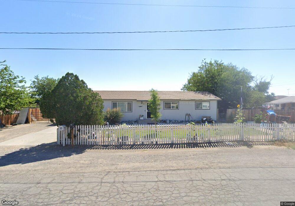
25 Arrow St Fernley, NV 89408
Estimated Value: $295,000 - $340,000
3
Beds
2
Baths
1,200
Sq Ft
$261/Sq Ft
Est. Value
About This Home
This home is located at 25 Arrow St, Fernley, NV 89408 and is currently estimated at $313,592, approximately $261 per square foot. 25 Arrow St is a home located in Lyon County with nearby schools including Cottonwood Elementary School, Fernley Intermediate School, and Fernley High School.
Ownership History
Date
Name
Owned For
Owner Type
Purchase Details
Closed on
Apr 5, 2016
Sold by
Oille Michelle Walker
Bought by
Oille Nicholas
Current Estimated Value
Purchase Details
Closed on
Jan 21, 2009
Sold by
Us Bank National Association
Bought by
Oille Michelle Walker
Purchase Details
Closed on
Nov 25, 2008
Sold by
Dalton Frederick W and Dalton Tamara L
Bought by
Us Bank National Association
Purchase Details
Closed on
Sep 29, 2005
Sold by
Vanetten John and Van Etten Lyn B
Bought by
Dalton Frederick W and Dalton Tamara L
Home Financials for this Owner
Home Financials are based on the most recent Mortgage that was taken out on this home.
Original Mortgage
$148,000
Interest Rate
5.72%
Mortgage Type
Adjustable Rate Mortgage/ARM
Create a Home Valuation Report for This Property
The Home Valuation Report is an in-depth analysis detailing your home's value as well as a comparison with similar homes in the area
Home Values in the Area
Average Home Value in this Area
Purchase History
| Date | Buyer | Sale Price | Title Company |
|---|---|---|---|
| Oille Nicholas | $45,000 | Title Svc & Escrow Fernle | |
| Oille Michelle Walker | $63,900 | Ticor Title Reno | |
| Us Bank National Association | $68,950 | Lsi Title Agency Inc | |
| Dalton Frederick W | $185,000 | Title Service & Escrow Co |
Source: Public Records
Mortgage History
| Date | Status | Borrower | Loan Amount |
|---|---|---|---|
| Previous Owner | Dalton Frederick W | $148,000 |
Source: Public Records
Tax History Compared to Growth
Tax History
| Year | Tax Paid | Tax Assessment Tax Assessment Total Assessment is a certain percentage of the fair market value that is determined by local assessors to be the total taxable value of land and additions on the property. | Land | Improvement |
|---|---|---|---|---|
| 2025 | $876 | $74,538 | $57,750 | $16,788 |
| 2024 | $1,260 | $75,316 | $57,750 | $17,565 |
| 2023 | $1,260 | $74,746 | $57,750 | $16,996 |
| 2022 | $1,198 | $74,116 | $57,750 | $16,366 |
| 2021 | $1,199 | $63,700 | $47,250 | $16,450 |
| 2020 | $1,172 | $58,128 | $42,000 | $16,128 |
| 2019 | $1,166 | $57,954 | $42,000 | $15,954 |
| 2018 | $1,147 | $42,190 | $26,250 | $15,940 |
| 2017 | $1,159 | $37,319 | $21,000 | $16,319 |
| 2016 | $984 | $24,528 | $7,350 | $17,178 |
| 2015 | $1,020 | $18,269 | $7,350 | $10,919 |
| 2014 | $1,002 | $17,050 | $7,350 | $9,700 |
Source: Public Records
Map
Nearby Homes
- 1241 Newlands Dr W
- 267 Wildwood St
- 136 Farmington Way
- 859 B St
- 350 Randon Ct
- 125 Farmington Way
- 347 7th St
- 95 Middleton Way
- 77 Middleton Way
- 70 Middleton Way
- 836 E St
- 332 Wildrose Dr
- 114 Primrose Dr
- 331 Wildrose Dr
- 320 Wildrose Dr
- 1224 Mountain Rose Dr
- 736 Shadow Ln
- 333 Vine
- 715 Shadow Ln
- 1494 Mountain Rose Dr
