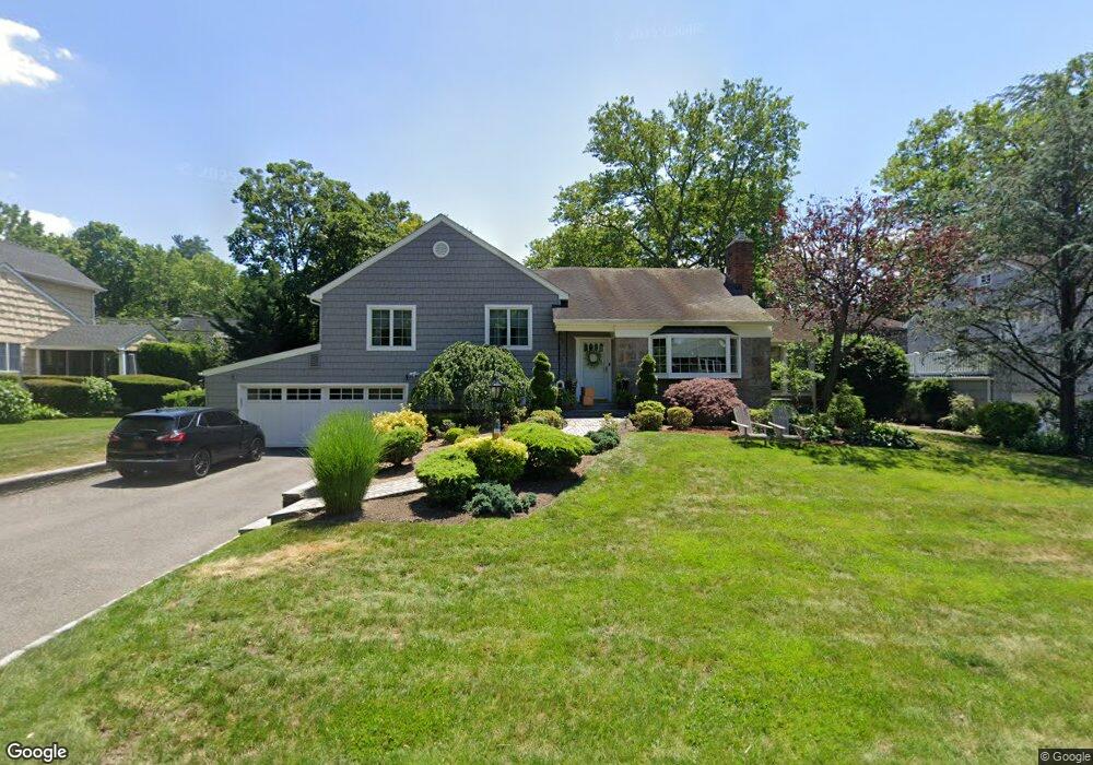
25 Beachway Port Washington, NY 11050
Estimated Value: $1,477,000 - $1,497,162
--
Bed
3
Baths
1,843
Sq Ft
$807/Sq Ft
Est. Value
About This Home
This home is located at 25 Beachway, Port Washington, NY 11050 and is currently estimated at $1,487,081, approximately $806 per square foot. 25 Beachway is a home located in Nassau County with nearby schools including John Philip Sousa Elementary School, Carrie Palmer Weber Middle School, and Paul D. Schreiber Senior High School.
Ownership History
Date
Name
Owned For
Owner Type
Purchase Details
Closed on
Aug 28, 2023
Sold by
Mansfield Thomas R and Mansfield Donna M
Bought by
Caruso Jordan and Caruso Alexandra
Current Estimated Value
Purchase Details
Closed on
Aug 19, 2004
Sold by
Lascala Russell
Bought by
Mansfield Thomas
Purchase Details
Closed on
Apr 17, 2002
Sold by
Macina Donald
Bought by
Lascala Russell
Create a Home Valuation Report for This Property
The Home Valuation Report is an in-depth analysis detailing your home's value as well as a comparison with similar homes in the area
Home Values in the Area
Average Home Value in this Area
Purchase History
| Date | Buyer | Sale Price | Title Company |
|---|---|---|---|
| Caruso Jordan | $1,400,000 | Old Republic Title Ins Co | |
| Caruso Jordan | $1,400,000 | Old Republic Title Ins Co | |
| Caruso Jordan | $1,400,000 | Old Republic Title Ins Co | |
| Mansfield Thomas | $944,000 | -- | |
| Mansfield Thomas | $944,000 | -- | |
| Lascala Russell | $755,000 | David Baron | |
| Lascala Russell | $755,000 | David Baron |
Source: Public Records
Tax History Compared to Growth
Tax History
| Year | Tax Paid | Tax Assessment Tax Assessment Total Assessment is a certain percentage of the fair market value that is determined by local assessors to be the total taxable value of land and additions on the property. | Land | Improvement |
|---|---|---|---|---|
| 2025 | $23,610 | $1,008 | $499 | $509 |
| 2024 | $7,366 | $1,047 | $519 | $528 |
| 2023 | $22,662 | $1,078 | $534 | $544 |
| 2022 | $22,662 | $1,078 | $534 | $544 |
| 2021 | $22,124 | $1,100 | $545 | $555 |
| 2020 | $22,399 | $1,487 | $995 | $492 |
| 2019 | $20,776 | $1,487 | $995 | $492 |
| 2018 | $18,541 | $1,487 | $0 | $0 |
| 2017 | $11,208 | $1,587 | $995 | $592 |
| 2016 | $17,633 | $1,587 | $995 | $592 |
| 2015 | $6,253 | $1,587 | $995 | $592 |
| 2014 | $6,253 | $1,587 | $995 | $592 |
| 2013 | $5,873 | $1,587 | $995 | $592 |
Source: Public Records
Map
Nearby Homes
- 1 Luquer Rd
- 0 Route 5 & 20
- 454 Main St
- 96 Davis Rd
- 43 Amherst Rd
- 100 Gristmill Ln
- 47 Carlton Ave
- 17 Willow Dr
- 74 Bayview Ave Unit A
- 28 Charles St
- 372 Main St Unit 105
- 2 Smull Ln
- 18 S Washington St
- 38 Madison St Unit 38L
- 107 Bayview Rd
- 113 Murray Ave
- 2 Stonytown Rd
- 34 Davis Rd
- 1270 Plandome Rd
- 22 Franklin Ave