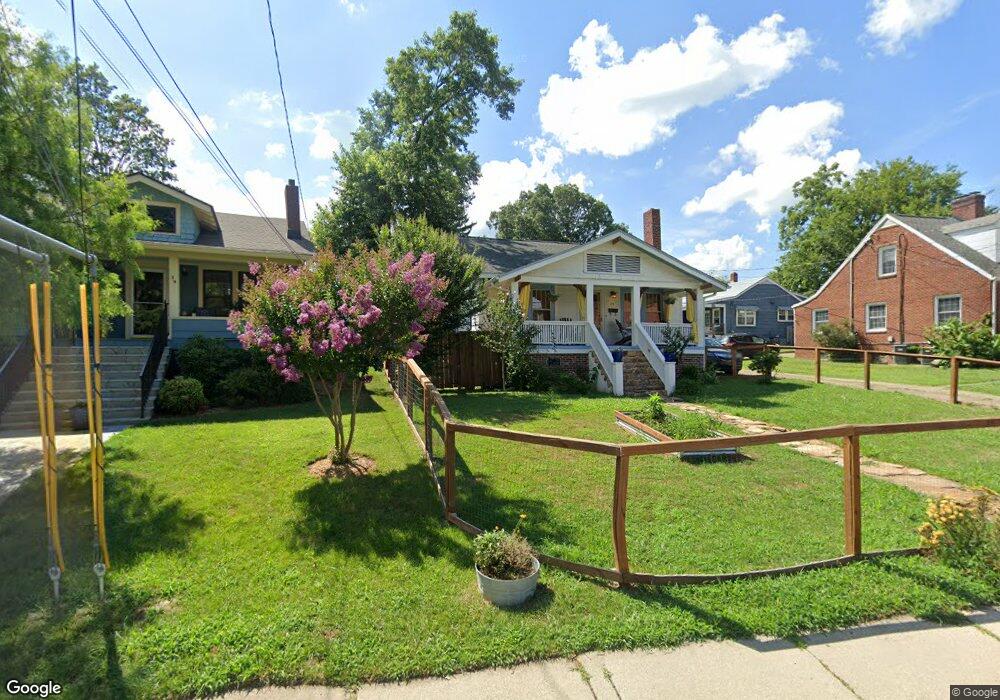
25 Brevard Rd Asheville, NC 28806
West Asheville NeighborhoodEstimated Value: $420,000 - $482,000
3
Beds
1
Bath
1,146
Sq Ft
$382/Sq Ft
Est. Value
About This Home
This home is located at 25 Brevard Rd, Asheville, NC 28806 and is currently estimated at $438,243, approximately $382 per square foot. 25 Brevard Rd is a home located in Buncombe County with nearby schools including Hall Fletcher Elementary, Isaac Dickson Elementary, and Ira B Jones Elementary.
Ownership History
Date
Name
Owned For
Owner Type
Purchase Details
Closed on
Feb 21, 2020
Sold by
Lefevers William M and Lefevers Kim L
Bought by
Watson Molly K
Current Estimated Value
Home Financials for this Owner
Home Financials are based on the most recent Mortgage that was taken out on this home.
Original Mortgage
$260,910
Outstanding Balance
$231,018
Interest Rate
3.6%
Mortgage Type
New Conventional
Estimated Equity
$207,225
Purchase Details
Closed on
Oct 31, 2003
Sold by
Lefevers Victoria T
Bought by
Lefevers William M
Create a Home Valuation Report for This Property
The Home Valuation Report is an in-depth analysis detailing your home's value as well as a comparison with similar homes in the area
Home Values in the Area
Average Home Value in this Area
Purchase History
| Date | Buyer | Sale Price | Title Company |
|---|---|---|---|
| Watson Molly K | $290,000 | None Available | |
| Lefevers William M | -- | -- |
Source: Public Records
Mortgage History
| Date | Status | Borrower | Loan Amount |
|---|---|---|---|
| Open | Watson Molly K | $260,910 |
Source: Public Records
Tax History Compared to Growth
Tax History
| Year | Tax Paid | Tax Assessment Tax Assessment Total Assessment is a certain percentage of the fair market value that is determined by local assessors to be the total taxable value of land and additions on the property. | Land | Improvement |
|---|---|---|---|---|
| 2025 | $2,568 | $248,600 | $113,900 | $134,700 |
| 2024 | $2,568 | $248,600 | $113,900 | $134,700 |
| 2023 | $2,568 | $248,600 | $113,900 | $134,700 |
| 2022 | $2,479 | $248,600 | $0 | $0 |
| 2021 | $2,479 | $248,600 | $0 | $0 |
| 2020 | $2,112 | $195,900 | $0 | $0 |
| 2019 | $2,112 | $195,900 | $0 | $0 |
| 2018 | $2,112 | $195,900 | $0 | $0 |
| 2017 | $971 | $137,200 | $0 | $0 |
| 2016 | $1,686 | $137,200 | $0 | $0 |
| 2015 | $713 | $137,200 | $0 | $0 |
| 2014 | $693 | $137,200 | $0 | $0 |
Source: Public Records
Map
Nearby Homes
- 56 Brevard Rd
- 18 Jarrett St
- 18 Sand Hill Rd
- 30 Sand Hill Rd
- 75 Nevada Ave
- 91 Virginia Ave
- 55 Herron Ave
- 99 Nevada Ave
- 54 Louisiana Ave
- 68 1/2 Nevada Ave
- 31 Oakwood St
- 43 Vermont Ct Unit D14
- 20 Cloyes St
- 32 Harnett St
- 197 Brucemont Cir
- 9999 Rex Dr
- 12 Rex Dr
- 12 & 9999 Rex Dr
- 60 Dorchester Ave
- 89 Galax Ave
- 29 Brevard Rd
- 21 Brevard Rd
- 11 McGlamery Ln
- 35 Brevard Rd
- 24 Vance Crescent St
- 17 McGlamery Ln
- 41 Brevard Rd
- 16 Brevard Rd
- 24 Brevard Rd Unit 29
- 24 Brevard Rd Unit 29, 31, 32
- 24 Brevard Rd
- 44 Brevard Rd
- 19 Brevard Rd
- 20 Vance Crescent St
- 43 Brevard Rd
- 16 Vance Crescent St
- 30 Vance Crescent St
- 12 Vance Crescent St
- 23 & 15 Vance Crescent St
- 67 Brevard Rd