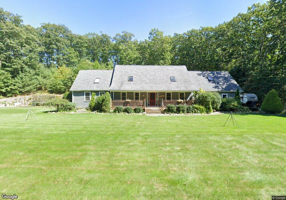
25 Briarcliff Ln Spencer, MA 01562
Estimated Value: $635,000 - $667,000
4
Beds
3
Baths
3,000
Sq Ft
$217/Sq Ft
Est. Value
About This Home
This home is located at 25 Briarcliff Ln, Spencer, MA 01562 and is currently estimated at $651,604, approximately $217 per square foot. 25 Briarcliff Ln is a home located in Worcester County with nearby schools including David Prouty High School.
Ownership History
Date
Name
Owned For
Owner Type
Purchase Details
Closed on
Apr 23, 2010
Sold by
Webster 1St Fcu
Bought by
Belton Thomas J and Belton Carey L
Current Estimated Value
Home Financials for this Owner
Home Financials are based on the most recent Mortgage that was taken out on this home.
Original Mortgage
$256,600
Outstanding Balance
$170,904
Interest Rate
5%
Mortgage Type
Purchase Money Mortgage
Estimated Equity
$480,700
Purchase Details
Closed on
Mar 4, 2010
Sold by
Defosse David R and Defosse Deborah A
Bought by
Webster First Fcu
Home Financials for this Owner
Home Financials are based on the most recent Mortgage that was taken out on this home.
Original Mortgage
$256,600
Outstanding Balance
$170,904
Interest Rate
5%
Mortgage Type
Purchase Money Mortgage
Estimated Equity
$480,700
Purchase Details
Closed on
Apr 23, 2004
Sold by
Chris Kay Llc
Bought by
Defosse David R and Defosse Deborah A
Home Financials for this Owner
Home Financials are based on the most recent Mortgage that was taken out on this home.
Original Mortgage
$280,000
Interest Rate
5.4%
Mortgage Type
Purchase Money Mortgage
Create a Home Valuation Report for This Property
The Home Valuation Report is an in-depth analysis detailing your home's value as well as a comparison with similar homes in the area
Home Values in the Area
Average Home Value in this Area
Purchase History
| Date | Buyer | Sale Price | Title Company |
|---|---|---|---|
| Belton Thomas J | $290,000 | -- | |
| Webster First Fcu | $289,229 | -- | |
| Defosse David R | $85,000 | -- |
Source: Public Records
Mortgage History
| Date | Status | Borrower | Loan Amount |
|---|---|---|---|
| Open | Belton Thomas J | $256,600 | |
| Previous Owner | Defosse David R | $280,000 |
Source: Public Records
Tax History Compared to Growth
Tax History
| Year | Tax Paid | Tax Assessment Tax Assessment Total Assessment is a certain percentage of the fair market value that is determined by local assessors to be the total taxable value of land and additions on the property. | Land | Improvement |
|---|---|---|---|---|
| 2025 | $75 | $636,600 | $56,900 | $579,700 |
| 2024 | $6,807 | $595,000 | $56,900 | $538,100 |
| 2023 | $6,383 | $529,300 | $56,900 | $472,400 |
| 2022 | $6,256 | $475,400 | $51,500 | $423,900 |
| 2021 | $6,092 | $433,900 | $51,500 | $382,400 |
| 2020 | $5,589 | $395,800 | $51,500 | $344,300 |
| 2019 | $5,264 | $379,800 | $46,700 | $333,100 |
| 2018 | $4,729 | $352,400 | $53,900 | $298,500 |
| 2017 | $4,651 | $332,700 | $51,500 | $281,200 |
| 2016 | $4,407 | $308,400 | $51,500 | $256,900 |
| 2015 | $4,272 | $312,500 | $56,900 | $255,600 |
| 2014 | $4,109 | $312,500 | $56,900 | $255,600 |
Source: Public Records
Map
Nearby Homes
- 3 Cranberry Meadow Shore Rd
- 86 Jolicoeur Ave
- 9 Hebert Rd
- 65 Old Spencer Rd
- 208 Sunset Dr
- 50 Old Spencer Rd
- 199 Center Depot Rd
- 9 Knollwood Dr
- 49 Jennings Rd
- 45 Jennings Rd
- 68 Borkum Rd
- 204 Brookfield Rd
- 216 Brookfield Rd
- 38 Stevens Park Rd
- 7 Little Muggett Rd
- Lot 3 0 N Sullivan Rd
- Lot 6 0 N Sullivan Rd
- Lot 5 0 N Sullivan Rd
- Lot 4 0 N Sullivan Rd
- 0 I Capen Rd
- 4 Ethier Dr
- 23 Briarcliff Ln
- 64 Cranberry Meadow Rd
- 0 Hiland Rd
- 62 Cranberry Meadow Rd
- 8 Hiland Rd
- 6 Ethier Dr
- 60 Cranberry Meadow Rd
- 19 Briarcliff Ln
- 0
- 0 Hiland Rd L:2 Unit 73131632
- 0 Hiland Rd L:4
- 0 Hiland Rd L:2
- 0 Hiland Rd L:3
- 0 Hiland Rd L:5
- 134 Cranberry Meadow Rd
- 0 Hiland Rd L:1 Unit 72621108
- 0 Hiland Rd L:1 Unit 72477969
- 58 Cranberry Meadow Rd
- 21 Briarcliff Ln