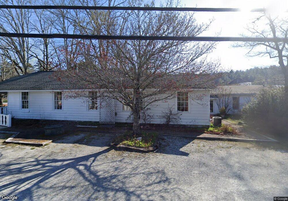
25 Burns St Cashiers, NC 28717
Estimated Value: $913,683
--
Bed
2
Baths
2,908
Sq Ft
$314/Sq Ft
Est. Value
About This Home
This home is located at 25 Burns St, Cashiers, NC 28717 and is currently estimated at $913,683, approximately $314 per square foot. 25 Burns St is a home located in Jackson County with nearby schools including Blue Ridge School, Smoky Mountain High School, and Summit Charter School.
Ownership History
Date
Name
Owned For
Owner Type
Purchase Details
Closed on
May 23, 2018
Sold by
Pepper David
Bought by
Cashiers Props Of Jax
Current Estimated Value
Purchase Details
Closed on
Apr 16, 2014
Sold by
Land Holding Llc
Bought by
Pepper David
Purchase Details
Closed on
Jan 8, 2014
Sold by
Mann Marjorie R
Bought by
Land Holding Llc
Purchase Details
Closed on
Jul 29, 2005
Sold by
Rooth Robert S and Rooth Ann Carroll
Bought by
Rooth Scott K
Home Financials for this Owner
Home Financials are based on the most recent Mortgage that was taken out on this home.
Original Mortgage
$375,000
Interest Rate
5.51%
Mortgage Type
Future Advance Clause Open End Mortgage
Create a Home Valuation Report for This Property
The Home Valuation Report is an in-depth analysis detailing your home's value as well as a comparison with similar homes in the area
Home Values in the Area
Average Home Value in this Area
Purchase History
| Date | Buyer | Sale Price | Title Company |
|---|---|---|---|
| Cashiers Props Of Jax | -- | -- | |
| Pepper David | $380,000 | None Available | |
| Land Holding Llc | $348,736 | None Available | |
| Rooth Scott K | -- | -- | |
| Rooth Robert S | -- | -- |
Source: Public Records
Mortgage History
| Date | Status | Borrower | Loan Amount |
|---|---|---|---|
| Previous Owner | Rooth Robert S | $375,000 |
Source: Public Records
Tax History Compared to Growth
Tax History
| Year | Tax Paid | Tax Assessment Tax Assessment Total Assessment is a certain percentage of the fair market value that is determined by local assessors to be the total taxable value of land and additions on the property. | Land | Improvement |
|---|---|---|---|---|
| 2025 | $1,963 | $516,468 | $272,110 | $244,358 |
| 2024 | $1,771 | $466,070 | $263,420 | $202,650 |
| 2023 | $1,978 | $466,070 | $263,420 | $202,650 |
| 2022 | $1,969 | $466,070 | $263,420 | $202,650 |
| 2021 | $1,876 | $466,070 | $263,420 | $202,650 |
| 2020 | $1,571 | $376,270 | $226,800 | $149,470 |
| 2019 | $1,571 | $376,270 | $226,800 | $149,470 |
| 2018 | $1,518 | $376,270 | $226,800 | $149,470 |
| 2017 | $1,480 | $376,270 | $226,800 | $149,470 |
| 2015 | $1,574 | $512,350 | $362,880 | $149,470 |
| 2011 | -- | $509,630 | $344,250 | $165,380 |
Source: Public Records
Map
Nearby Homes
- 33 Cottage Walk Ln
- 50 Cottage Walk Ln
- 1 U S Highway 64
- N/A Valley Rd
- RT-9 Broadwing
- 204 Lance Rd
- 920 Post Office Rd
- 2125 N Carolina 107
- 2678 N Carolina 107
- 435 U S 64
- 11 Sky Ranch Ln
- TBD N Carolina 107
- 138 Belladonna Dr
- 477 Lance Rd
- RT-10 Broadwing
- 489 Lance Rd
- 194 1/2 Tarragon Dr
- 42 Tarragon Dr
- Lot B Edward Fowler Rd
- 56 Plateau Ridge
- 10 Cottage Row
- 40 Burns St
- 75 Village Walk Way Unit 1
- 92 Burns St
- 28 Cottage Walk Ln
- 84 Village Walk Way
- 19 Cottage Row
- 0 Highway 107 S
- 0 North St
- Lt B2 Courtside Cottage Way
- 47 Highway 107 S
- 1010 Us Hwy 107 S
- 36 Cottage Row
- 0 U S Highway 64 Unit 55145
- 0 U S Highway 64 Unit 73605
- 0 U S Highway 64 Unit 73618
- 0 U S Highway 64 Unit 73619
- 0 U S Highway 64 Unit 75437
- 0 U S Highway 64 Unit 26037166
- 0 U S Highway 64 Unit 55489