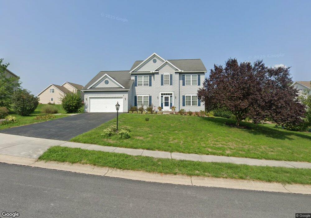
25 Cannon Ridge Way Unit 11 Gettysburg, PA 17325
Estimated Value: $477,105 - $516,000
4
Beds
3
Baths
2,908
Sq Ft
$171/Sq Ft
Est. Value
About This Home
This home is located at 25 Cannon Ridge Way Unit 11, Gettysburg, PA 17325 and is currently estimated at $497,776, approximately $171 per square foot. 25 Cannon Ridge Way Unit 11 is a home located in Adams County with nearby schools including Gettysburg Area High School, Childrens Montessori School of Gettysburg, and St. Francis Xavier Catholic School.
Ownership History
Date
Name
Owned For
Owner Type
Purchase Details
Closed on
Mar 28, 2006
Sold by
S & A Custom Built Homes Inc
Bought by
Williams Roger W and Williams Joyce E
Current Estimated Value
Home Financials for this Owner
Home Financials are based on the most recent Mortgage that was taken out on this home.
Original Mortgage
$275,000
Outstanding Balance
$157,668
Interest Rate
6.32%
Mortgage Type
New Conventional
Estimated Equity
$340,108
Create a Home Valuation Report for This Property
The Home Valuation Report is an in-depth analysis detailing your home's value as well as a comparison with similar homes in the area
Home Values in the Area
Average Home Value in this Area
Purchase History
| Date | Buyer | Sale Price | Title Company |
|---|---|---|---|
| Williams Roger W | $393,722 | -- |
Source: Public Records
Mortgage History
| Date | Status | Borrower | Loan Amount |
|---|---|---|---|
| Open | Williams Roger W | $275,000 |
Source: Public Records
Tax History Compared to Growth
Tax History
| Year | Tax Paid | Tax Assessment Tax Assessment Total Assessment is a certain percentage of the fair market value that is determined by local assessors to be the total taxable value of land and additions on the property. | Land | Improvement |
|---|---|---|---|---|
| 2025 | $5,958 | $319,300 | $62,200 | $257,100 |
| 2024 | $5,699 | $319,300 | $62,200 | $257,100 |
| 2023 | $5,619 | $319,300 | $62,200 | $257,100 |
| 2022 | $5,570 | $319,300 | $62,200 | $257,100 |
| 2021 | $5,463 | $319,300 | $62,200 | $257,100 |
| 2020 | $5,463 | $319,300 | $62,200 | $257,100 |
| 2019 | $5,428 | $319,300 | $62,200 | $257,100 |
| 2018 | $5,398 | $319,300 | $62,200 | $257,100 |
| 2017 | $5,100 | $319,300 | $62,200 | $257,100 |
| 2016 | -- | $319,300 | $62,200 | $257,100 |
| 2015 | -- | $319,300 | $62,200 | $257,100 |
| 2014 | -- | $319,300 | $62,200 | $257,100 |
Source: Public Records
Map
Nearby Homes
- 32 Partridge Ct Unit C57
- 23 Partridge Ct Unit C68
- 11 Nuthatch Dr Unit 186
- 185 E Audubon Rd Unit 177
- 191 E Audubon Rd Unit 176
- 184 E Audubon Rd Unit 175
- 166 E Audubon Rd Unit 172
- 179 E Audubon Rd Unit 178
- 358 Pegram St
- 370 Pegram St
- 360 Friendship Ln
- 334 Friendship Ln Unit 69
- 323 Benning Ave
- 31 Davis Ave
- 51 W Audubon Rd Unit 170
- 67 W Audubon Rd Unit 168
- 118 Fairplay Rd
- 115 W Audubon Rd Unit 162
- 200 Knoxlyn Rd
- 0 Fairfield and Iron Springs Rd Unit PAAD2014760
- 37 Cannon Ridge Way Unit 12
- 11 Cannon Ridge Way Unit 10
- 26 Cannon Ridge Way Unit 9
- 83 Battalion Ln Unit 41
- 21 Brigadier Ct Unit 15
- 87 Battalion Ln Unit 13
- 34 Cannon Ridge Way Unit 8
- 12 Cannon Ridge Way Unit 86
- 84 Battalion Ln Unit 42
- 99 Battalion Ln Unit 14
- 36 Sabre Cir Unit 5
- 96 Battalion Ln Unit 41
- 25 Brigadier Ct Unit 16
- 51 Battalion Ln Unit 7
- 20 Kingsgate Ct Unit 2
- 10 Kingsgate Ct Unit 1
- 64 Battalion Ln Unit 44
- 280 Kingsgate Ct Unit 28
- 35 Sabre Cir Unit 4
- 40 Kingsgate Ct Unit 4