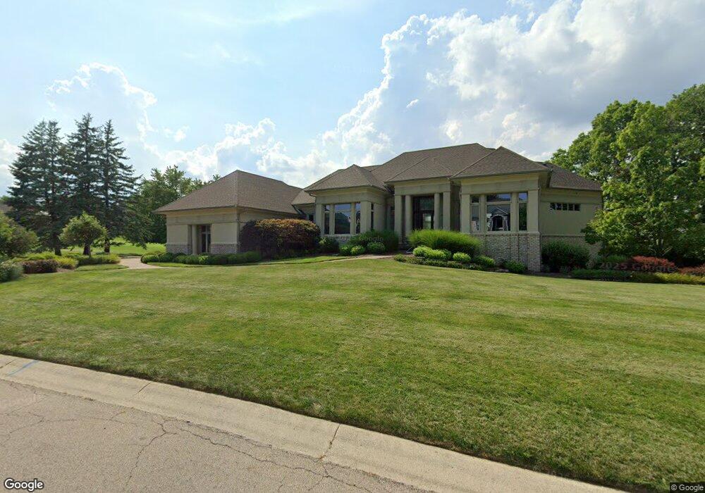
25 Carnoustie Ln Springboro, OH 45066
Estimated Value: $690,000 - $928,000
3
Beds
4
Baths
3,265
Sq Ft
$254/Sq Ft
Est. Value
About This Home
This home is located at 25 Carnoustie Ln, Springboro, OH 45066 and is currently estimated at $829,947, approximately $254 per square foot. 25 Carnoustie Ln is a home located in Warren County with nearby schools including Clearcreek Elementary School, Dennis Elementary School, and Springboro Intermediate School.
Ownership History
Date
Name
Owned For
Owner Type
Purchase Details
Closed on
Jul 21, 1997
Sold by
K & W Dev Inc
Bought by
Hensley Richard D and Hensley Sandra J
Current Estimated Value
Create a Home Valuation Report for This Property
The Home Valuation Report is an in-depth analysis detailing your home's value as well as a comparison with similar homes in the area
Home Values in the Area
Average Home Value in this Area
Purchase History
| Date | Buyer | Sale Price | Title Company |
|---|---|---|---|
| Hensley Richard D | $160,000 | -- |
Source: Public Records
Tax History Compared to Growth
Tax History
| Year | Tax Paid | Tax Assessment Tax Assessment Total Assessment is a certain percentage of the fair market value that is determined by local assessors to be the total taxable value of land and additions on the property. | Land | Improvement |
|---|---|---|---|---|
| 2024 | $12,047 | $301,500 | $98,000 | $203,500 |
| 2023 | $9,819 | $230,643 | $57,820 | $172,823 |
| 2022 | $9,819 | $230,643 | $57,820 | $172,823 |
| 2021 | $9,173 | $230,643 | $57,820 | $172,823 |
| 2020 | $8,848 | $195,461 | $49,000 | $146,461 |
| 2019 | $8,198 | $195,461 | $49,000 | $146,461 |
| 2018 | $7,694 | $195,461 | $49,000 | $146,461 |
| 2017 | $8,025 | $175,105 | $40,964 | $134,141 |
| 2016 | $8,352 | $175,105 | $40,964 | $134,141 |
| 2015 | $7,594 | $175,105 | $40,964 | $134,141 |
| 2014 | $7,594 | $159,190 | $37,240 | $121,950 |
| 2013 | $7,588 | $209,460 | $49,000 | $160,460 |
Source: Public Records
Map
Nearby Homes
- 6265 Red Lion 5 Points Rd
- 595 Heatherwoode Cir
- 44 Dunnington Ct
- Hampton Plan at Northampton
- 55 Glasgow St Unit 37
- 65 Morris St Unit 17
- 130 Morris St Unit 8
- 70 Morris St Unit 6
- 65 Morris St
- 70 Morris St
- Cooke Plan at Northampton
- Barrett Plan at Northampton
- 45 Morris St
- 25 Morris St
- 30 Morris St
- 50 Morris St
- 35 Morris St
- Melville Plan at Northampton
- Clayton Plan at Northampton
- Nicholas Plan at Northampton
- 810 Heatherwoode Cir
- 910 Heatherwoode Cir
- 20 Carnoustie Ln
- 10 Carnoustie Ln
- 920 Heatherwoode Cir
- 30 Carnoustie Ln
- 47 Carnoustie Ln
- 780 Heatherwoode Cir
- 835 Heatherwoode Cir
- 825 Heatherwoode Cir
- 905 Heatherwoode Cir
- 795 Heatherwoode Cir
- 40 Carnoustie Ln
- 55 Carnoustie Ln
- 770 Heatherwoode Cir
- 40 Royal Dornosh
- 30 Royal Dornosh
- 15 Royal Dornosh
- 805 Heatherwoode Cir
- 15 Dalfaber Ln