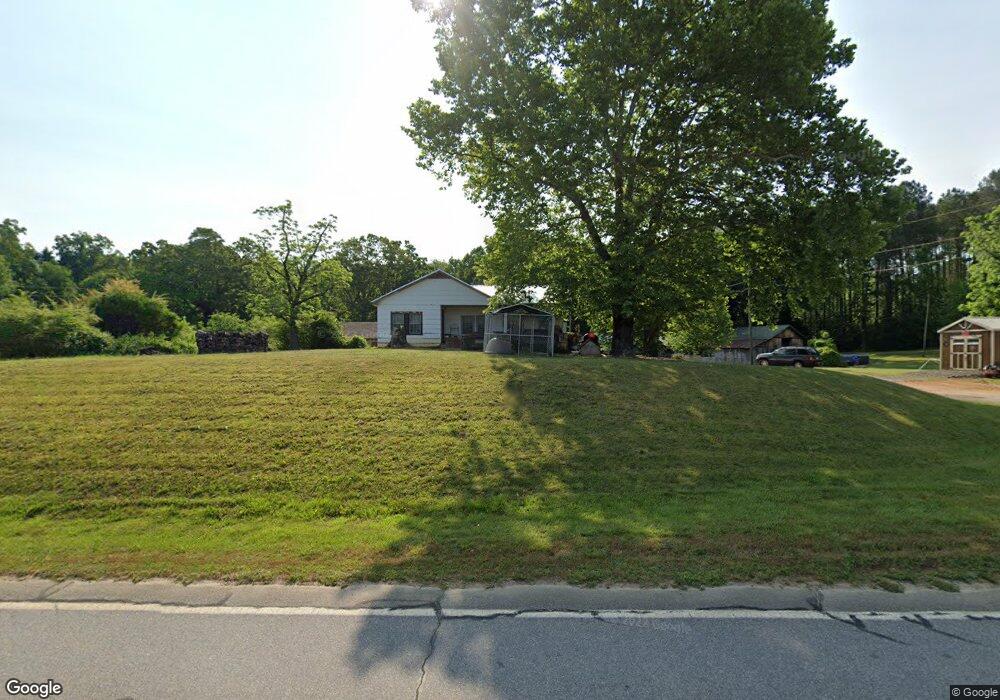
25 Carters Dr Toccoa, GA 30577
Estimated Value: $131,752 - $238,000
2
Beds
1
Bath
1,144
Sq Ft
$163/Sq Ft
Est. Value
About This Home
This home is located at 25 Carters Dr, Toccoa, GA 30577 and is currently estimated at $186,188, approximately $162 per square foot. 25 Carters Dr is a home with nearby schools including Stephens County High School.
Ownership History
Date
Name
Owned For
Owner Type
Purchase Details
Closed on
Apr 23, 2024
Sold by
Williams John D
Bought by
Dalton Len B
Current Estimated Value
Purchase Details
Closed on
Jul 23, 2007
Sold by
Not Provided
Bought by
Dalton Len B
Purchase Details
Closed on
Apr 10, 2000
Bought by
<Buyer Info Not Present>
Purchase Details
Closed on
Dec 10, 1999
Bought by
<Buyer Info Not Present>
Purchase Details
Closed on
Jul 7, 1999
Bought by
<Buyer Info Not Present>
Purchase Details
Closed on
Jan 1, 1998
Bought by
<Buyer Info Not Present>
Purchase Details
Closed on
May 1, 1995
Bought by
<Buyer Info Not Present>
Purchase Details
Closed on
Mar 1, 1995
Bought by
<Buyer Info Not Present>
Create a Home Valuation Report for This Property
The Home Valuation Report is an in-depth analysis detailing your home's value as well as a comparison with similar homes in the area
Home Values in the Area
Average Home Value in this Area
Purchase History
| Date | Buyer | Sale Price | Title Company |
|---|---|---|---|
| Dalton Len B | -- | -- | |
| Dalton Len B | -- | -- | |
| Dalton Len B | $62,500 | -- | |
| <Buyer Info Not Present> | $59,500 | -- | |
| <Buyer Info Not Present> | $40,000 | -- | |
| <Buyer Info Not Present> | -- | -- | |
| <Buyer Info Not Present> | -- | -- | |
| <Buyer Info Not Present> | $40,000 | -- | |
| <Buyer Info Not Present> | -- | -- |
Source: Public Records
Tax History Compared to Growth
Tax History
| Year | Tax Paid | Tax Assessment Tax Assessment Total Assessment is a certain percentage of the fair market value that is determined by local assessors to be the total taxable value of land and additions on the property. | Land | Improvement |
|---|---|---|---|---|
| 2025 | $960 | $34,977 | $2,918 | $32,059 |
| 2024 | $768 | $25,234 | $2,918 | $22,316 |
| 2023 | $710 | $23,866 | $2,918 | $20,948 |
| 2022 | $664 | $22,310 | $2,918 | $19,392 |
| 2021 | $659 | $21,078 | $2,918 | $18,160 |
| 2020 | $659 | $20,874 | $2,918 | $17,956 |
| 2019 | $654 | $20,609 | $2,653 | $17,956 |
| 2018 | $654 | $20,609 | $2,653 | $17,956 |
| 2017 | $664 | $20,609 | $2,653 | $17,956 |
| 2016 | $654 | $20,608 | $2,652 | $17,956 |
| 2015 | $685 | $20,627 | $2,652 | $17,974 |
| 2014 | $686 | $20,333 | $2,653 | $17,680 |
| 2013 | -- | $21,500 | $3,820 | $17,680 |
Source: Public Records
Map
Nearby Homes
- 0 Trestle Ridge Rd Unit 10654142
- 0 Louden Ridge Rd Unit 7627451
- 0 Louden Ridge Rd Unit 10578243
- 2146 Bend N Hickory Rd
- 339 Ben Loudermilk Rd
- 0 Highway 184 Unit 7606848
- 0 Highway 184 Unit 10547296
- 1886 Bend N Hickory Rd
- 75 Cawthon Rd
- 9369 Sherwood Ct
- 16 Terri Ln
- 1241 W Currahee St
- 0 S Highway 365 Unit 10006827
- 336 Dixie Ct
- 441 Expressway
- 110 Waterloo Dr
- 167 Bridgewater Dr
- 10 Busha St
- 51 Busha St
- 871 W Leatherwood Rd
- 39 Carters Dr
- 6160 W Currahee St
- 68 Carters Dr
- 6138 W Currahee St
- 9116 Dicks Hill Pkwy
- 87 Carters Dr
- 6262 W Currahee St
- 6266 W Currahee St
- 193 Carters Dr
- 6286 W Currahee St
- 6370 W Currahee St
- 6050 W Currahee St
- 0 W Currahee St Ga Highway 123 Unit 43 ACRES 8748152
- 55 Starby Ln
- 6217 W Currahee St
- 6752 W Currahee St
- 50 Starby Ln
- 146 Green Oaks Dr
- 6846 W Currahee St
- 198 Davis Mountain Rd