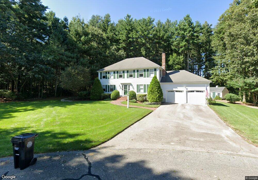
25 Charles Samuel Way Wrentham, MA 02093
Estimated Value: $855,846 - $994,000
4
Beds
3
Baths
2,348
Sq Ft
$404/Sq Ft
Est. Value
About This Home
This home is located at 25 Charles Samuel Way, Wrentham, MA 02093 and is currently estimated at $949,212, approximately $404 per square foot. 25 Charles Samuel Way is a home located in Norfolk County with nearby schools including Delaney Elementary School, Charles E Roderick, and Foxborough Regional Charter School.
Ownership History
Date
Name
Owned For
Owner Type
Purchase Details
Closed on
Oct 12, 2021
Sold by
Carr William G
Bought by
Carr Rt and Carr
Current Estimated Value
Purchase Details
Closed on
Jun 23, 2004
Sold by
Carr Birgitta and Carr William C
Bought by
Carr William G
Purchase Details
Closed on
Aug 15, 1996
Sold by
Pericolo Constr Inc
Bought by
Carr William G and Carr Birgitta
Purchase Details
Closed on
Apr 29, 1996
Sold by
Joel Construction Inc
Bought by
Pericolo Constr Inc
Create a Home Valuation Report for This Property
The Home Valuation Report is an in-depth analysis detailing your home's value as well as a comparison with similar homes in the area
Home Values in the Area
Average Home Value in this Area
Purchase History
| Date | Buyer | Sale Price | Title Company |
|---|---|---|---|
| Carr Rt | -- | None Available | |
| Carr Rt | -- | None Available | |
| Carr William G | -- | -- | |
| Carr William G | -- | -- | |
| Carr William G | $280,850 | -- | |
| Carr William G | -- | -- | |
| Carr William G | $280,850 | -- | |
| Pericolo Constr Inc | $100,000 | -- |
Source: Public Records
Mortgage History
| Date | Status | Borrower | Loan Amount |
|---|---|---|---|
| Previous Owner | Pericolo Constr Inc | $342,000 | |
| Previous Owner | Pericolo Constr Inc | $363,000 |
Source: Public Records
Tax History Compared to Growth
Tax History
| Year | Tax Paid | Tax Assessment Tax Assessment Total Assessment is a certain percentage of the fair market value that is determined by local assessors to be the total taxable value of land and additions on the property. | Land | Improvement |
|---|---|---|---|---|
| 2025 | $8,757 | $755,600 | $305,400 | $450,200 |
| 2024 | $8,369 | $697,400 | $305,400 | $392,000 |
| 2023 | $8,054 | $638,200 | $277,800 | $360,400 |
| 2022 | $7,864 | $575,300 | $259,300 | $316,000 |
| 2021 | $7,284 | $517,700 | $226,700 | $291,000 |
| 2020 | $7,340 | $515,100 | $201,900 | $313,200 |
| 2019 | $7,073 | $500,900 | $201,900 | $299,000 |
| 2018 | $7,221 | $507,100 | $202,200 | $304,900 |
| 2017 | $7,027 | $493,100 | $198,300 | $294,800 |
| 2016 | $6,923 | $484,800 | $192,600 | $292,200 |
| 2015 | $6,898 | $460,500 | $185,100 | $275,400 |
| 2014 | $6,830 | $446,100 | $178,100 | $268,000 |
Source: Public Records
Map
Nearby Homes
- 20 Charles Samuel Way
- 53 Chamberlain Dr
- 15 Charles Samuel Way
- 10 Charles Samuel Way
- 66 Geordan Ave
- 60 Geordan Ave
- 50 Geordan Ave
- 25 Lyndon Rd
- 59 Geordan Ave
- 15 Lyndon Rd
- 33 Geordan Ave
- 5 Lyndon Rd
- 42 Geordan Ave
- 50 Lyndon Rd
- 34 Geordan Ave
- 40 Lyndon Rd
- 75 Geordan Ave
- 30 Lyndon Rd
- 144 Winter St
- 24 Geordan Ave