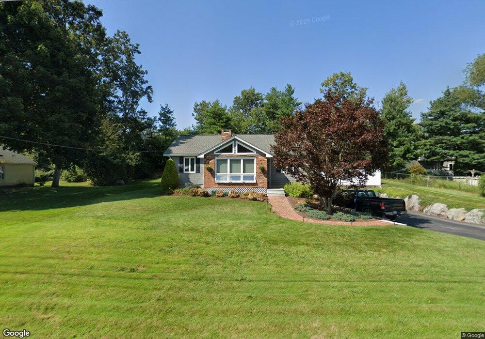
25 Chris Dr North Attleboro, MA 02760
Estimated Value: $543,673 - $624,000
3
Beds
1
Bath
1,280
Sq Ft
$459/Sq Ft
Est. Value
About This Home
This home is located at 25 Chris Dr, North Attleboro, MA 02760 and is currently estimated at $586,918, approximately $458 per square foot. 25 Chris Dr is a home located in Bristol County with nearby schools including North Attleboro High School, Cadence Academy Preschool - North Attleborough, and St John The Evangelist School.
Ownership History
Date
Name
Owned For
Owner Type
Purchase Details
Closed on
Jan 1, 1986
Bought by
Buckley Robert J and Buckley Janet M
Current Estimated Value
Create a Home Valuation Report for This Property
The Home Valuation Report is an in-depth analysis detailing your home's value as well as a comparison with similar homes in the area
Home Values in the Area
Average Home Value in this Area
Purchase History
| Date | Buyer | Sale Price | Title Company |
|---|---|---|---|
| Buckley Robert J | -- | -- |
Source: Public Records
Mortgage History
| Date | Status | Borrower | Loan Amount |
|---|---|---|---|
| Open | Buckley Robert J | $100,000 | |
| Closed | Buckley Robert J | $130,000 | |
| Closed | Buckley Robert J | $35,000 | |
| Closed | Buckley Robert J | $111,000 |
Source: Public Records
Tax History Compared to Growth
Tax History
| Year | Tax Paid | Tax Assessment Tax Assessment Total Assessment is a certain percentage of the fair market value that is determined by local assessors to be the total taxable value of land and additions on the property. | Land | Improvement |
|---|---|---|---|---|
| 2025 | $5,339 | $452,800 | $148,500 | $304,300 |
| 2024 | $5,057 | $438,200 | $148,500 | $289,700 |
| 2023 | $4,984 | $389,700 | $148,500 | $241,200 |
| 2022 | $4,614 | $331,200 | $148,500 | $182,700 |
| 2021 | $4,872 | $341,400 | $148,500 | $192,900 |
| 2020 | $4,595 | $320,200 | $148,500 | $171,700 |
| 2019 | $4,430 | $311,100 | $135,000 | $176,100 |
| 2018 | $3,901 | $292,400 | $135,000 | $157,400 |
| 2017 | $3,762 | $284,600 | $135,000 | $149,600 |
| 2016 | $3,695 | $279,500 | $149,900 | $129,600 |
| 2015 | $3,524 | $268,200 | $149,900 | $118,300 |
| 2014 | $3,290 | $248,500 | $131,700 | $116,800 |
Source: Public Records
Map
Nearby Homes
- 11 Buckthorn Ln
- 255 Mckeon Dr
- 115 Westfield Dr
- 21 Shady Ln
- 20 Sperry Ln
- 196 Donald Tennant Cir
- 747 N Main St
- 678 N Main St
- 57 Vine St
- 10 Hazelwood Ct
- 158 Ivy St
- 11 Landry Ave
- 150 Gilbert St
- 59 Laurelwood Dr
- 451R Gilbert St
- Lot 2 Jeffrey Dr
- 71 Richardson Ave
- Lot 5 Jeffrey Dr
- 136 Lindsey St
- 29 Lyman St