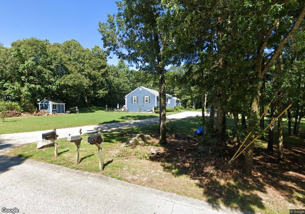
25 Clark Rd Wrentham, MA 02093
Estimated Value: $369,975 - $515,000
2
Beds
2
Baths
958
Sq Ft
$445/Sq Ft
Est. Value
About This Home
This home is located at 25 Clark Rd, Wrentham, MA 02093 and is currently estimated at $426,744, approximately $445 per square foot. 25 Clark Rd is a home located in Norfolk County with nearby schools including Delaney Elementary School, Charles E Roderick, and The Sage School.
Ownership History
Date
Name
Owned For
Owner Type
Purchase Details
Closed on
Dec 9, 2014
Sold by
Beaulieu Derek M and Beaulieu Laura M
Bought by
Beaulieu Derek M
Current Estimated Value
Purchase Details
Closed on
Dec 7, 1998
Sold by
Gacheru Stephen N and Gacheru Hilda R
Bought by
Beaulieu Derek M and Beaulieu Laura M
Home Financials for this Owner
Home Financials are based on the most recent Mortgage that was taken out on this home.
Original Mortgage
$99,450
Interest Rate
6.68%
Mortgage Type
Purchase Money Mortgage
Purchase Details
Closed on
Jun 28, 1996
Sold by
Demattia David M and Demattia Lena
Bought by
Gacheru Stephen N and Gacheru Hilda R
Home Financials for this Owner
Home Financials are based on the most recent Mortgage that was taken out on this home.
Original Mortgage
$107,150
Interest Rate
8.05%
Mortgage Type
Purchase Money Mortgage
Purchase Details
Closed on
Jun 1, 1995
Sold by
Wojcik Robert S and Wojcik Ellen
Bought by
Demattia David M and Demattia Lana
Home Financials for this Owner
Home Financials are based on the most recent Mortgage that was taken out on this home.
Original Mortgage
$82,480
Interest Rate
8.2%
Mortgage Type
Purchase Money Mortgage
Purchase Details
Closed on
Apr 3, 1989
Sold by
Volpicelli Joseph A
Bought by
Rizzotto John J
Purchase Details
Closed on
Jan 8, 1988
Sold by
Volpicelli Joseph A
Bought by
Rico Ellen C
Create a Home Valuation Report for This Property
The Home Valuation Report is an in-depth analysis detailing your home's value as well as a comparison with similar homes in the area
Home Values in the Area
Average Home Value in this Area
Purchase History
| Date | Buyer | Sale Price | Title Company |
|---|---|---|---|
| Beaulieu Derek M | -- | -- | |
| Beaulieu Derek M | $110,500 | -- | |
| Gacheru Stephen N | $110,500 | -- | |
| Demattia David M | $103,100 | -- | |
| Rizzotto John J | $134,900 | -- | |
| Rico Ellen C | $135,900 | -- |
Source: Public Records
Mortgage History
| Date | Status | Borrower | Loan Amount |
|---|---|---|---|
| Previous Owner | Rico Ellen C | $99,450 | |
| Previous Owner | Rico Ellen C | $107,150 | |
| Previous Owner | Rico Ellen C | $82,480 | |
| Previous Owner | Rico Ellen C | $91,000 |
Source: Public Records
Tax History Compared to Growth
Tax History
| Year | Tax Paid | Tax Assessment Tax Assessment Total Assessment is a certain percentage of the fair market value that is determined by local assessors to be the total taxable value of land and additions on the property. | Land | Improvement |
|---|---|---|---|---|
| 2025 | $3,325 | $286,900 | $0 | $286,900 |
| 2024 | $3,443 | $286,900 | $0 | $286,900 |
| 2023 | $3,549 | $281,200 | $0 | $281,200 |
| 2022 | $3,584 | $262,200 | $0 | $262,200 |
| 2021 | $3,420 | $243,100 | $0 | $243,100 |
| 2020 | $3,336 | $234,100 | $0 | $234,100 |
| 2019 | $3,305 | $234,100 | $0 | $234,100 |
| 2018 | $3,345 | $234,900 | $0 | $234,900 |
| 2017 | $3,259 | $228,700 | $0 | $228,700 |
| 2016 | $3,143 | $220,100 | $0 | $220,100 |
| 2015 | $2,773 | $185,100 | $0 | $185,100 |
| 2014 | $2,865 | $187,100 | $0 | $187,100 |
Source: Public Records
Map
Nearby Homes
- 362 East St
- 1 Lorraine Metcalf Dr
- 10 Nature View Dr
- 15 Nature View Dr
- 319 Taunton St
- 270 Dedham St
- 65 Pond St
- 120 Hawes St
- 11 Earle Stewart Ln
- 131 Creek St Unit 7
- 483 Thurston St
- Lot 3 - 14 Earle Stewart Ln
- Lot 1 - Blueberry 2 Car Plan at King Philip Estates
- Lot 8 - Blueberry 2 Car Plan at King Philip Estates
- Lot 6 - Blueberry 3 Car Plan at King Philip Estates
- Lot 2 - Camden 2 Car Plan at King Philip Estates
- Lot 7 - Cedar Plan at King Philip Estates
- Lot 4 - Hemingway 2 Car Plan at King Philip Estates
- Lot 3 - Blueberry 2 Car Plan at King Philip Estates
- 25 Foxboro Rd