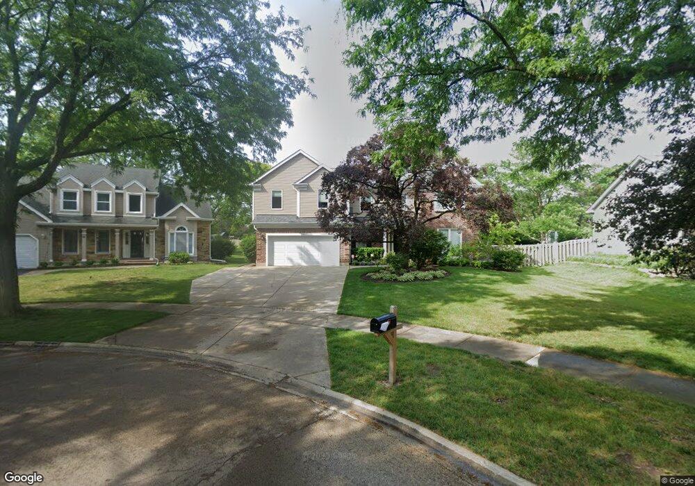
25 Dellmont Ct Buffalo Grove, IL 60089
Estimated Value: $668,000 - $730,000
--
Bed
3
Baths
2,574
Sq Ft
$271/Sq Ft
Est. Value
About This Home
This home is located at 25 Dellmont Ct, Buffalo Grove, IL 60089 and is currently estimated at $698,782, approximately $271 per square foot. 25 Dellmont Ct is a home located in Lake County with nearby schools including Meridian Middle School, Tripp Elementary School, and Aptakisic Junior High School.
Ownership History
Date
Name
Owned For
Owner Type
Purchase Details
Closed on
Oct 27, 1993
Sold by
Zerbinopoulos William G and Zerbinopoulos Lori A
Bought by
Zucker David G and Zucker Debra
Current Estimated Value
Home Financials for this Owner
Home Financials are based on the most recent Mortgage that was taken out on this home.
Original Mortgage
$164,500
Interest Rate
7.02%
Create a Home Valuation Report for This Property
The Home Valuation Report is an in-depth analysis detailing your home's value as well as a comparison with similar homes in the area
Home Values in the Area
Average Home Value in this Area
Purchase History
| Date | Buyer | Sale Price | Title Company |
|---|---|---|---|
| Zucker David G | $156,666 | Chicago Title Insurance Co |
Source: Public Records
Mortgage History
| Date | Status | Borrower | Loan Amount |
|---|---|---|---|
| Closed | Zucker David G | $164,500 |
Source: Public Records
Tax History Compared to Growth
Tax History
| Year | Tax Paid | Tax Assessment Tax Assessment Total Assessment is a certain percentage of the fair market value that is determined by local assessors to be the total taxable value of land and additions on the property. | Land | Improvement |
|---|---|---|---|---|
| 2024 | $17,964 | $201,064 | $54,756 | $146,308 |
| 2023 | $15,701 | $182,421 | $49,679 | $132,742 |
| 2022 | $15,701 | $166,708 | $45,400 | $121,308 |
| 2021 | $11,893 | $130,784 | $44,757 | $86,027 |
| 2020 | $11,661 | $131,230 | $44,910 | $86,320 |
| 2019 | $15,248 | $173,573 | $44,744 | $128,829 |
| 2018 | $15,342 | $174,270 | $48,640 | $125,630 |
| 2017 | $15,144 | $170,203 | $47,505 | $122,698 |
| 2016 | $14,622 | $162,983 | $45,490 | $117,493 |
| 2015 | $14,341 | $152,420 | $42,542 | $109,878 |
| 2014 | $12,472 | $131,902 | $45,689 | $86,213 |
| 2012 | $12,073 | $132,167 | $45,781 | $86,386 |
Source: Public Records
Map
Nearby Homes
- 1272 Sandhurst Dr
- 15 Thompson Ct
- 1012 Hobson Dr
- 148 White Branch Ct
- 938 Hidden Lake Dr
- 60 E Fabish Dr
- 51 W Fabish Dr
- 1113 Lockwood Dr
- 1157 Russellwood Ct
- 381 Bentley Place
- 1118 Larraway Dr
- 393 Bentley Place
- 720 Dunhill Dr
- 12 Aberdeen Ct
- 625 Marseilles Cir
- 538 Lasalle Ct
- 620 Cobblestone Ln
- 603 Cherbourg Ct N
- 22118 N Prairie Rd
- 327 Lasalle Ln
- 31 Dellmont Ct
- 19 Dellmont Ct
- 1257 Sandhurst Dr
- 1253 Sandhurst Dr
- 35 Longridge Ct
- 1263 Sandhurst Dr
- 37 Dellmont Ct
- 1247 Sandhurst Dr
- 1277 Sandhurst Dr
- 29 Longridge Ct
- 43 Dellmont Ct
- 1243 Sandhurst Dr
- 41 Longridge Ct Unit 1
- 61 Dellmont Ct
- 23 Longridge Ct
- 55 Dellmont Ct
- 49 Dellmont Ct
- 67 Dellmont Ct
- 1237 Sandhurst Dr
- 1252 Sandhurst Dr