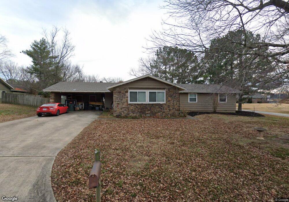
25 E 27th Cir Fayetteville, AR 72701
Fayette Junction NeighborhoodEstimated Value: $359,309 - $412,000
--
Bed
2
Baths
1,830
Sq Ft
$209/Sq Ft
Est. Value
About This Home
This home is located at 25 E 27th Cir, Fayetteville, AR 72701 and is currently estimated at $381,827, approximately $208 per square foot. 25 E 27th Cir is a home located in Washington County with nearby schools including Washington Elementary School, Owl Creek School, and Ramay Junior High School.
Ownership History
Date
Name
Owned For
Owner Type
Purchase Details
Closed on
Dec 24, 2020
Sold by
Daniels Floyd L and Daniels Jennifer G
Bought by
Daniels Floyd L and Daniels Jennifer G
Current Estimated Value
Home Financials for this Owner
Home Financials are based on the most recent Mortgage that was taken out on this home.
Original Mortgage
$179,000
Outstanding Balance
$144,782
Interest Rate
2.7%
Mortgage Type
New Conventional
Estimated Equity
$237,045
Purchase Details
Closed on
Apr 30, 2004
Sold by
Gazzola Pat and Gazzola Janie
Bought by
Daniels Floyd L
Home Financials for this Owner
Home Financials are based on the most recent Mortgage that was taken out on this home.
Original Mortgage
$101,000
Interest Rate
5.81%
Mortgage Type
Purchase Money Mortgage
Purchase Details
Closed on
May 25, 1993
Bought by
Israel Roger D
Purchase Details
Closed on
Jan 1, 1985
Bought by
Smith Cleo and Smith Irene B
Create a Home Valuation Report for This Property
The Home Valuation Report is an in-depth analysis detailing your home's value as well as a comparison with similar homes in the area
Home Values in the Area
Average Home Value in this Area
Purchase History
| Date | Buyer | Sale Price | Title Company |
|---|---|---|---|
| Daniels Floyd L | -- | Lenders Title Company | |
| Daniels Floyd L | -- | Triad Title Company | |
| Israel Roger D | $70,000 | -- | |
| Smith Cleo | -- | -- |
Source: Public Records
Mortgage History
| Date | Status | Borrower | Loan Amount |
|---|---|---|---|
| Open | Daniels Floyd L | $179,000 | |
| Previous Owner | Daniels Floyd L | $101,000 |
Source: Public Records
Tax History Compared to Growth
Tax History
| Year | Tax Paid | Tax Assessment Tax Assessment Total Assessment is a certain percentage of the fair market value that is determined by local assessors to be the total taxable value of land and additions on the property. | Land | Improvement |
|---|---|---|---|---|
| 2024 | $1,709 | $61,540 | $20,250 | $41,290 |
| 2023 | $1,722 | $61,540 | $20,250 | $41,290 |
| 2022 | $1,590 | $36,630 | $15,000 | $21,630 |
| 2021 | $1,505 | $36,630 | $15,000 | $21,630 |
| 2020 | $1,419 | $36,630 | $15,000 | $21,630 |
| 2019 | $1,334 | $29,490 | $9,000 | $20,490 |
| 2018 | $1,359 | $29,490 | $9,000 | $20,490 |
| 2017 | $134 | $29,490 | $9,000 | $20,490 |
| 2016 | $1,344 | $29,490 | $9,000 | $20,490 |
| 2015 | $1,265 | $29,490 | $9,000 | $20,490 |
| 2014 | $1,469 | $33,850 | $9,000 | $24,850 |
Source: Public Records
Map
Nearby Homes
- 210 W Ravenswood Ln
- 2957 S College Dr
- 380 & 460 W Ravenswood Ln
- 1026 S Morningside Dr
- 0 24th & S School
- 290 W 22nd St
- TBD W 22nd St
- 318 W 22nd St
- 492 E Fairway Ln
- 660 & 664 W Whillock St
- TBD W Whillock St
- Tbd Hwy 156 Unit LotWP001
- 956 W Cato Springs Rd
- 100 W Greenwood Fulbright Hall
- 100 W Greenwood St
- 123 E 15th St
- 1410 S Washington Ave
- 1928 S Garland Ave
- TBD Arkansas 156
- 901 E Sparrow Cir
- 3.27 Acres E Zion Rd
- 3.27 Acres Zion Rd
- 33 E 27th Cir
- 0 Country Club Dr Unit 1269326
- 0 Country Club Dr Unit 655308
- 0 Country Club Dr Unit 691971
- Tract C S College Dr
- 0 Brophy 6 27a Cir Unit 586238
- 0 Brophy 6 27a Cir Unit 671489
- 0 Brophy 6 27a Cir Unit 717067
- 0 Brophy 6 27a Cir Unit 735735
- 0 Brophy 6 27a Cir Unit 1006529
- 0 Oakland Zion 2 27a Rd Unit 572177
- 4 E 28th Cir
- 2730 S Country Club Dr
- 49 E 27th Cir
- 2851 S Country Club Dr
- 0 Black Oak 55 28a Rd Unit 631479
- 48 E 27th Cir
- 12 E 28th Cir