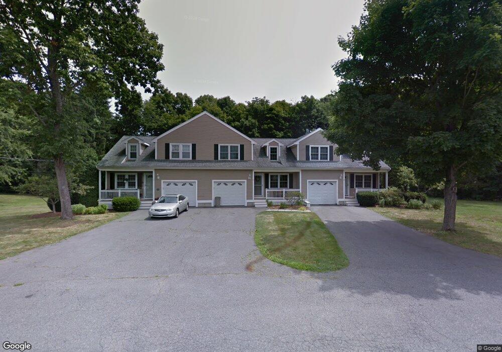
25 Eastside Rd Wrentham, MA 02093
Estimated Value: $456,000 - $572,000
3
Beds
2
Baths
1,746
Sq Ft
$284/Sq Ft
Est. Value
About This Home
This home is located at 25 Eastside Rd, Wrentham, MA 02093 and is currently estimated at $495,724, approximately $283 per square foot. 25 Eastside Rd is a home located in Norfolk County with nearby schools including Delaney Elementary School and Charles E Roderick.
Ownership History
Date
Name
Owned For
Owner Type
Purchase Details
Closed on
Jan 4, 1999
Sold by
Raymond Loel A
Bought by
Meau Michael J and Meau Lisa J
Current Estimated Value
Home Financials for this Owner
Home Financials are based on the most recent Mortgage that was taken out on this home.
Original Mortgage
$85,000
Interest Rate
6.84%
Mortgage Type
Purchase Money Mortgage
Purchase Details
Closed on
Dec 17, 1998
Sold by
Raymond Loel A
Bought by
Nolet Nancy
Home Financials for this Owner
Home Financials are based on the most recent Mortgage that was taken out on this home.
Original Mortgage
$85,000
Interest Rate
6.84%
Mortgage Type
Purchase Money Mortgage
Create a Home Valuation Report for This Property
The Home Valuation Report is an in-depth analysis detailing your home's value as well as a comparison with similar homes in the area
Purchase History
| Date | Buyer | Sale Price | Title Company |
|---|---|---|---|
| Meau Michael J | $139,000 | -- | |
| Nolet Nancy | $134,000 | -- |
Source: Public Records
Mortgage History
| Date | Status | Borrower | Loan Amount |
|---|---|---|---|
| Open | Nolet Nancy | $185,500 | |
| Closed | Nolet Nancy | $15,000 | |
| Closed | Nolet Nancy | $40,000 | |
| Closed | Nolet Nancy | $85,000 |
Source: Public Records
Tax History
| Year | Tax Paid | Tax Assessment Tax Assessment Total Assessment is a certain percentage of the fair market value that is determined by local assessors to be the total taxable value of land and additions on the property. | Land | Improvement |
|---|---|---|---|---|
| 2025 | $4,232 | $365,100 | $0 | $365,100 |
| 2024 | $4,381 | $365,100 | $0 | $365,100 |
| 2023 | $4,498 | $356,400 | $0 | $356,400 |
| 2022 | $4,284 | $313,400 | $0 | $313,400 |
| 2021 | $4,082 | $290,100 | $0 | $290,100 |
| 2020 | $3,977 | $279,100 | $0 | $279,100 |
| 2019 | $3,941 | $279,100 | $0 | $279,100 |
| 2018 | $3,690 | $259,100 | $0 | $259,100 |
| 2017 | $3,554 | $249,400 | $0 | $249,400 |
| 2016 | $3,429 | $240,100 | $0 | $240,100 |
| 2015 | $3,498 | $233,500 | $0 | $233,500 |
| 2014 | $3,399 | $222,000 | $0 | $222,000 |
Source: Public Records
Map
Nearby Homes
- 11 Earle Stewart Ln
- Lot 1 - Blueberry 2 Car Plan at King Philip Estates
- Lot 8 - Blueberry 2 Car Plan at King Philip Estates
- Lot 5 - Hughes 2 car Plan at King Philip Estates
- Lot 6 - Blueberry 3 Car Plan at King Philip Estates
- 10 Earle Stewart Ln Unit Lot 5
- Lot 2 - Camden 2 Car Plan at King Philip Estates
- Lot 7 - Cedar Plan at King Philip Estates
- Lot 4 - Hemingway 2 Car Plan at King Philip Estates
- 14 Earle Stewart Ln
- Lot 3 - Blueberry 2 Car Plan at King Philip Estates
- 12 Earle Stewart Ln
- 319 Taunton St
- 10 Nature View Dr
- 15 Nature View Dr
- 500 Franklin St
- 155 Clark Rd Unit 155
- 287 Park St
- 440 Chestnut St
- 1222 South St
- 15 Eastside Rd
- 15 Eastside Rd Unit 15
- 5 Eastside Rd
- 5 Eastside Rd Unit 1,1
- 35 Eastside Rd
- 382 South St
- 3 Earle Stewart Ln
- 7 Earle Stewart Ln
- 394 South St
- 32 Eastside Rd
- 22 Eastside Rd
- 374 South St
- 45 Eastside Rd
- 418 South St
- 42 Eastside Rd
- 2 Badus Brook Rd
- 52 Eastside Rd
- 364 South St Unit 366
- 422 South St
- 430 South St
Your Personal Tour Guide
Ask me questions while you tour the home.