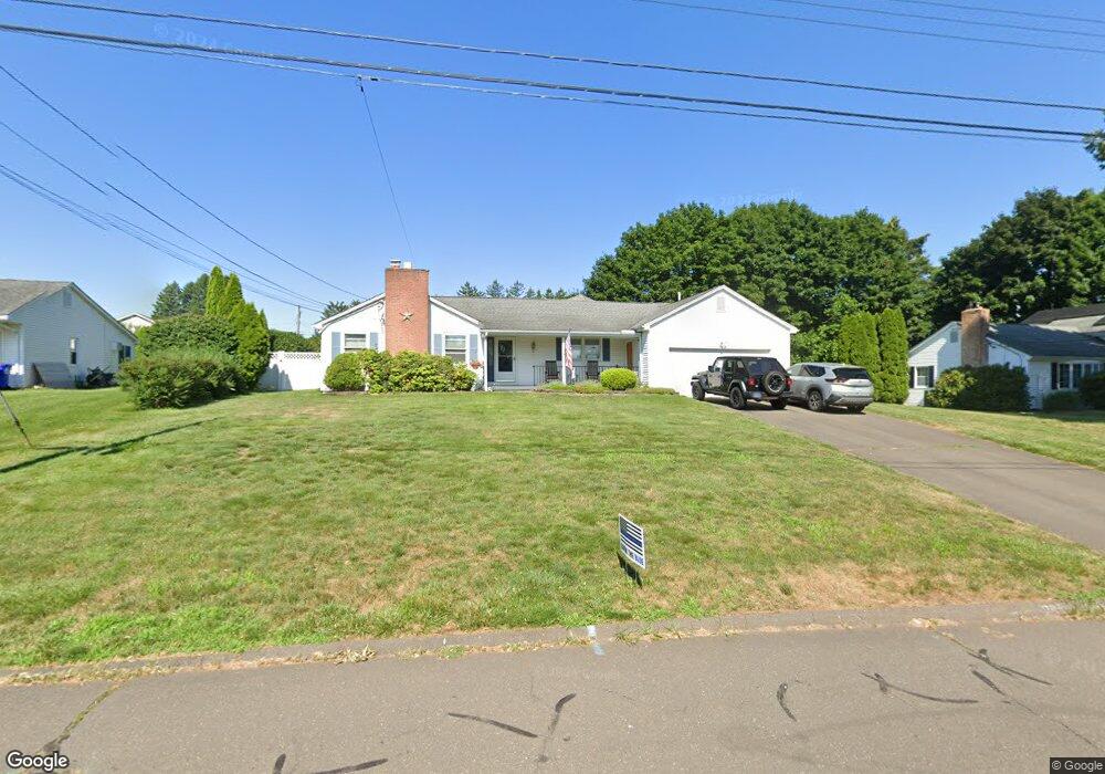
25 Farmstead Rd Wethersfield, CT 06109
Estimated Value: $458,000 - $589,000
3
Beds
3
Baths
1,835
Sq Ft
$281/Sq Ft
Est. Value
About This Home
This home is located at 25 Farmstead Rd, Wethersfield, CT 06109 and is currently estimated at $514,922, approximately $280 per square foot. 25 Farmstead Rd is a home located in Hartford County with nearby schools including Highcrest School, Silas Deane Middle School, and Wethersfield High School.
Ownership History
Date
Name
Owned For
Owner Type
Purchase Details
Closed on
Feb 16, 2018
Sold by
Parker Thomas E
Bought by
Sterling Property Serv
Current Estimated Value
Purchase Details
Closed on
Jun 4, 2014
Sold by
Thompson Douglas C
Bought by
Parker Robert T and Parker Thomas E
Purchase Details
Closed on
Aug 18, 2008
Sold by
Phenix Paul N and Phenix Carol A
Bought by
Ptak Peter and Ptak Nancy
Purchase Details
Closed on
Apr 18, 2005
Sold by
Est Lewis Irene and Barrabee Juanita Louise
Bought by
Phenix Paul N and Phenix Carol A
Create a Home Valuation Report for This Property
The Home Valuation Report is an in-depth analysis detailing your home's value as well as a comparison with similar homes in the area
Home Values in the Area
Average Home Value in this Area
Purchase History
| Date | Buyer | Sale Price | Title Company |
|---|---|---|---|
| Sterling Property Serv | -- | -- | |
| Sterling Property Serv | -- | -- | |
| Pdp Financial Llc | -- | -- | |
| Parker Robert T | -- | -- | |
| Ptak Peter | $338,000 | -- | |
| Phenix Paul N | $355,000 | -- |
Source: Public Records
Mortgage History
| Date | Status | Borrower | Loan Amount |
|---|---|---|---|
| Previous Owner | Phenix Paul N | $280,000 | |
| Previous Owner | Phenix Paul N | $22,200 | |
| Previous Owner | Phenix Paul N | $278,450 |
Source: Public Records
Tax History
| Year | Tax Paid | Tax Assessment Tax Assessment Total Assessment is a certain percentage of the fair market value that is determined by local assessors to be the total taxable value of land and additions on the property. | Land | Improvement |
|---|---|---|---|---|
| 2025 | $11,514 | $279,330 | $95,680 | $183,650 |
| 2024 | $8,085 | $187,060 | $77,000 | $110,060 |
| 2023 | $7,815 | $187,060 | $77,000 | $110,060 |
| 2022 | $7,684 | $187,060 | $77,000 | $110,060 |
| 2021 | $7,608 | $187,060 | $77,000 | $110,060 |
| 2020 | $7,611 | $187,060 | $77,000 | $110,060 |
| 2019 | $7,621 | $187,060 | $77,000 | $110,060 |
| 2018 | $7,658 | $187,800 | $76,000 | $111,800 |
| 2017 | $7,469 | $187,800 | $76,000 | $111,800 |
| 2016 | $7,238 | $187,800 | $76,000 | $111,800 |
| 2015 | $7,172 | $187,800 | $76,000 | $111,800 |
| 2014 | $6,900 | $187,800 | $76,000 | $111,800 |
Source: Public Records
Map
Nearby Homes
- 89 Merriman Rd
- 38 Wheeler Rd
- 455 Brimfield Rd
- 137 Dale Rd
- 0 Collier Rd
- 101 Collier Rd
- 104 Willow St
- 268 Fox Hill Rd
- 119 Coleman Rd
- 108 Chamberlain Rd
- 5 Robeth Ln
- 195 Middletown Ave
- 508 Highland St
- 116 Wells Farm Dr
- 155 Old Common Rd
- 35 Stillwold Dr
- 72 Concord Dr
- 186 Hang Dog Ln
- 50 Concord Dr Unit 50
- 25 Sutton Rd
- 15 Farmstead Rd
- 33 Farmstead Rd
- 24 Garden Hill Rd
- 42 Farmstead Rd
- 16 Garden Hill Rd
- 34 Garden Hill Rd
- 34 Farmstead Rd
- 56 Country Club Rd
- 24 Farmstead Rd
- 48 Country Club Rd
- 43 Farmstead Rd
- 16 Farmstead Rd
- 66 Country Club Rd
- 42 Garden Hill Rd
- 36 Country Club Rd
- 21 Garden Hill Rd
- 141 Griswold Rd
- 31 Garden Hill Rd
- 15 Garden Hill Rd
- 50 Farmstead Rd
Your Personal Tour Guide
Ask me questions while you tour the home.