Estimated Value: $207,000 - $293,000
--
Bed
2
Baths
1,056
Sq Ft
$235/Sq Ft
Est. Value
About This Home
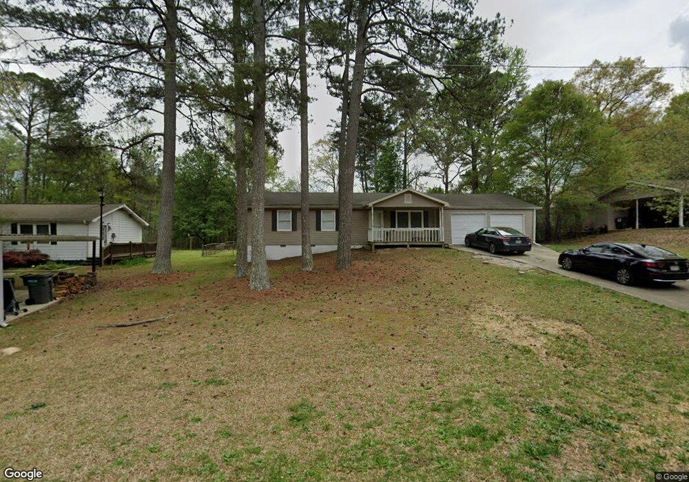
This home is located at 25 Forkwood Cir, Hiram, GA 30141 and is currently estimated at $247,722, approximately $234 per square foot. 25 Forkwood Cir is a home located in Paulding County with nearby schools including Bessie L. Baggett Elementary School, J. A. Dobbins Middle School, and Hiram High School.
Ownership History
Date
Name
Owned For
Owner Type
Purchase Details
Closed on
Jan 29, 2003
Sold by
Federal Home Loan Mortgage Corporation
Bought by
Sorrentino Robert E
Current Estimated Value
Home Financials for this Owner
Home Financials are based on the most recent Mortgage that was taken out on this home.
Original Mortgage
$49,500
Outstanding Balance
$18,561
Interest Rate
4.25%
Mortgage Type
New Conventional
Estimated Equity
$229,161
Purchase Details
Closed on
Sep 3, 2002
Sold by
Greenpoint Mtg
Bought by
Federal Home Loan Mortgage Corporation
Create a Home Valuation Report for This Property
The Home Valuation Report is an in-depth analysis detailing your home's value as well as a comparison with similar homes in the area
Home Values in the Area
Average Home Value in this Area
Purchase History
| Date | Buyer | Sale Price | Title Company |
|---|---|---|---|
| Sorrentino Robert E | -- | -- | |
| Federal Home Loan Mortgage Corporation | -- | -- | |
| Greenpoint Mtg | $74,069 | -- |
Source: Public Records
Mortgage History
| Date | Status | Borrower | Loan Amount |
|---|---|---|---|
| Open | Sorrentino Robert E | $49,500 |
Source: Public Records
Tax History Compared to Growth
Tax History
| Year | Tax Paid | Tax Assessment Tax Assessment Total Assessment is a certain percentage of the fair market value that is determined by local assessors to be the total taxable value of land and additions on the property. | Land | Improvement |
|---|---|---|---|---|
| 2024 | $1,840 | $73,980 | $8,457 | $65,523 |
| 2023 | $1,929 | $73,980 | $12,000 | $61,980 |
| 2022 | $1,077 | $41,320 | $7,964 | $33,356 |
| 2021 | $1,201 | $41,320 | $7,964 | $33,356 |
| 2020 | $1,227 | $41,320 | $8,000 | $33,320 |
| 2019 | $600 | $19,908 | $5,089 | $14,819 |
| 2018 | $600 | $19,908 | $5,089 | $14,819 |
| 2017 | $1,097 | $35,896 | $8,000 | $27,896 |
| 2016 | $602 | $19,908 | $8,000 | $11,908 |
| 2015 | $613 | $19,908 | $8,000 | $11,908 |
| 2014 | $524 | $16,600 | $8,000 | $8,600 |
| 2013 | -- | $16,600 | $8,000 | $8,600 |
Source: Public Records
Map
Nearby Homes
- 0 Morris Rd Unit 7337374
- 0 Morris Rd Unit 10626403
- 0 Morris Rd Unit 10352308
- 214 S Lake Dr
- 24 Echo Ridge Dr
- 589 Linda Ln
- 4291 Defoors Farm Trail
- 820 Bennett Rd
- 2794 Cleburne Pkwy
- 3920 Hiram Lithia Springs Rd
- 3880 Hiram Lithia Springs Rd SW
- 5554 Racetrack Ct
- 5441 Stirrup Way
- 554 Morningside Dr
- 4350 Defoors Farm Trail
- 54 Jean Ct
- 3861 Riding Trail SW
- 5785 Angham Rd
- 5641 Riding Woods Dr SW
- 5422 Hill Rd SW
- 7 Forkwood Cir
- 37 Forkwood Cir
- 16 Forkwood Cir
- 1 Forkwood Cir
- 55 Forkwood Cir
- 26 Forkwood Cir
- 4 Forkwood Cir Unit 2
- 75 Forkwood Cir
- 66 Forkwood Cir
- 100* Forkwood Cir
- 100* Forkwood Cir Unit 52 /
- 180 Forkwood Way
- 124 Forkwood Way
- 57 Scuppernong Dr
- 93 Forkwood Cir
- O Forkwood Circle Lot 15
- O Forkwood Circle Lot 16
- O Forkwood Circle Lot 17
- O Forkwood Circle Lot 14
- 736 Morris Rd