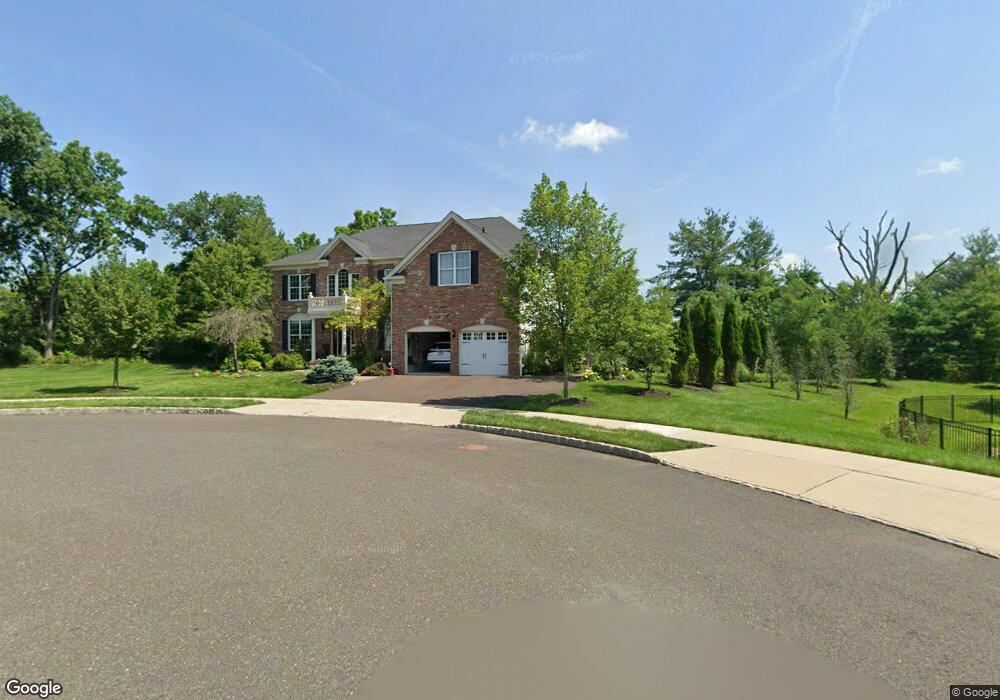
25 Green Way Dr Doylestown, PA 18901
Estimated Value: $1,341,000 - $1,471,000
4
Beds
4
Baths
4,071
Sq Ft
$346/Sq Ft
Est. Value
About This Home
This home is located at 25 Green Way Dr, Doylestown, PA 18901 and is currently estimated at $1,407,746, approximately $345 per square foot. 25 Green Way Dr is a home with nearby schools including Groveland Elementary School, Tohickon Middle School, and Central Bucks High School-West.
Ownership History
Date
Name
Owned For
Owner Type
Purchase Details
Closed on
Jan 18, 2024
Sold by
Allenby Kent S and Allenby Patrice
Bought by
Kent And Patrice Allenby Nest Egg Trust and Allenby
Current Estimated Value
Purchase Details
Closed on
Jun 30, 2017
Sold by
Toll Pa Xv Lp
Bought by
Allenby Kent S and Allenby Patricia
Home Financials for this Owner
Home Financials are based on the most recent Mortgage that was taken out on this home.
Original Mortgage
$682,354
Interest Rate
3.95%
Mortgage Type
New Conventional
Create a Home Valuation Report for This Property
The Home Valuation Report is an in-depth analysis detailing your home's value as well as a comparison with similar homes in the area
Home Values in the Area
Average Home Value in this Area
Purchase History
| Date | Buyer | Sale Price | Title Company |
|---|---|---|---|
| Kent And Patrice Allenby Nest Egg Trust | -- | None Listed On Document | |
| Allenby Kent S | $852,943 | None Available |
Source: Public Records
Mortgage History
| Date | Status | Borrower | Loan Amount |
|---|---|---|---|
| Previous Owner | Allenby Kent S | $682,354 |
Source: Public Records
Tax History Compared to Growth
Tax History
| Year | Tax Paid | Tax Assessment Tax Assessment Total Assessment is a certain percentage of the fair market value that is determined by local assessors to be the total taxable value of land and additions on the property. | Land | Improvement |
|---|---|---|---|---|
| 2025 | $16,290 | $92,050 | $10,980 | $81,070 |
| 2024 | $16,290 | $92,050 | $10,980 | $81,070 |
| 2023 | $15,533 | $92,050 | $10,980 | $81,070 |
| 2022 | $15,359 | $92,050 | $10,980 | $81,070 |
| 2021 | $15,043 | $92,050 | $10,980 | $81,070 |
| 2020 | $14,974 | $92,050 | $10,980 | $81,070 |
| 2019 | $14,813 | $92,050 | $10,980 | $81,070 |
| 2018 | $14,767 | $92,050 | $10,980 | $81,070 |
| 2017 | $1,748 | $10,980 | $10,980 | $0 |
| 2016 | -- | $10,980 | $10,980 | $0 |
| 2015 | -- | $10,980 | $10,980 | $0 |
Source: Public Records
Map
Nearby Homes
- 21 Greenway Dr
- 85 Trafalgar Rd Unit 52
- 1 Stacey Dr
- 14 Broadale Rd
- 5 Broadale Rd
- 5415 Rinker Cir Unit 256
- 5513 Rinker Cir Unit 349
- 3769 Swetland Dr
- 301 Windy Run Rd
- 925 E Sandy Ridge Rd
- 3600 Jacob Stout Rd Unit 3
- 3723 William Daves Rd
- 3688 Christopher Day Rd
- 3765 William Daves Rd
- 3669 Jacob Stout Rd Unit 8
- 6 Edison Ln Unit 1
- 90 Chapman Ave
- 3822 Jacob Stout Rd
- 4893 W Swamp Rd Unit A
- 418 North St
- 23 Green Way Dr
- 21 Green Way Dr
- 24 Greenway Dr Unit C
- 24 Greenway Dr Unit B
- 24 Greenway Dr
- 24 Greenway Dr Unit D
- 24 Greenway Dr Unit A
- 121 Blackfriars Cir Unit 88
- 19 Green Way Dr
- 122 Blackfriars Cir Unit 89
- 120 Blackfriars Cir Unit 87
- 123 Blackfriars Cir Unit 90
- 124 Blackfriars Cir Unit 91
- 119 Blackfriars Cir Unit 86
- 125 Blackfriars Cir Unit 92
- 22 Green Way Dr
- 118 Blackfriars Cir Unit 85
- 126 Blackfriars Cir Unit 93
- 117 Blackfriars Cir Unit 84
- 117 Blackfriars Cir