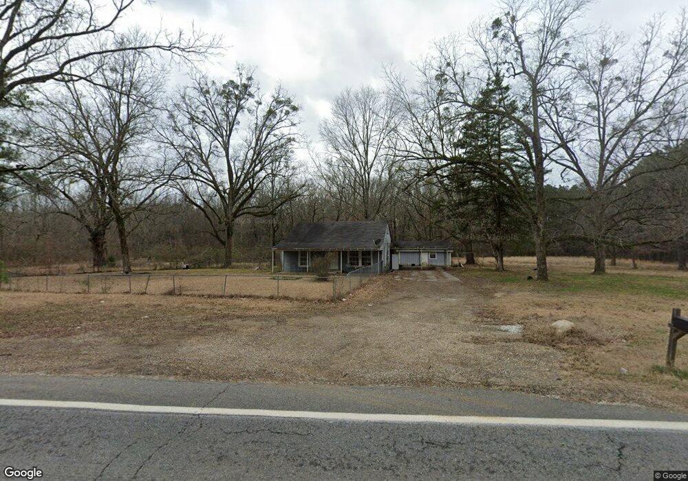
25 Highway 53 N Gurdon, AR 71743
Estimated Value: $72,248 - $159,000
--
Bed
1
Bath
1,624
Sq Ft
$81/Sq Ft
Est. Value
About This Home
This home is located at 25 Highway 53 N, Gurdon, AR 71743 and is currently estimated at $131,062, approximately $80 per square foot. 25 Highway 53 N is a home located in Clark County with nearby schools including Gurdon Primary School, Cabe Middle School, and Gurdon High School.
Ownership History
Date
Name
Owned For
Owner Type
Purchase Details
Closed on
Apr 1, 2011
Sold by
Wilson & Associates Pllc
Bought by
Leamons Nicki
Current Estimated Value
Purchase Details
Closed on
Nov 16, 2010
Sold by
Federal National Mortgage Association
Bought by
Enterprise Corporation Of The Delta
Purchase Details
Closed on
Oct 18, 2010
Sold by
Enterprise Corporation Of The Delta
Bought by
Prince Jimmie Renee
Purchase Details
Closed on
Jun 15, 2007
Bought by
Prince Jimmie Renee
Purchase Details
Closed on
Aug 1, 1997
Bought by
Key Paul K and Key Ceciley C
Purchase Details
Closed on
Nov 1, 1989
Bought by
Blanton
Create a Home Valuation Report for This Property
The Home Valuation Report is an in-depth analysis detailing your home's value as well as a comparison with similar homes in the area
Home Values in the Area
Average Home Value in this Area
Purchase History
| Date | Buyer | Sale Price | Title Company |
|---|---|---|---|
| Leamons Nicki | -- | -- | |
| Enterprise Corporation Of The Delta | -- | -- | |
| Prince Jimmie Renee | $72,047 | -- | |
| Prince Jimmie Renee | $43,000 | -- | |
| Key Paul K | $41,000 | -- | |
| Blanton | -- | -- |
Source: Public Records
Tax History Compared to Growth
Tax History
| Year | Tax Paid | Tax Assessment Tax Assessment Total Assessment is a certain percentage of the fair market value that is determined by local assessors to be the total taxable value of land and additions on the property. | Land | Improvement |
|---|---|---|---|---|
| 2024 | $82 | $11,620 | $1,600 | $10,020 |
| 2023 | $76 | $11,620 | $1,600 | $10,020 |
| 2022 | $126 | $11,620 | $1,600 | $10,020 |
| 2021 | $498 | $11,620 | $1,600 | $10,020 |
| 2020 | $79 | $11,620 | $1,600 | $10,020 |
| 2019 | $58 | $10,040 | $1,600 | $8,440 |
| 2018 | $78 | $10,040 | $1,600 | $8,440 |
| 2017 | $78 | $10,040 | $1,600 | $8,440 |
| 2016 | $78 | $10,040 | $1,600 | $8,440 |
| 2015 | $78 | $10,040 | $1,600 | $8,440 |
| 2014 | $122 | $11,070 | $1,600 | $9,470 |
Source: Public Records
Map
Nearby Homes
- TBD Hwy 67 S
- 313 W Miller St
- 109 N 7th St
- 7104 Highway 67 S
- 326 Arkansas 53
- 0000 Arkansas 53
- 110 S 10th St
- 103 Stonegate Ct
- 51 South St
- 1795 Bowen Hill Rd
- TBD Kansas Rd
- 000 Kansas Rd
- 236 Lockie Rd
- 845 Stevenson Rd
- 58 Dodgen Rd
- TBD Hwy 67
- 602 Stevenson Rd
- 196 Stevenson Rd
- 505 Stevenson Rd
- 652 Center Point
- 19 Highway 53 N
- 805 N Elm St
- 93 Highway 53 N
- 0 Highway 53 Unit 17008331
- 1306 N Elm St
- 34 Brewer Rd
- 710 N Elm St
- 1002 N Elm St
- 129 Highway 53 N
- 143 Highway 53 N
- 86 Brewer Rd
- 1312 N Elm St
- 181 Highway 53 N
- 22 Greenville Rd
- 100 Potter Rd
- 66 Greenville Rd
- 204 Highway 53 N
- 91 Rutherford Rd
- 141 Brewer Rd
- 0 Tbd Hwy 67