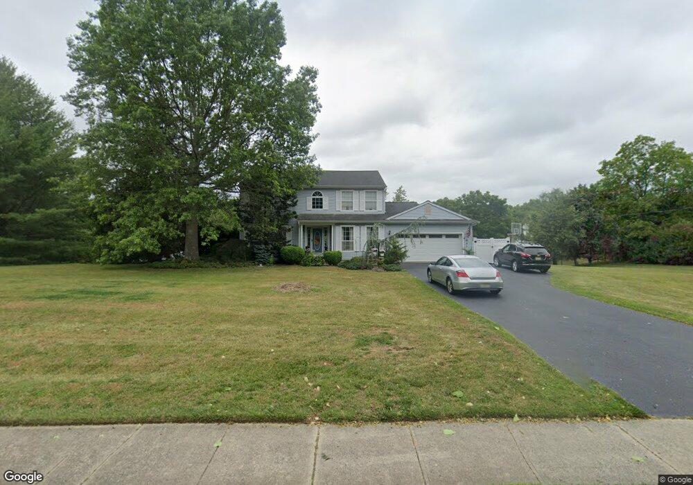
25 Indian Path Millstone Township, NJ 08535
Estimated Value: $817,000 - $902,000
4
Beds
3
Baths
2,216
Sq Ft
$380/Sq Ft
Est. Value
About This Home
This home is located at 25 Indian Path, Millstone Township, NJ 08535 and is currently estimated at $842,898, approximately $380 per square foot. 25 Indian Path is a home located in Monmouth County with nearby schools including Oak Tree Elementary School, Monroe Township Middle School, and Monroe Township High School.
Ownership History
Date
Name
Owned For
Owner Type
Purchase Details
Closed on
Sep 20, 2001
Sold by
Ruszczyk Lawrence
Bought by
Demonte David and Demonte Bianca
Current Estimated Value
Home Financials for this Owner
Home Financials are based on the most recent Mortgage that was taken out on this home.
Original Mortgage
$252,000
Outstanding Balance
$97,335
Interest Rate
6.86%
Estimated Equity
$745,563
Create a Home Valuation Report for This Property
The Home Valuation Report is an in-depth analysis detailing your home's value as well as a comparison with similar homes in the area
Home Values in the Area
Average Home Value in this Area
Purchase History
| Date | Buyer | Sale Price | Title Company |
|---|---|---|---|
| Demonte David | $315,000 | -- |
Source: Public Records
Mortgage History
| Date | Status | Borrower | Loan Amount |
|---|---|---|---|
| Open | Demonte David | $252,000 |
Source: Public Records
Tax History Compared to Growth
Tax History
| Year | Tax Paid | Tax Assessment Tax Assessment Total Assessment is a certain percentage of the fair market value that is determined by local assessors to be the total taxable value of land and additions on the property. | Land | Improvement |
|---|---|---|---|---|
| 2025 | $9,623 | $518,800 | $136,200 | $382,600 |
| 2024 | $9,985 | $401,800 | $151,300 | $250,500 |
| 2023 | $9,985 | $401,800 | $151,300 | $250,500 |
| 2022 | $9,699 | $401,800 | $151,300 | $250,500 |
| 2021 | $9,699 | $401,800 | $151,300 | $250,500 |
| 2020 | $9,591 | $401,800 | $151,300 | $250,500 |
| 2019 | $9,410 | $401,800 | $151,300 | $250,500 |
| 2018 | $9,177 | $401,800 | $151,300 | $250,500 |
| 2017 | $9,137 | $401,800 | $151,300 | $250,500 |
| 2016 | $9,069 | $401,800 | $151,300 | $250,500 |
| 2015 | $8,962 | $377,500 | $151,300 | $226,200 |
| 2014 | $8,630 | $331,800 | $128,300 | $203,500 |
Source: Public Records
Map
Nearby Homes
- 14 Indian Path
- 13 Indian Path
- 12 Dugans Grove
- 12 Dugans Grove Rd
- 45 Iron Ore Rd
- 19 Jurgelsky Rd
- 0 E Route 33 Unit 22432705
- 491 State Route 33
- 12 Colt Ln
- 6 Colt Ln
- 146 Mustang Dr
- 23 Mustang Dr
- 5 Colt Ln
- 49 Mustang Dr
- 47 Mustang Dr
- 45 Mustang Dr
- 35 Mustang Dr
- 172 Mustang Dr
- 130 Mustang Dr
- 39 Mustang Dr
- 23 Indian Path
- 27 Indian Path
- 14 Algonquin Terrace
- 16 Algonquin Terrace
- 10 Algonquin Terrace
- 21 Indian Path
- 24 Indian Path
- 26 Indian Path
- 29 Indian Path
- 18 Algonquin Terrace
- 8 Algonquin Terrace
- 13 Algonquin Terrace
- 15 Algonquin Terrace
- 30 Indian Path
- 20 Indian Path
- 32 Indian Path
- 17 Algonquin Terrace
- 9 Algonquin Terrace
- 22 Algonquin Terrace
- 31 Indian Path