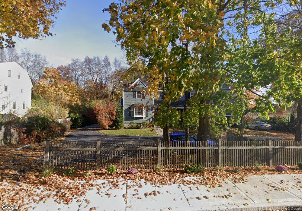
25 Johnson St Unit A Newburyport, MA 01950
Estimated Value: $970,000 - $1,164,000
3
Beds
3
Baths
2,451
Sq Ft
$436/Sq Ft
Est. Value
About This Home
This home is located at 25 Johnson St Unit A, Newburyport, MA 01950 and is currently estimated at $1,069,461, approximately $436 per square foot. 25 Johnson St Unit A is a home located in Essex County with nearby schools including Francis T. Bresnahan Elementary School, Edward G. Molin Elementary School, and Rupert A. Nock Middle School.
Ownership History
Date
Name
Owned For
Owner Type
Purchase Details
Closed on
Mar 28, 2013
Sold by
Mccarthy George G and Mccarthy Stephanie M
Bought by
Forrest-Hay Alexander and Forrest-Hay Rachel
Current Estimated Value
Home Financials for this Owner
Home Financials are based on the most recent Mortgage that was taken out on this home.
Original Mortgage
$392,000
Outstanding Balance
$277,824
Interest Rate
3.56%
Mortgage Type
New Conventional
Estimated Equity
$791,637
Purchase Details
Closed on
Jun 7, 2002
Sold by
Benson Diane C and Sapienza Alfred M
Bought by
Mccarthy George G and Allen Stephanie M
Home Financials for this Owner
Home Financials are based on the most recent Mortgage that was taken out on this home.
Original Mortgage
$275,000
Interest Rate
6.9%
Mortgage Type
Purchase Money Mortgage
Create a Home Valuation Report for This Property
The Home Valuation Report is an in-depth analysis detailing your home's value as well as a comparison with similar homes in the area
Home Values in the Area
Average Home Value in this Area
Purchase History
| Date | Buyer | Sale Price | Title Company |
|---|---|---|---|
| Forrest-Hay Alexander | $490,000 | -- | |
| Mccarthy George G | $420,250 | -- |
Source: Public Records
Mortgage History
| Date | Status | Borrower | Loan Amount |
|---|---|---|---|
| Open | Forrest-Hay Alexander | $392,000 | |
| Previous Owner | Mccarthy George G | $275,000 |
Source: Public Records
Tax History Compared to Growth
Tax History
| Year | Tax Paid | Tax Assessment Tax Assessment Total Assessment is a certain percentage of the fair market value that is determined by local assessors to be the total taxable value of land and additions on the property. | Land | Improvement |
|---|---|---|---|---|
| 2025 | $8,241 | $860,200 | $0 | $860,200 |
| 2024 | $8,040 | $806,400 | $0 | $806,400 |
| 2023 | $8,005 | $745,300 | $0 | $745,300 |
| 2022 | $7,804 | $649,800 | $0 | $649,800 |
| 2021 | $7,751 | $613,200 | $0 | $613,200 |
| 2020 | $7,716 | $600,900 | $0 | $600,900 |
| 2019 | $7,606 | $581,500 | $0 | $581,500 |
| 2018 | $7,479 | $564,000 | $0 | $564,000 |
| 2017 | $6,942 | $516,100 | $0 | $516,100 |
| 2016 | $6,525 | $487,300 | $0 | $487,300 |
| 2015 | $6,353 | $476,200 | $0 | $476,200 |
Source: Public Records
Map
Nearby Homes
- 14 Dexter Ln Unit B
- 14 Dexter Ln Unit A
- 45 Boardman St Unit 1
- 41 Washington St Unit B
- 44 Washington St Unit C
- 27 Warren St Unit 1
- 158 Merrimac St Unit 3
- 13 Broad St
- 2 Court St Unit 4
- 1 Hill St
- 1 Hill St Unit 1
- 110 Low St
- 126 Merrimac St Unit 35
- 58 Merrimac St Unit 2-5
- 138 Low St
- 266 Merrimac St Unit F
- 288 Merrimac St
- 105 State St Unit 301
- 105 State St Unit 101
- 105 State St Unit 201
- 25A Johnson St
- 25 Johnson St Unit B
- 27 Johnson St
- 23 Johnson St Unit 2
- 23 Johnson St Unit 1
- 23 Johnson St Unit B
- 23 Johnson St Unit A
- 23 Johnson St
- 23 A Johnson St Unit 23A
- 24 Johnson St Unit 1
- 24 Johnson St
- 26 - 26 R Johnson St
- 20 Johnson St
- 29 Johnson St
- 21 Johnson St Unit B
- 21 Johnson St Unit C
- 30 Johnson St Unit 32
- 30 Johnson St
- 14 Johnson St
- 28 Johnson St