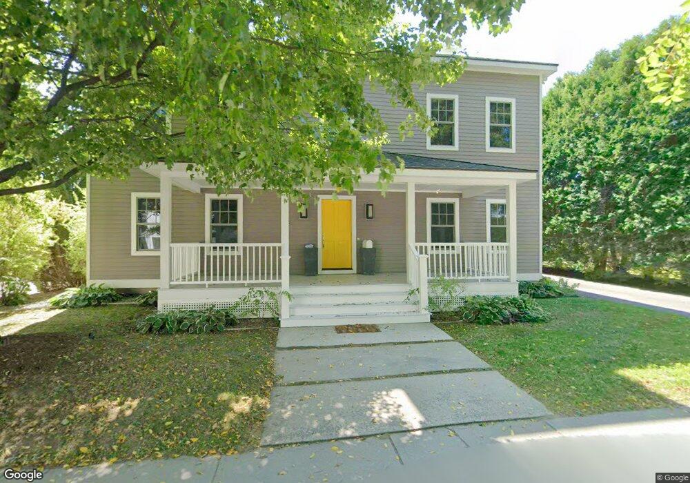
25 Latham St Williamstown, MA 01267
Estimated Value: $784,000 - $890,621
5
Beds
3
Baths
2,125
Sq Ft
$403/Sq Ft
Est. Value
About This Home
This home is located at 25 Latham St, Williamstown, MA 01267 and is currently estimated at $856,155, approximately $402 per square foot. 25 Latham St is a home located in Berkshire County with nearby schools including Lanesborough Elementary School, Mt. Greylock Regional High School, and Pine Cobble School.
Ownership History
Date
Name
Owned For
Owner Type
Purchase Details
Closed on
Oct 28, 2009
Sold by
Hitb Nt and Meehan Agnese J
Bought by
Oak Mgmt
Current Estimated Value
Home Financials for this Owner
Home Financials are based on the most recent Mortgage that was taken out on this home.
Original Mortgage
$262,500
Outstanding Balance
$171,927
Interest Rate
5.06%
Mortgage Type
Purchase Money Mortgage
Estimated Equity
$684,228
Purchase Details
Closed on
Nov 6, 2003
Sold by
Berube Dennis L and Berube Christine B
Bought by
Hitb Nominee Rt and Shepard Michael J
Create a Home Valuation Report for This Property
The Home Valuation Report is an in-depth analysis detailing your home's value as well as a comparison with similar homes in the area
Home Values in the Area
Average Home Value in this Area
Purchase History
| Date | Buyer | Sale Price | Title Company |
|---|---|---|---|
| Oak Mgmt | $525,000 | -- | |
| Hitb Nominee Rt | $265,000 | -- |
Source: Public Records
Mortgage History
| Date | Status | Borrower | Loan Amount |
|---|---|---|---|
| Open | Oak Mgmt | $262,500 |
Source: Public Records
Tax History Compared to Growth
Tax History
| Year | Tax Paid | Tax Assessment Tax Assessment Total Assessment is a certain percentage of the fair market value that is determined by local assessors to be the total taxable value of land and additions on the property. | Land | Improvement |
|---|---|---|---|---|
| 2025 | $10,303 | $746,600 | $126,600 | $620,000 |
| 2024 | $10,455 | $690,100 | $119,300 | $570,800 |
| 2023 | $10,173 | $629,100 | $108,500 | $520,600 |
| 2022 | $10,101 | $597,000 | $104,300 | $492,700 |
| 2021 | $9,553 | $552,200 | $104,300 | $447,900 |
| 2020 | $8,752 | $497,300 | $71,800 | $425,500 |
| 2019 | $8,095 | $448,500 | $60,700 | $387,800 |
| 2018 | $8,046 | $448,500 | $60,700 | $387,800 |
| 2017 | $7,642 | $448,500 | $60,700 | $387,800 |
| 2016 | $7,082 | $448,500 | $60,700 | $387,800 |
| 2015 | $7,001 | $448,500 | $60,700 | $387,800 |
| 2014 | $6,998 | $458,000 | $65,900 | $392,100 |
Source: Public Records
Map
Nearby Homes
- 1 River Run Unit 1
- 2 River Run
- 2 River Run Rd
- 160 Water St Unit 102
- 160 Water St Unit 407
- 160 Water St Unit 112
- 160 Water St Unit 23
- 160 Water St Unit 103
- 160 Water St Unit 209
- 160 Water St Unit 309
- 12 River Run
- 0 Water St
- 196 South St
- 111 Park St
- 51 Colonial Ave
- 15 Orchard Ln
- 108 Berkshire Dr
- 14 Orchard Ln
- 111 North St
- 189 Stratton Rd Unit E2
- 21 Latham St
- 15 Latham St
- 110 Meacham St
- 22 Latham St
- 104 Meacham St
- 407 Meacham St
- 7 Latham St
- 14 Latham St
- 144 Meacham St
- 115 & 7 Water & Latham St
- 23 Meadow St
- 11 Meadow St Unit 13
- 131 Water St
- 137 Water St
- 154 Meacham St Unit C
- 154 Meacham St Unit B
- 154 Meacham St
- 154 Meacham St Unit 154 C
- 87 Water St
- 118 Water St