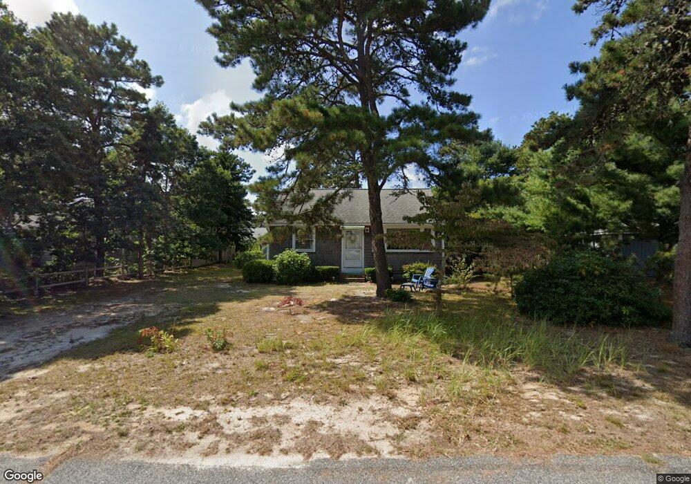
25 Lawrence Rd Dennis Port, MA 02639
Dennis Port NeighborhoodEstimated Value: $454,000 - $594,000
2
Beds
1
Bath
840
Sq Ft
$635/Sq Ft
Est. Value
About This Home
This home is located at 25 Lawrence Rd, Dennis Port, MA 02639 and is currently estimated at $533,166, approximately $634 per square foot. 25 Lawrence Rd is a home located in Barnstable County with nearby schools including Dennis-Yarmouth Regional High School and St. Pius X. School.
Ownership History
Date
Name
Owned For
Owner Type
Purchase Details
Closed on
Jun 22, 2017
Sold by
Lundquist Eric S
Bought by
Eric S Lundquist Ft
Current Estimated Value
Purchase Details
Closed on
Jan 23, 2013
Sold by
Lundquist Eric S and Beach Betty A
Bought by
Lundquist Eric S
Purchase Details
Closed on
Jan 7, 2009
Sold by
Lundquist Vivian
Bought by
Beach Elizabeth A and Lundquist Eric S
Purchase Details
Closed on
Apr 9, 2002
Sold by
Olmstead Mildred and Sigren Sonja
Bought by
Lundquist Vivian
Create a Home Valuation Report for This Property
The Home Valuation Report is an in-depth analysis detailing your home's value as well as a comparison with similar homes in the area
Home Values in the Area
Average Home Value in this Area
Purchase History
| Date | Buyer | Sale Price | Title Company |
|---|---|---|---|
| Eric S Lundquist Ft | -- | -- | |
| Lundquist Eric S | $100,000 | -- | |
| Beach Elizabeth A | -- | -- | |
| Lundquist Vivian | $80,000 | -- |
Source: Public Records
Tax History Compared to Growth
Tax History
| Year | Tax Paid | Tax Assessment Tax Assessment Total Assessment is a certain percentage of the fair market value that is determined by local assessors to be the total taxable value of land and additions on the property. | Land | Improvement |
|---|---|---|---|---|
| 2025 | $2,223 | $513,500 | $207,400 | $306,100 |
| 2024 | $2,073 | $472,200 | $199,500 | $272,700 |
| 2023 | $2,005 | $429,300 | $181,300 | $248,000 |
| 2022 | $1,944 | $347,100 | $163,400 | $183,700 |
| 2021 | $2,010 | $333,300 | $183,000 | $150,300 |
| 2020 | $1,809 | $296,600 | $160,100 | $136,500 |
| 2019 | $1,718 | $278,500 | $157,000 | $121,500 |
| 2018 | $1,640 | $258,600 | $149,500 | $109,100 |
| 2017 | $1,558 | $253,300 | $138,800 | $114,500 |
| 2016 | $1,616 | $247,400 | $149,500 | $97,900 |
| 2015 | $1,583 | $247,400 | $149,500 | $97,900 |
| 2014 | $1,435 | $226,000 | $128,100 | $97,900 |
Source: Public Records
Map
Nearby Homes
- 37 Ocean Dr Unit 2
- 80 Michaels Ave
- 64 Beaten Rd
- 112 Old Wharf Rd Unit E4
- 112 Old Wharf Rd Unit E1
- 120 Old Wharf Rd Unit 11
- 154 Old Wharf Rd Unit 26
- 154 Old Wharf Rd Unit 14
- 31 Easy St
- 19 Standish Way
- 61 Trotters Ln
- 6 Baker Way
- 217 Old Wharf Rd Unit 64
- 22 Wixon Rd
- 12 Spoonbill Rd
- 241 Old Wharf Rd Unit 82
- 241 Old Wharf Rd Unit 127
- 241 Old Wharf Rd Unit 90
- 15 Woodside Park Rd
- 262 Old Wharf Rd Unit 67
- 21 Lawrence Rd
- 29 Lawrence Rd
- 14 Greeneedle Ln
- 16 Greeneedle Ln
- 12 Greeneedle Ln
- 20 Greeneedle Ln
- 19 Lawrence Rd
- 24 Lawrence Rd
- 28 Lawrence Rd
- 20 Lawrence Rd
- 22 Greeneedle Ln
- 8 Greeneedle Ln
- 30 Lawrence Rd
- 37 Lawrence Rd
- 16 Lawrence Rd
- 15 Lawrence Rd
- 7 Greeneedle Ln
- 13 Nipigon Way E
- 9 Nipigon Way E
- 34 Lawrence Rd