
Seller's Agent in 2025
Nicolette Mascari
Rutledge Properties
(617) 890-9525
8 in this area
55 Total Sales
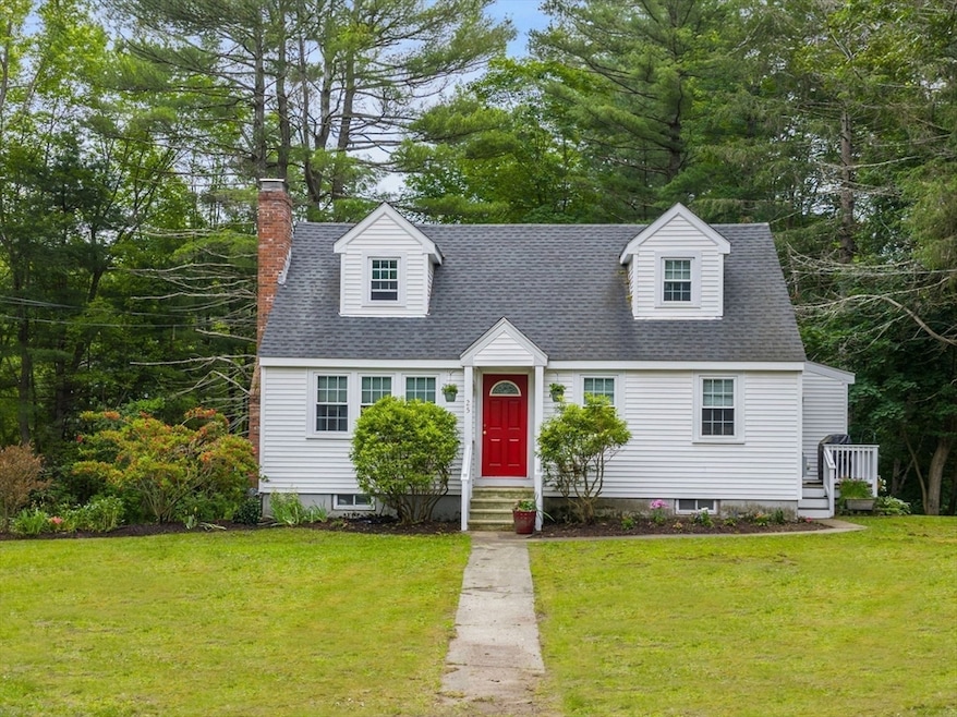
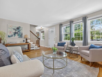
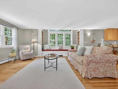
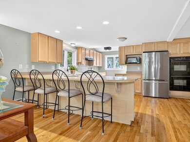
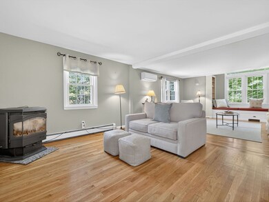
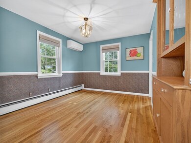
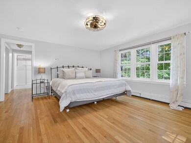
Welcome to 25 Lee Rd, a lovingly maintained Cape tucked into a peaceful North Wayland neighborhood. This home will surpass your expectations as you step inside, with its open floor plan and effortless flow. The first floor features a well appointed living, dining and mudroom with laundry for your convenience. The kitchen opens into a large family room with a oversized built in window seat and attached den. The second floor features 3 generous bedrooms, including a spacious primary suite, with a walk-in closet and generous bath. The basement is partially finished and well insulated for additional flex space. With only four streets in the neighborhood, no through traffic, and direct access to trails, conservation, and the aqueduct at the end of the block, the setting is as special as the home itself. Owned and cared for by the same family for 35 years, it offers a brand-new septic system, a flat yard, and the opportunity to move right in or add your personal touches.
| Date | Type | Sale Price | Title Company |
|---|---|---|---|
| Quit Claim Deed | $931,000 | -- | |
| Deed | $192,500 | -- | |
| Deed | $192,500 | -- |
| Date | Status | Loan Amount | Loan Type |
|---|---|---|---|
| Open | $631,000 | New Conventional | |
| Previous Owner | $50,000 | No Value Available | |
| Previous Owner | $280,000 | No Value Available |
| Date | Event | Price | List to Sale | Price per Sq Ft |
|---|---|---|---|---|
| 10/10/2025 10/10/25 | Sold | $931,000 | +0.6% | $357 / Sq Ft |
| 09/08/2025 09/08/25 | Pending | -- | -- | -- |
| 09/03/2025 09/03/25 | For Sale | $925,000 | -- | $354 / Sq Ft |
| Year | Tax Paid | Tax Assessment Tax Assessment Total Assessment is a certain percentage of the fair market value that is determined by local assessors to be the total taxable value of land and additions on the property. | Land | Improvement |
|---|---|---|---|---|
| 2025 | $14,400 | $921,300 | $467,700 | $453,600 |
| 2024 | $13,611 | $877,000 | $445,400 | $431,600 |
| 2023 | $13,195 | $792,500 | $404,900 | $387,600 |
| 2022 | $12,540 | $683,400 | $335,400 | $348,000 |
| 2021 | $12,092 | $652,900 | $304,900 | $348,000 |
| 2020 | $11,596 | $652,900 | $304,900 | $348,000 |
| 2019 | $4,687 | $605,400 | $290,400 | $315,000 |
| 2018 | $5,121 | $573,200 | $290,400 | $282,800 |
| 2017 | $14,293 | $554,900 | $276,500 | $278,400 |
| 2016 | $9,530 | $549,600 | $285,300 | $264,300 |
| 2015 | $9,818 | $533,900 | $285,300 | $248,600 |
Seller's Agent in 2025
Nicolette Mascari
Rutledge Properties
(617) 890-9525
8 in this area
55 Total Sales
Source: MLS Property Information Network (MLS PIN)
MLS Number: 73424803
APN: WAYL-000024-000000-000050
Disclaimer: Certain information contained herein is derived from information provided by parties other than Homes.com. All information provided is deemed reliable, but is not guaranteed to be accurate and should be independently verified.
![]() The property listing data and information, or the Images, set forth herein were provided to MLS Property Information Network, Inc. from third party sources, including sellers, lessors and public records, and were compiled by MLS Property Information Network, Inc. The property listing data and information, and the Images, are for the personal, non-commercial use of consumers having a good faith interest in purchasing or leasing listed properties of the type displayed to them and may not be used for any purpose other than to identify prospective properties which such consumers may have a good faith interest in purchasing or leasing. MLS Property Information Network, Inc. and its subscribers disclaim any and all representations and warranties as to the accuracy of the property listing data and information, or as to the accuracy of any of the Images, set forth herein.
The property listing data and information, or the Images, set forth herein were provided to MLS Property Information Network, Inc. from third party sources, including sellers, lessors and public records, and were compiled by MLS Property Information Network, Inc. The property listing data and information, and the Images, are for the personal, non-commercial use of consumers having a good faith interest in purchasing or leasing listed properties of the type displayed to them and may not be used for any purpose other than to identify prospective properties which such consumers may have a good faith interest in purchasing or leasing. MLS Property Information Network, Inc. and its subscribers disclaim any and all representations and warranties as to the accuracy of the property listing data and information, or as to the accuracy of any of the Images, set forth herein.
Ask me questions while you tour the home.